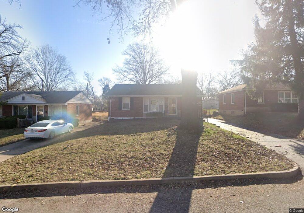
1216 Gilbert Ave Saint Louis, MO 63119
Estimated Value: $280,000 - $324,000
3
Beds
2
Baths
864
Sq Ft
$342/Sq Ft
Est. Value
About This Home
This home is located at 1216 Gilbert Ave, Saint Louis, MO 63119 and is currently estimated at $295,417, approximately $341 per square foot. 1216 Gilbert Ave is a home located in St. Louis County with nearby schools including Hudson Elementary School, Hixson Middle School, and Webster Groves High School.
Ownership History
Date
Name
Owned For
Owner Type
Purchase Details
Closed on
Jan 6, 2011
Sold by
Manor Real Estate Residential Llc
Bought by
Rabe Dawn
Current Estimated Value
Purchase Details
Closed on
Aug 19, 2010
Sold by
Rhodes Janice N
Bought by
Manor Real Estate Residential Llc
Home Financials for this Owner
Home Financials are based on the most recent Mortgage that was taken out on this home.
Original Mortgage
$65,200
Interest Rate
4.6%
Mortgage Type
Future Advance Clause Open End Mortgage
Create a Home Valuation Report for This Property
The Home Valuation Report is an in-depth analysis detailing your home's value as well as a comparison with similar homes in the area
Home Values in the Area
Average Home Value in this Area
Purchase History
| Date | Buyer | Sale Price | Title Company |
|---|---|---|---|
| Rabe Dawn | $152,000 | Ust | |
| Manor Real Estate Residential Llc | $65,200 | Ctc |
Source: Public Records
Mortgage History
| Date | Status | Borrower | Loan Amount |
|---|---|---|---|
| Previous Owner | Manor Real Estate Residential Llc | $65,200 |
Source: Public Records
Tax History
| Year | Tax Paid | Tax Assessment Tax Assessment Total Assessment is a certain percentage of the fair market value that is determined by local assessors to be the total taxable value of land and additions on the property. | Land | Improvement |
|---|---|---|---|---|
| 2025 | $3,289 | $54,220 | $31,100 | $23,120 |
| 2024 | $3,289 | $45,620 | $21,770 | $23,850 |
| 2023 | $3,326 | $45,620 | $21,770 | $23,850 |
| 2022 | $3,256 | $41,680 | $21,770 | $19,910 |
| 2021 | $3,235 | $41,680 | $21,770 | $19,910 |
| 2020 | $2,889 | $35,550 | $18,660 | $16,890 |
| 2019 | $2,872 | $35,550 | $18,660 | $16,890 |
| 2018 | $2,846 | $30,950 | $13,550 | $17,400 |
| 2017 | $2,832 | $30,950 | $13,550 | $17,400 |
| 2016 | $2,902 | $30,270 | $11,650 | $18,620 |
| 2015 | $2,798 | $30,270 | $11,650 | $18,620 |
| 2014 | $2,611 | $27,490 | $9,880 | $17,610 |
Source: Public Records
Map
Nearby Homes
- 9760 Old Warson Rd
- 9780 Old Warson Rd
- 9838 Oak Haven Ave
- 9816 Obrien Ct
- 1048 Martha Ln
- 1253 Charlane Ct
- 2712 McKnight Crossing Ct Unit 104
- 2714 McKnight Crossing Ct
- 2716 McKnight Crossing Ct Unit 114
- 515 Crestvale Dr
- 2918 Wingate Ct
- 1012 Nolan Dr
- 619 N Rock Hill Rd
- 519 Bismark Ave
- 9241 Merritt Ave
- 9425 White Ave
- 433 Bismark Ave
- 9239 Merritt Ave
- 203 Almentor Ave
- 1400 Norman Place
- 1214 Gilbert Ave
- 1218 Gilbert Ave
- 1212 Gilbert Ave
- 1217 Oakleaf Dr
- 9846 Boulder Ct
- 1215 Oakleaf Dr
- 1219 Oakleaf Dr
- 1210 Gilbert Ave
- 1215 Gilbert Ave
- 1213 Oakleaf Dr
- 1217 Gilbert Ave
- 9901 Kenyon Ct
- 1208 Gilbert Ave
- 1211 Oakleaf Dr
- 9900 Boulder Ct
- 9840 Boulder Ct
- 1206 Gilbert Ave
- 9902 Boulder Ct
- 1214 Kenyon Ct
- 1216 Kenyon Ct
Your Personal Tour Guide
Ask me questions while you tour the home.