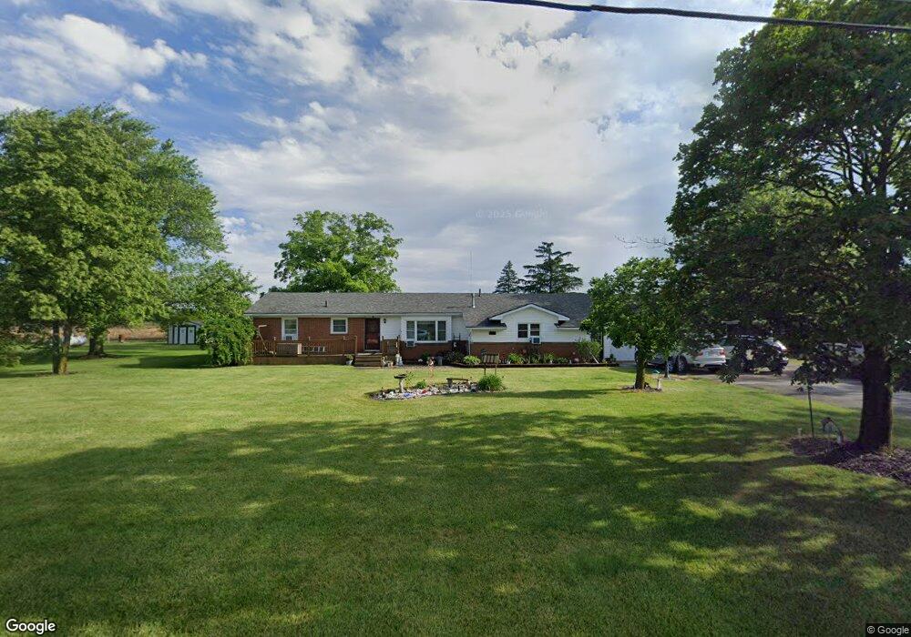
1216 Joseph Rd Luckey, OH 43443
Estimated Value: $262,631
3
Beds
2
Baths
2,156
Sq Ft
$122/Sq Ft
Est. Value
About This Home
This home is located at 1216 Joseph Rd, Luckey, OH 43443 and is currently priced at $262,631, approximately $121 per square foot. 1216 Joseph Rd is a home located in Wood County with nearby schools including Pemberville Elementary School, Eastwood Middle School, and Eastwood High School.
Ownership History
Date
Name
Owned For
Owner Type
Purchase Details
Closed on
Nov 21, 2022
Sold by
Wagoner Michael A and Wagoner Cheryl A
Bought by
Wagoner Michael A and Wagoner Cheryl A
Current Estimated Value
Purchase Details
Closed on
Jun 28, 2005
Sold by
Schnoor Frederick L and Schnoor Sandra J
Bought by
Wagoner Michael A and Wagoner Cheryl A
Home Financials for this Owner
Home Financials are based on the most recent Mortgage that was taken out on this home.
Original Mortgage
$135,000
Interest Rate
7.2%
Mortgage Type
Fannie Mae Freddie Mac
Purchase Details
Closed on
Apr 22, 1991
Bought by
Schnoor Frederick L
Create a Home Valuation Report for This Property
The Home Valuation Report is an in-depth analysis detailing your home's value as well as a comparison with similar homes in the area
Home Values in the Area
Average Home Value in this Area
Purchase History
| Date | Buyer | Sale Price | Title Company |
|---|---|---|---|
| Wagoner Michael A | -- | -- | |
| Wagoner Michael A | $3,000 | -- | |
| Wagoner Michael A | $150,000 | Chicago Title Insurance Co | |
| Schnoor Frederick L | $88,000 | -- |
Source: Public Records
Mortgage History
| Date | Status | Borrower | Loan Amount |
|---|---|---|---|
| Previous Owner | Wagoner Michael A | $135,000 |
Source: Public Records
Tax History Compared to Growth
Tax History
| Year | Tax Paid | Tax Assessment Tax Assessment Total Assessment is a certain percentage of the fair market value that is determined by local assessors to be the total taxable value of land and additions on the property. | Land | Improvement |
|---|---|---|---|---|
| 2021 | $2,528 | $63,250 | $10,850 | $52,400 |
| 2020 | $2,551 | $63,250 | $10,850 | $52,400 |
| 2019 | $2,280 | $53,450 | $10,850 | $42,600 |
| 2018 | $2,277 | $53,450 | $10,850 | $42,600 |
| 2017 | $2,081 | $53,450 | $10,850 | $42,600 |
| 2016 | $1,919 | $48,300 | $10,850 | $37,450 |
| 2015 | $1,919 | $48,300 | $10,850 | $37,450 |
| 2014 | $2,126 | $48,300 | $10,850 | $37,450 |
| 2013 | $2,263 | $48,300 | $10,850 | $37,450 |
Source: Public Records
Map
Nearby Homes
- 20180 Us Highway 23
- 2067 Devils Hole Rd
- 0 Pemberville Rd
- 0 Recker Rd
- 3291 Middleton Pike
- 571 Parklane Dr
- 421 Parklane Dr
- 739 Riverside Dr
- 612 W Main St
- 219 Lime St
- 415 Fort Findlay Rd
- 712 Lueke Ave Unit 572 p
- 212 S Perry St
- 110 E 1st St
- 210 School St
- 4396 Dowling Rd
- 24764 Bradner Rd
- 3698 Truman Rd
- 3708 Truman Rd
- 151 Marshall Ave
- 1270 Joseph Rd
- 1178 Joseph Rd
- 1282 Joseph Rd
- 1158 Joseph Rd
- 1308 Joseph Rd
- 1108 Joseph Rd
- 1360 Joseph Rd
- 1087 Joseph Rd
- 1199 Joseph Rd
- 1271 Joseph Rd
- 21701 Fostoria Rd
- 1040 Joseph Rd
- 0 Joseph Rd Lot 7
- 0 Joseph Rd Lot 5
- 0 Joseph Rd Lot 9
- 0
- 21475 Fostoria Rd
- 21440 Fostoria Rd
- 1516 Joseph Rd
- 21297 Fostoria Rd