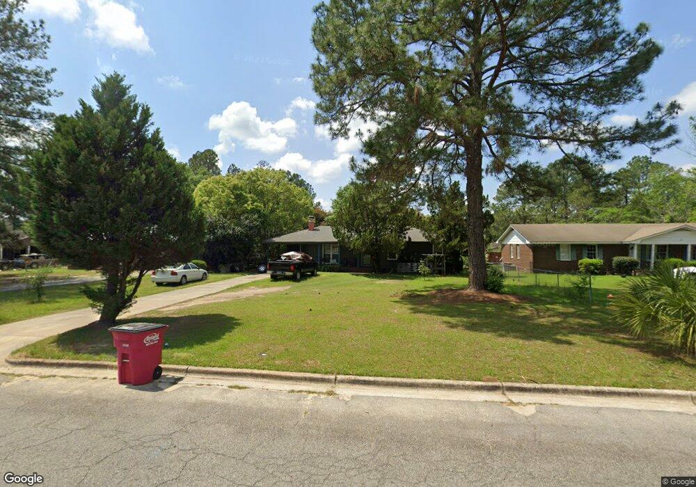
1216 Newton Dr Tifton, GA 31794
Estimated Value: $108,000 - $163,982
3
Beds
2
Baths
1,388
Sq Ft
$97/Sq Ft
Est. Value
About This Home
This home is located at 1216 Newton Dr, Tifton, GA 31794 and is currently estimated at $134,246, approximately $96 per square foot. 1216 Newton Dr is a home located in Tift County with nearby schools including G.O. Bailey Elementary School, Charles Spencer Elementary School, and J.T. Reddick School.
Ownership History
Date
Name
Owned For
Owner Type
Purchase Details
Closed on
Nov 19, 1998
Sold by
Cuomo Andrew M
Bought by
Popoca Isidro
Current Estimated Value
Purchase Details
Closed on
Jul 7, 1998
Sold by
Regions Mortgage Inc
Bought by
Secretary Of Housing And
Purchase Details
Closed on
Feb 25, 1994
Sold by
Holcombe Fred A and Holcombe Connie B
Bought by
Wood Kimberly
Purchase Details
Closed on
Apr 9, 1979
Sold by
Carter Rodney D
Bought by
Holcombe Fred A and Holcombe Connie B
Purchase Details
Closed on
Aug 29, 1978
Sold by
Carter Barbara R
Bought by
Carter Rodney D
Create a Home Valuation Report for This Property
The Home Valuation Report is an in-depth analysis detailing your home's value as well as a comparison with similar homes in the area
Home Values in the Area
Average Home Value in this Area
Purchase History
| Date | Buyer | Sale Price | Title Company |
|---|---|---|---|
| Popoca Isidro | -- | -- | |
| Secretary Of Housing And | $68,800 | -- | |
| Regions Mortgageinc Fka Real Estate Fin | $68,800 | -- | |
| Wood Kimberly | $52,500 | -- | |
| Holcombe Fred A | -- | -- | |
| Carter Rodney D | -- | -- |
Source: Public Records
Tax History Compared to Growth
Tax History
| Year | Tax Paid | Tax Assessment Tax Assessment Total Assessment is a certain percentage of the fair market value that is determined by local assessors to be the total taxable value of land and additions on the property. | Land | Improvement |
|---|---|---|---|---|
| 2024 | $980 | $36,339 | $7,400 | $28,939 |
| 2023 | $1,042 | $27,490 | $2,400 | $25,090 |
| 2022 | $1,035 | $27,490 | $2,400 | $25,090 |
| 2021 | $1,041 | $27,490 | $2,400 | $25,090 |
| 2020 | $1,067 | $27,490 | $2,400 | $25,090 |
| 2019 | $1,068 | $27,490 | $2,400 | $25,090 |
| 2018 | $1,068 | $27,490 | $2,400 | $25,090 |
| 2017 | $1,095 | $27,490 | $2,400 | $25,090 |
| 2016 | $1,097 | $27,490 | $2,400 | $25,090 |
| 2015 | $1,098 | $27,490 | $2,400 | $25,090 |
| 2014 | $1,100 | $27,490 | $2,400 | $25,090 |
| 2013 | -- | $27,490 | $2,400 | $25,090 |
Source: Public Records
Map
Nearby Homes
- 1430 Madison Ave
- 33 Oquinn Rd
- 1137 Oquinn Dr
- 0 Ferry Lake Rd
- 801 12th St E
- 566 Osprey Cir
- 219 Cypress Ridge Rd
- 0 44th & 46th St Lots Unit 138029
- 515 Osprey Cir
- 1003 Davis Ave
- 724 6th 1 2 St
- 724 6th 1 2 St Unit 22
- 722 6th 1 2 St
- 1601 Wanda Way
- 620 Prince Ave
- 0 Old Ocilla Rd Unit 138781
- 0 Old Ocilla Rd Unit 10611000
- 409 Davis Ave
- 1809 Davis Ave
- 810 Tift Ave N
- 1314 Newton Dr
- 1212 Newton Dr
- 1109 Martin Dr
- 1316 Newton Dr
- 1208 Newton Dr
- 1107 Martin Dr
- 1111 Martin Dr
- 1213 Newton Dr
- 1113 Martin Dr
- 1301 Newton Dr
- 1206 Newton Dr
- 1211 Newton Dr
- 1103 Martin Dr
- 1401 Sanders Dr
- 1115 Martin Dr
- 1209 Newton Dr
- 1320 Newton Dr
- 1204 Newton Dr
- 1207 Newton Dr
- 1117 Martin Dr