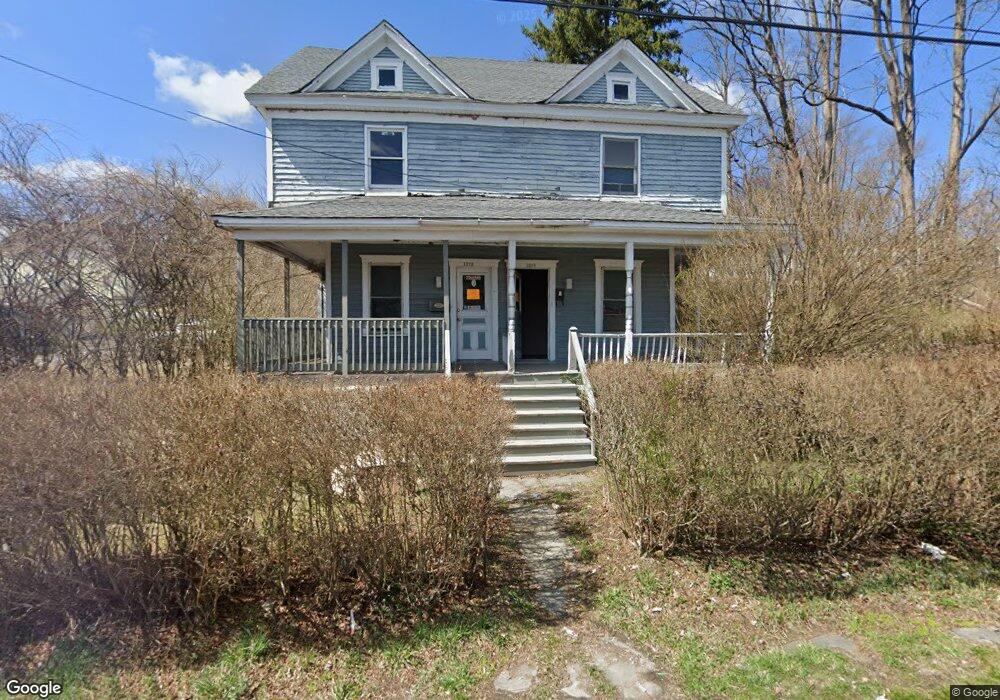
1216 S 6th Ave Unit 1218 Scranton, PA 18504
Hyde Park NeighborhoodEstimated Value: $98,000 - $118,000
--
Bed
--
Bath
--
Sq Ft
7,492
Sq Ft Lot
About This Home
This home is located at 1216 S 6th Ave Unit 1218, Scranton, PA 18504 and is currently estimated at $110,667. 1216 S 6th Ave Unit 1218 is a home located in Lackawanna County with nearby schools including Frances Willard School, West Scranton Intrmd School, and West Scranton High School.
Ownership History
Date
Name
Owned For
Owner Type
Purchase Details
Closed on
Apr 3, 2025
Sold by
12166 Ave 1214 Llc
Bought by
26 Gordon Llc
Current Estimated Value
Home Financials for this Owner
Home Financials are based on the most recent Mortgage that was taken out on this home.
Original Mortgage
$196,800
Outstanding Balance
$195,960
Interest Rate
6.85%
Mortgage Type
Construction
Estimated Equity
-$85,293
Purchase Details
Closed on
Nov 14, 2024
Sold by
Semian Ronald and Semian Barbara
Bought by
N & A Management Inc
Purchase Details
Closed on
Jul 15, 2011
Sold by
Semian Andrew
Bought by
Semian Ronald
Create a Home Valuation Report for This Property
The Home Valuation Report is an in-depth analysis detailing your home's value as well as a comparison with similar homes in the area
Home Values in the Area
Average Home Value in this Area
Purchase History
| Date | Buyer | Sale Price | Title Company |
|---|---|---|---|
| 26 Gordon Llc | $110,000 | None Listed On Document | |
| N & A Management Inc | $41,000 | None Listed On Document | |
| Semian Ronald | -- | None Available |
Source: Public Records
Mortgage History
| Date | Status | Borrower | Loan Amount |
|---|---|---|---|
| Open | 26 Gordon Llc | $196,800 |
Source: Public Records
Tax History Compared to Growth
Tax History
| Year | Tax Paid | Tax Assessment Tax Assessment Total Assessment is a certain percentage of the fair market value that is determined by local assessors to be the total taxable value of land and additions on the property. | Land | Improvement |
|---|---|---|---|---|
| 2025 | $1,698 | $5,000 | $1,250 | $3,750 |
| 2024 | $1,558 | $5,000 | $1,250 | $3,750 |
| 2023 | $1,558 | $5,000 | $1,250 | $3,750 |
| 2022 | $1,524 | $5,000 | $1,250 | $3,750 |
| 2021 | $1,524 | $5,000 | $1,250 | $3,750 |
| 2020 | $1,497 | $5,000 | $1,250 | $3,750 |
| 2019 | $1,410 | $5,000 | $1,250 | $3,750 |
| 2018 | $1,410 | $5,000 | $1,250 | $3,750 |
| 2017 | $1,386 | $5,000 | $1,250 | $3,750 |
| 2016 | $0 | $5,000 | $1,250 | $3,750 |
| 2015 | $1,056 | $5,000 | $1,250 | $3,750 |
| 2014 | -- | $5,000 | $1,250 | $3,750 |
Source: Public Records
Map
Nearby Homes
- 1203 Acker Ave
- 610 Landis St
- 1241 Snyder Ave
- 1250 S 1252 6th
- 1009 1011 Acker Ave Unit L 109
- 1115 Watson St
- 924 S Main Ave
- 1106 Dartmouth St
- 901 Eynon St
- 607 3rd Ave
- 1114 W Elm St
- 1114 W Elm St Unit L 6
- LOT#16 Reynolds Ave
- Lot# 7 Reynolds Ave
- 727 Fellows St
- 1301 Sloan St
- 1324 Dartmouth St
- 1021 Fellows St
- 819 Luzerne St
- 1157-59 Hampton St
- 1220 S 6th Ave Unit 1222
- 1228 S 6th Ave Unit 30
- 1209 Acker Ave
- 1232 S 6th Ave Unit 1st floor
- 1232 S 6th Ave Unit 1234
- 1211 Acker Ave
- 1127 Acker Ave
- 1213 Acker Ave
- 1123 Acker Ave
- 1117 Acker Ave
- 606 Smith St
- 610 Smith St
- 602 Smith St
- 614 Smith St
- 1200 S 5th Ave
- 1235 S 6th Ave
- 625 Landis St
- 1237 S 6th Ave
- 1237 S 6th Ave Unit 1235-1237
- 627 Landis St