Estimated Value: $240,777 - $260,000
3
Beds
2
Baths
1,171
Sq Ft
$212/Sq Ft
Est. Value
About This Home
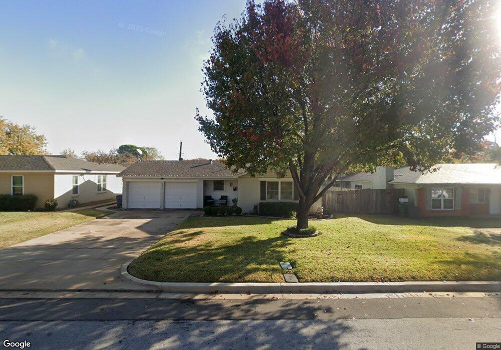
This home is located at 1216 Simpson Dr, Hurst, TX 76053 and is currently estimated at $248,444, approximately $212 per square foot. 1216 Simpson Dr is a home located in Tarrant County with nearby schools including Harrison Lane Elementary School, Hurst J High School, and L.D. Bell High School.
Ownership History
Date
Name
Owned For
Owner Type
Purchase Details
Closed on
Apr 18, 2025
Sold by
Hoover Truitt and Hoover Marla
Bought by
Hoover Family Trust and Hoover
Current Estimated Value
Purchase Details
Closed on
Jul 14, 2008
Sold by
Carroll Carolyn S
Bought by
Hoover Truitt
Home Financials for this Owner
Home Financials are based on the most recent Mortgage that was taken out on this home.
Original Mortgage
$103,377
Interest Rate
6.09%
Mortgage Type
Purchase Money Mortgage
Purchase Details
Closed on
May 22, 2002
Sold by
Harper Mona L
Bought by
Carroll Carolyn S
Home Financials for this Owner
Home Financials are based on the most recent Mortgage that was taken out on this home.
Original Mortgage
$87,310
Interest Rate
6.96%
Mortgage Type
FHA
Purchase Details
Closed on
Oct 6, 1995
Sold by
Reese Jerry W and Reese Mary Virginia
Bought by
Harper Mona L
Home Financials for this Owner
Home Financials are based on the most recent Mortgage that was taken out on this home.
Original Mortgage
$52,965
Interest Rate
7.62%
Mortgage Type
FHA
Create a Home Valuation Report for This Property
The Home Valuation Report is an in-depth analysis detailing your home's value as well as a comparison with similar homes in the area
Home Values in the Area
Average Home Value in this Area
Purchase History
| Date | Buyer | Sale Price | Title Company |
|---|---|---|---|
| Hoover Family Trust | -- | None Listed On Document | |
| Hoover Truitt | -- | Hexter Fair Title Company | |
| Carroll Carolyn S | -- | Commonwealth Land Title | |
| Harper Mona L | -- | Fidelity National Title Agen |
Source: Public Records
Mortgage History
| Date | Status | Borrower | Loan Amount |
|---|---|---|---|
| Previous Owner | Hoover Truitt | $103,377 | |
| Previous Owner | Carroll Carolyn S | $87,310 | |
| Previous Owner | Harper Mona L | $52,965 |
Source: Public Records
Tax History
| Year | Tax Paid | Tax Assessment Tax Assessment Total Assessment is a certain percentage of the fair market value that is determined by local assessors to be the total taxable value of land and additions on the property. | Land | Improvement |
|---|---|---|---|---|
| 2025 | $2,677 | $201,957 | $55,000 | $146,957 |
| 2024 | $2,677 | $201,957 | $55,000 | $146,957 |
| 2023 | $3,642 | $207,325 | $35,000 | $172,325 |
| 2022 | $3,805 | $181,939 | $35,000 | $146,939 |
| 2021 | $3,623 | $176,919 | $35,000 | $141,919 |
| 2020 | $3,286 | $142,547 | $35,000 | $107,547 |
| 2019 | $3,039 | $146,497 | $35,000 | $111,497 |
| 2018 | $2,250 | $112,869 | $16,000 | $96,869 |
| 2017 | $2,597 | $135,033 | $16,000 | $119,033 |
| 2016 | $2,360 | $109,768 | $16,000 | $93,768 |
| 2015 | $1,846 | $84,800 | $15,000 | $69,800 |
| 2014 | $1,846 | $84,800 | $15,000 | $69,800 |
Source: Public Records
Map
Nearby Homes
- 1160 Harrison Ln
- 1236 Harrison Ln
- 1148 Simpson Dr
- 1113 Norwood Dr
- 1348 Norwood Dr
- 1352 Simpson Dr
- 905 Brown Trail
- 1213 Glenda Dr
- 1016 Keith Dr
- 344 Bedford Ct E
- 341 Hurst Dr
- 153 Sheri Ln
- 224 Plainview Dr
- 1112 Karla Dr
- 802 Brown Trail
- 1428 Pamela St
- 1236 King Dr
- 33 Somerset Terrace
- 936 Barbara Ann Dr
- 209 W Cedar St
- 1220 Simpson Dr
- 1212 Simpson Dr
- 1217 Norwood Dr
- 1221 Norwood Dr
- 1213 Norwood Dr
- 1208 Simpson Dr
- 1217 Simpson Dr
- 1225 Norwood Dr
- 1213 Simpson Dr
- 1209 Norwood Dr
- 1204 Simpson Dr
- 1228 Simpson Dr
- 1225 Simpson Dr
- 1209 Simpson Dr
- 1205 Norwood Dr
- 1229 Norwood Dr
- 1229 Simpson Dr
- 1205 Simpson Dr
- 1232 Simpson Dr
- 1200 Simpson Dr
Your Personal Tour Guide
Ask me questions while you tour the home.