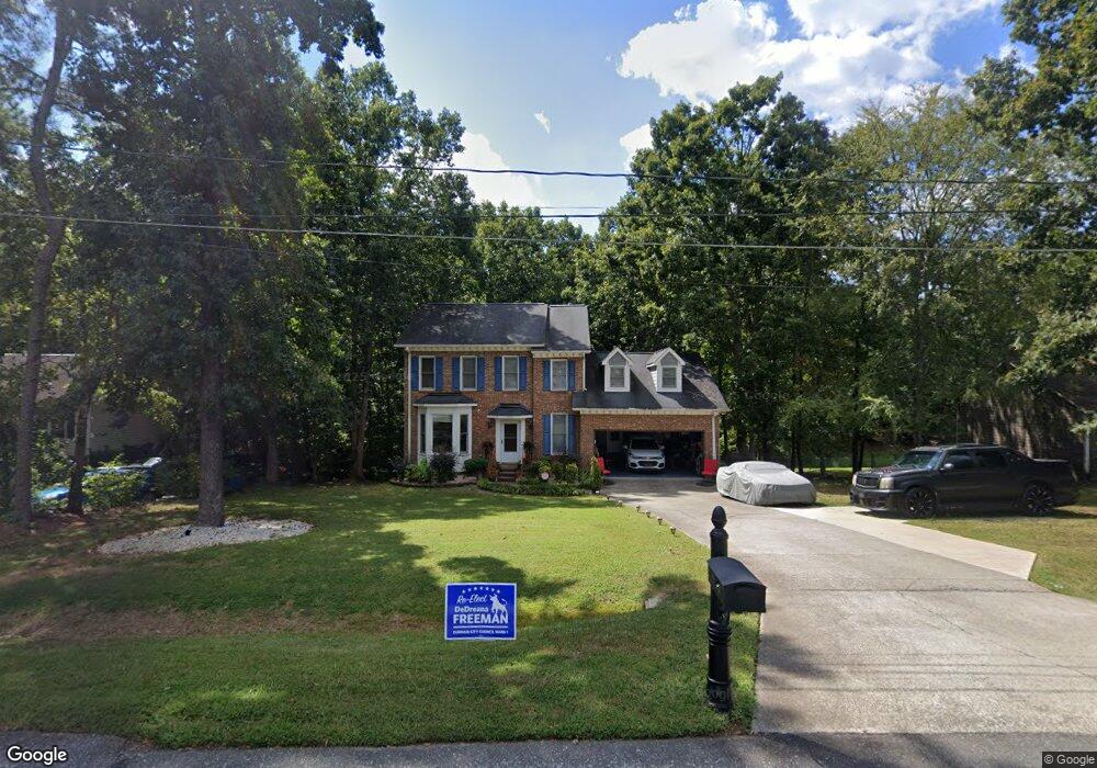
1216 Theodore Ln Durham, NC 27703
Estimated Value: $422,000 - $453,000
3
Beds
3
Baths
2,091
Sq Ft
$207/Sq Ft
Est. Value
About This Home
This home is located at 1216 Theodore Ln, Durham, NC 27703 and is currently estimated at $432,932, approximately $207 per square foot. 1216 Theodore Ln is a home located in Durham County with nearby schools including R.N. Harris Elementary School, James E. Shepard Middle School, and Hillside High School.
Ownership History
Date
Name
Owned For
Owner Type
Purchase Details
Closed on
Nov 16, 2016
Sold by
Bushfan Joseph M
Bought by
Oneal Elaine M
Current Estimated Value
Purchase Details
Closed on
Nov 10, 2006
Sold by
Oneal Elaine M and Bushfan Elaine M
Bought by
Bushfan Joseph M and Bushfan Elaine M
Home Financials for this Owner
Home Financials are based on the most recent Mortgage that was taken out on this home.
Original Mortgage
$158,000
Interest Rate
6.25%
Mortgage Type
New Conventional
Create a Home Valuation Report for This Property
The Home Valuation Report is an in-depth analysis detailing your home's value as well as a comparison with similar homes in the area
Home Values in the Area
Average Home Value in this Area
Purchase History
| Date | Buyer | Sale Price | Title Company |
|---|---|---|---|
| Oneal Elaine M | -- | -- | |
| Bushfan Joseph M | $12,500 | None Available |
Source: Public Records
Mortgage History
| Date | Status | Borrower | Loan Amount |
|---|---|---|---|
| Previous Owner | Bushfan Joseph M | $158,000 |
Source: Public Records
Tax History Compared to Growth
Tax History
| Year | Tax Paid | Tax Assessment Tax Assessment Total Assessment is a certain percentage of the fair market value that is determined by local assessors to be the total taxable value of land and additions on the property. | Land | Improvement |
|---|---|---|---|---|
| 2025 | $4,999 | $504,334 | $174,800 | $329,534 |
| 2024 | $3,554 | $254,775 | $36,820 | $217,955 |
| 2023 | $3,337 | $254,775 | $36,820 | $217,955 |
| 2022 | $3,261 | $254,775 | $36,820 | $217,955 |
| 2021 | $3,246 | $254,775 | $36,820 | $217,955 |
| 2020 | $3,169 | $254,775 | $36,820 | $217,955 |
| 2019 | $3,169 | $254,775 | $36,820 | $217,955 |
| 2018 | $2,336 | $172,201 | $34,518 | $137,683 |
| 2017 | $2,319 | $172,201 | $34,518 | $137,683 |
| 2016 | $2,241 | $172,201 | $34,518 | $137,683 |
| 2015 | $2,582 | $186,556 | $37,411 | $149,145 |
| 2014 | $2,582 | $186,556 | $37,411 | $149,145 |
Source: Public Records
Map
Nearby Homes
- 7 Mint Hill Ct
- 1412 Scholar Dr
- 2401 Southern Dr
- 1202 Ellis Rd
- 1206 Ellis Rd
- 2002 Strickland Oak Way
- 3306 Opal Dr
- 3304 Opal Dr
- 3300 Opal Dr
- 3004 Cypress Lagoon Ct
- 1112 Pate Farm Ln
- 1905 Edgerton Dr
- 3521 Esther Dr
- 1403 Sunset Peak Way
- 3112 Star Gazing Ln
- 511 Hester Rd
- 112 Churment Ct
- 1008 Talbot Place
- 229 Zante Currant Rd
- 802 Malta Way
- 1212 Theodore Ln
- 1220 Theodore Ln
- 1208 Theodore Ln
- 1224 Theodore Ln
- 1215 Theodore Ln
- 2304 Kristy Place
- 1223 Theodore Ln
- 1204 Theodore Ln
- 1302 Theodore Ln
- 2310 Kristy Place
- 2505 Jane Ct
- 2301 Kristy Place
- 1200 Theodore Ln
- 2307 Jane Ln
- 1134 Amber Shadow Dr
- 1136 Amber Shadow Dr
- 1138 Amber Shadow Dr Unit 107
- 1140 Amber Shadow Dr
- 1140 Amber Shadow Dr Unit 108
- 2304 Jane Ln