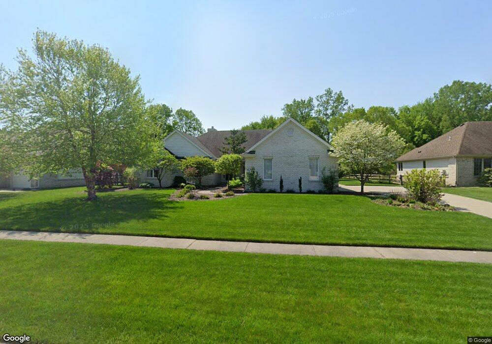
1217 Burningbush Ct Temperance, MI 48182
Estimated Value: $307,000 - $474,000
3
Beds
3
Baths
2,180
Sq Ft
$182/Sq Ft
Est. Value
About This Home
This home is located at 1217 Burningbush Ct, Temperance, MI 48182 and is currently estimated at $396,244, approximately $181 per square foot. 1217 Burningbush Ct is a home located in Monroe County with nearby schools including Jackman Road Elementary School, Bedford Junior High School, and Bedford High School.
Ownership History
Date
Name
Owned For
Owner Type
Purchase Details
Closed on
Nov 15, 2024
Sold by
Decola Salvatore J and Decola Alexis C
Bought by
Decola Salvatore J and Decola Alexis C
Current Estimated Value
Create a Home Valuation Report for This Property
The Home Valuation Report is an in-depth analysis detailing your home's value as well as a comparison with similar homes in the area
Home Values in the Area
Average Home Value in this Area
Purchase History
| Date | Buyer | Sale Price | Title Company |
|---|---|---|---|
| Decola Salvatore J | -- | None Listed On Document | |
| Decola Salvatore J | -- | None Listed On Document |
Source: Public Records
Tax History Compared to Growth
Tax History
| Year | Tax Paid | Tax Assessment Tax Assessment Total Assessment is a certain percentage of the fair market value that is determined by local assessors to be the total taxable value of land and additions on the property. | Land | Improvement |
|---|---|---|---|---|
| 2025 | $4,469 | $197,400 | $197,400 | $0 |
| 2024 | $1,843 | $188,100 | $0 | $0 |
| 2023 | $1,756 | $168,600 | $0 | $0 |
| 2022 | $4,132 | $168,600 | $0 | $0 |
| 2021 | $3,993 | $164,900 | $0 | $0 |
| 2020 | $3,803 | $170,600 | $0 | $0 |
| 2019 | $3,766 | $170,600 | $0 | $0 |
| 2018 | $3,385 | $165,200 | $0 | $0 |
| 2017 | $3,217 | $165,200 | $0 | $0 |
| 2016 | $3,215 | $137,400 | $0 | $0 |
| 2015 | $3,029 | $144,200 | $0 | $0 |
| 2014 | $3,029 | $144,200 | $0 | $0 |
| 2013 | $3,195 | $142,200 | $0 | $0 |
Source: Public Records
Map
Nearby Homes
- 1835 W Sterns Rd
- 7529 Indian Rd
- 7087 Sierra Ln
- 7665 Apache Trail
- 902 Hickory Creek Dr
- 1660 W Sterns Rd
- 6796 Hartland Rd
- 7808 Lewis Ave
- 7305 Cinden Rd
- 1138 Mapleway Dr
- 6712 Nanafield Dr
- 7768 Jackman Rd
- 6749 Stonegate Dr
- 1944 W Sterns Rd
- 8237 Lewis Ave
- 450 Glencoe
- 251 Inverness Ln
- 315 Nelly
- 6858 Yorktown Place
- 1905 Smith Rd
- 1229 Burningbush Ct
- 1205 Burningbush Ct
- 1241 Burningbush Ct
- 7335 Bentcreek Dr
- 1212 Burningbush Ct
- 1224 Burningbush Ct
- 1253 Burningbush Ct
- 1236 Burningbush Ct
- 7323 Bentcreek Dr
- 1200 Burningbush Ct
- 7311 Bentcreek Dr
- 7342 Bentcreek Dr
- 1265 Burningbush Ct
- 7330 Bentcreek Dr
- 1248 Burningbush Ct
- 1250 Burningbush Ct
- 7318 Bentcreek Dr
- 7299 Bentcreek Dr
- 7306 Bentcreek Dr
- 7287 Bentcreek Dr