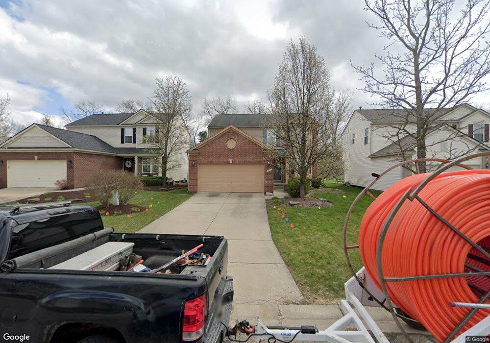
1217 Callaway Ct Unit 34 Howell, MI 48843
Estimated Value: $386,476 - $407,000
4
Beds
3
Baths
1,808
Sq Ft
$219/Sq Ft
Est. Value
About This Home
This home is located at 1217 Callaway Ct Unit 34, Howell, MI 48843 and is currently estimated at $396,619, approximately $219 per square foot. 1217 Callaway Ct Unit 34 is a home located in Livingston County with nearby schools including Ruahmah J. Hutchings Elementary, Parker Middle School, and Howell High School.
Ownership History
Date
Name
Owned For
Owner Type
Purchase Details
Closed on
Mar 29, 2011
Sold by
Tubbs Andrew John and Vettor Tubbs Carolyn Joan
Bought by
Aytes Greg
Current Estimated Value
Home Financials for this Owner
Home Financials are based on the most recent Mortgage that was taken out on this home.
Original Mortgage
$120,800
Interest Rate
4.92%
Mortgage Type
Purchase Money Mortgage
Purchase Details
Closed on
Sep 28, 2004
Sold by
Pulte Land Co Llc
Bought by
Tubbs Andrew John and Vettor Tubbs Carolyn Joan
Create a Home Valuation Report for This Property
The Home Valuation Report is an in-depth analysis detailing your home's value as well as a comparison with similar homes in the area
Home Values in the Area
Average Home Value in this Area
Purchase History
| Date | Buyer | Sale Price | Title Company |
|---|---|---|---|
| Aytes Greg | $151,000 | -- | |
| Tubbs Andrew John | $69,000 | Metropolitan Title Company |
Source: Public Records
Mortgage History
| Date | Status | Borrower | Loan Amount |
|---|---|---|---|
| Previous Owner | Aytes Greg | $120,800 |
Source: Public Records
Tax History
| Year | Tax Paid | Tax Assessment Tax Assessment Total Assessment is a certain percentage of the fair market value that is determined by local assessors to be the total taxable value of land and additions on the property. | Land | Improvement |
|---|---|---|---|---|
| 2025 | $1,621 | $172,700 | $0 | $0 |
| 2024 | $1,575 | $158,700 | $0 | $0 |
| 2023 | $1,505 | $142,300 | $0 | $0 |
| 2022 | $1,086 | $120,800 | $0 | $0 |
| 2021 | $2,085 | $125,600 | $0 | $0 |
| 2020 | $2,108 | $120,800 | $0 | $0 |
| 2019 | $2,078 | $112,900 | $0 | $0 |
| 2018 | $2,053 | $106,900 | $0 | $0 |
| 2017 | $2,026 | $104,200 | $0 | $0 |
| 2016 | $2,015 | $98,800 | $0 | $0 |
| 2014 | $1,954 | $85,700 | $0 | $0 |
| 2012 | $1,954 | $78,400 | $0 | $0 |
Source: Public Records
Map
Nearby Homes
- 1433 Callaway Ct Unit 258
- 3991 Rainier Dr Unit 1
- 636 Zion Ct
- 4112 Peach Tree Ln
- TBD Cannonade Loop
- 571 Cannonade Loop
- 5154 E Highland Rd
- The Austin Plan at Broadmoor
- The Charlotte Plan at Broadmoor
- The Harrison Plan at Broadmoor
- The Bloomington Plan at Broadmoor
- The Columbia Plan at Broadmoor
- 475 Cannonade Loop
- 607 Cannonade Loop
- 487 Cannonade Loop
- 559 Cannonade Loop
- 499 Cannonade Loop
- 2830 Bonny Brook Dr Unit 3
- 467 Lilly View Ct Unit 54
- 3800 Snowden Ln
- 1223 Callaway Ct Unit 33
- 1211 Callaway Ct Unit 35
- 1205 Callaway Ct Unit 36
- 1229 Callaway Ct Unit 32
- 1197 Callaway Ct
- 1235 Callaway Ct Unit 31
- 1218 Callaway Ct Unit 125
- 1224 Callaway Ct Unit 126
- 1212 Callaway Ct Unit 124
- 1191 Callaway Ct Unit 38
- 1202 Callaway Ct Unit 123
- 1241 Callaway Ct
- 1183 Callaway Ct
- 1247 Callaway Ct Unit 29
- 1240 Callaway Ct Unit 138
- 1024 Walcott Ln Unit 127
- 1015 Tudor Ln Unit 122
- 4340 McGunn Rd
- 1175 Callaway Ct Unit 40
- 1253 Callaway Ct Unit 28
Your Personal Tour Guide
Ask me questions while you tour the home.