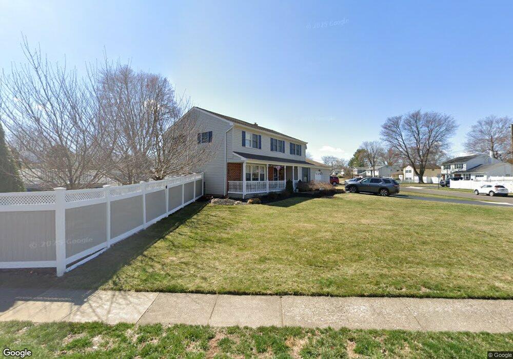
1217 Darrah Rd Warminster, PA 18974
Estimated Value: $546,000 - $591,000
3
Beds
2
Baths
2,198
Sq Ft
$258/Sq Ft
Est. Value
About This Home
This home is located at 1217 Darrah Rd, Warminster, PA 18974 and is currently estimated at $566,570, approximately $257 per square foot. 1217 Darrah Rd is a home located in Bucks County with nearby schools including Willow Dale El School, Log College Middle School, and William Tennent High School.
Ownership History
Date
Name
Owned For
Owner Type
Purchase Details
Closed on
Jan 31, 1997
Sold by
Soltoff Michael and Soltoff Sandra
Bought by
Alexander James A and Alexander Lori Ann
Current Estimated Value
Home Financials for this Owner
Home Financials are based on the most recent Mortgage that was taken out on this home.
Original Mortgage
$127,000
Outstanding Balance
$14,370
Interest Rate
7.57%
Estimated Equity
$552,200
Purchase Details
Closed on
Sep 2, 1986
Bought by
Soltoff Michael and Soltoff Sandra
Create a Home Valuation Report for This Property
The Home Valuation Report is an in-depth analysis detailing your home's value as well as a comparison with similar homes in the area
Home Values in the Area
Average Home Value in this Area
Purchase History
| Date | Buyer | Sale Price | Title Company |
|---|---|---|---|
| Alexander James A | $167,000 | -- | |
| Soltoff Michael | $98,900 | -- |
Source: Public Records
Mortgage History
| Date | Status | Borrower | Loan Amount |
|---|---|---|---|
| Open | Alexander James A | $127,000 |
Source: Public Records
Tax History Compared to Growth
Tax History
| Year | Tax Paid | Tax Assessment Tax Assessment Total Assessment is a certain percentage of the fair market value that is determined by local assessors to be the total taxable value of land and additions on the property. | Land | Improvement |
|---|---|---|---|---|
| 2025 | $6,079 | $28,800 | $6,400 | $22,400 |
| 2024 | $6,079 | $28,800 | $6,400 | $22,400 |
| 2023 | $5,892 | $28,800 | $6,400 | $22,400 |
| 2022 | $5,766 | $28,800 | $6,400 | $22,400 |
| 2021 | $5,631 | $28,800 | $6,400 | $22,400 |
| 2020 | $5,552 | $28,800 | $6,400 | $22,400 |
| 2019 | $5,257 | $28,800 | $6,400 | $22,400 |
| 2018 | $5,132 | $28,800 | $6,400 | $22,400 |
| 2017 | $4,981 | $28,800 | $6,400 | $22,400 |
| 2016 | $4,981 | $28,800 | $6,400 | $22,400 |
| 2015 | $4,864 | $28,800 | $6,400 | $22,400 |
| 2014 | $4,864 | $28,800 | $6,400 | $22,400 |
Source: Public Records
Map
Nearby Homes
- 1067 Log College Dr
- 1117 Lynch Cir
- 1127 Oak Leaf Ln
- 0 W Bristol Rd
- 1130 W Bristol Rd
- 949 Marshall Dr
- Kingswood Plan at Breton Hill
- Mayweather Plan at Breton Hill
- Cloverfield Plan at Breton Hill
- Raintree Plan at Breton Hill
- Rollins Plan at Breton Hill
- 1402 Valley View
- 919 Lavera Rd
- 1024 Gates Place
- 938 Jamison St
- 1203 Knox Ct Unit 1203
- 5302 Knox Ct Unit 5302
- 942 Stein Ct
- 2307 Knox Ct Unit 2307
- 1447 Bentley Dr
- 1209 Darrah Rd
- 1151 Log College Dr
- 1201 Darrah Rd
- 1125 Log College Dr
- 1148 Log College Dr
- 1222 Nassau Rd
- 1156 Log College Dr
- 1140 Log College Dr
- 1208 Darrah Rd
- 1164 Log College Dr
- 1206 Nassau Rd
- 1132 Log College Dr
- 1193 Darrah Rd
- 1119 Log College Dr
- 1200 Darrah Rd
- 1198 Nassau Rd
- 1124 Log College Dr
- 1105 Log College Dr
- 1185 Darrah Rd
- 1171 Log College Dr