Estimated Value: $153,000 - $179,000
3
Beds
1
Bath
1,070
Sq Ft
$154/Sq Ft
Est. Value
About This Home
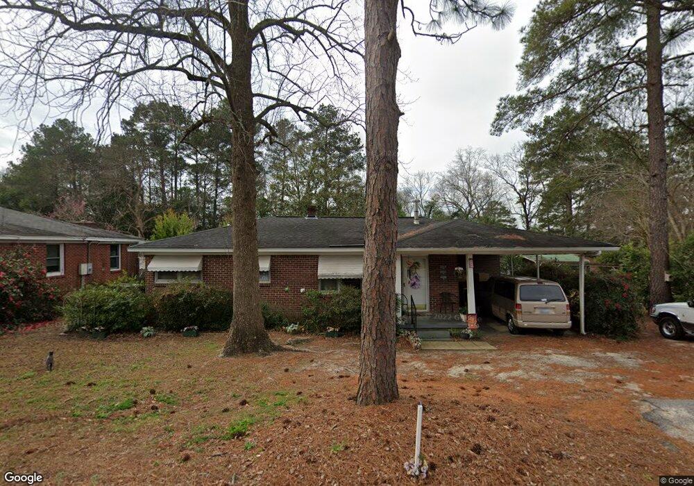
This home is located at 1217 Decatur St, Cayce, SC 29033 and is currently estimated at $164,389, approximately $153 per square foot. 1217 Decatur St is a home located in Lexington County with nearby schools including Cayce Elementary, Cyril B. Busbee Creative Arts Academy, and Brookland-Cayce High School.
Ownership History
Date
Name
Owned For
Owner Type
Purchase Details
Closed on
Jul 16, 2025
Sold by
Waters Herbert H
Bought by
Hallman Linda Waters
Current Estimated Value
Purchase Details
Closed on
Apr 3, 2020
Sold by
Waters Herbert and Waters Herbert H
Bought by
Hallman Linda Waters
Home Financials for this Owner
Home Financials are based on the most recent Mortgage that was taken out on this home.
Original Mortgage
$49,000
Interest Rate
3.4%
Mortgage Type
New Conventional
Purchase Details
Closed on
Mar 14, 2014
Sold by
Hallman Linda and Alexander Donnie
Bought by
Waters Herbert
Create a Home Valuation Report for This Property
The Home Valuation Report is an in-depth analysis detailing your home's value as well as a comparison with similar homes in the area
Home Values in the Area
Average Home Value in this Area
Purchase History
| Date | Buyer | Sale Price | Title Company |
|---|---|---|---|
| Hallman Linda Waters | -- | None Listed On Document | |
| Hallman Linda Waters | -- | None Available | |
| Waters Herbert | -- | -- | |
| Waters Herbert | -- | -- |
Source: Public Records
Mortgage History
| Date | Status | Borrower | Loan Amount |
|---|---|---|---|
| Previous Owner | Hallman Linda Waters | $49,000 |
Source: Public Records
Tax History Compared to Growth
Tax History
| Year | Tax Paid | Tax Assessment Tax Assessment Total Assessment is a certain percentage of the fair market value that is determined by local assessors to be the total taxable value of land and additions on the property. | Land | Improvement |
|---|---|---|---|---|
| 2024 | $1,623 | $2,584 | $720 | $1,864 |
| 2023 | $226 | $2,584 | $720 | $1,864 |
| 2022 | $227 | $2,584 | $720 | $1,864 |
| 2020 | $105 | $2,584 | $720 | $1,864 |
| 2019 | $111 | $2,585 | $720 | $1,865 |
| 2018 | $112 | $2,585 | $720 | $1,865 |
| 2017 | $100 | $2,585 | $720 | $1,865 |
| 2016 | $109 | $2,584 | $720 | $1,864 |
| 2014 | $107 | $2,942 | $720 | $2,222 |
| 2013 | -- | $2,940 | $720 | $2,220 |
Source: Public Records
Map
Nearby Homes
- 1210 Decatur St
- TBD Woodfield Jupiter & Daisey Track
- 826 Jefferson St
- 2312 Rainbow Dr
- 2405 Rainbow Dr
- 706 Westside Dr
- 1832 Wadsworth Dr
- 725 Brooks Ave
- 1911 Toole St
- 2024 Platt Springs Rd
- 0 Highway 302 Hwy Unit 589442
- 1800 Dunbar Rd
- 153 Cavendish Dr
- 151 Cavendish Dr
- 157 Cavendish Dr
- 2032 Pinewood St
- 1409 Hazel St
- 1414 Hazel St
- Oak Plan at Faith Hills
- 1112 Pine Croft Dr
- 1219 Decatur St
- 1215 Decatur St
- 1221 Decatur St
- 1222 Decatur St
- 108 Dale Ln
- 1223 Decatur St
- 1209 Decatur St
- 1224 Decatur St
- 1218 Decatur St
- 1226 Decatur St
- 1207 Decatur St
- 1225 Decatur St
- 1228 Decatur St
- 1216 Decatur St
- 300 Dale Ln
- 1230 Decatur St
- 1205 Decatur St
- 1212 Decatur St
- 1001 Brookwood Cir
- 1000 Brookwood Cir