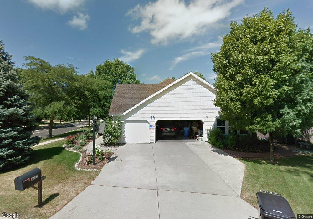
1217 Devonshire Ct Middleton, WI 53562
Fox Ridge NeighborhoodEstimated Value: $877,566 - $1,010,000
Studio
--
Bath
--
Sq Ft
0.32
Acres
About This Home
This home is located at 1217 Devonshire Ct, Middleton, WI 53562 and is currently estimated at $934,892. 1217 Devonshire Ct is a home located in Dane County with nearby schools including Elm Lawn Elementary School, Kromrey Middle School, and Middleton High School.
Ownership History
Date
Name
Owned For
Owner Type
Purchase Details
Closed on
May 31, 2016
Sold by
Huttleston David A and Huttleston Maryanne
Bought by
Parks David G and Parks Jessica L
Current Estimated Value
Home Financials for this Owner
Home Financials are based on the most recent Mortgage that was taken out on this home.
Original Mortgage
$414,000
Outstanding Balance
$329,713
Interest Rate
3.59%
Mortgage Type
New Conventional
Estimated Equity
$605,179
Create a Home Valuation Report for This Property
The Home Valuation Report is an in-depth analysis detailing your home's value as well as a comparison with similar homes in the area
Home Values in the Area
Average Home Value in this Area
Purchase History
| Date | Buyer | Sale Price | Title Company |
|---|---|---|---|
| Parks David G | $460,000 | Attorney |
Source: Public Records
Mortgage History
| Date | Status | Borrower | Loan Amount |
|---|---|---|---|
| Open | Parks David G | $414,000 |
Source: Public Records
Tax History
| Year | Tax Paid | Tax Assessment Tax Assessment Total Assessment is a certain percentage of the fair market value that is determined by local assessors to be the total taxable value of land and additions on the property. | Land | Improvement |
|---|---|---|---|---|
| 2023 | $11,291 | $681,900 | $116,900 | $565,000 |
| 2022 | $11,270 | $681,900 | $116,900 | $565,000 |
| 2021 | $10,453 | $525,300 | $116,900 | $408,400 |
| 2020 | $10,570 | $525,300 | $116,900 | $408,400 |
| 2019 | $9,964 | $525,300 | $116,900 | $408,400 |
| 2018 | $9,168 | $525,300 | $116,900 | $408,400 |
| 2017 | $8,890 | $442,600 | $128,000 | $314,600 |
| 2016 | $8,823 | $442,600 | $128,000 | $314,600 |
| 2015 | $9,024 | $442,600 | $128,000 | $314,600 |
| 2014 | $8,944 | $414,700 | $99,000 | $315,700 |
| 2013 | $7,901 | $414,700 | $99,000 | $315,700 |
Source: Public Records
Map
Nearby Homes
- 5 Norwalk Cir
- 1122 Middleton St
- 7330 Branford Ln W
- 7372 Old Sauk Rd
- 7428 South Ave
- 7106 Fortune Dr Unit 23
- 7009 Fortune Dr
- 0 Parmenter St Unit 2009257
- 7203 Old Sauk Rd Unit C
- 1030 Rooster Run Unit 19
- 7403 Elmwood Ave
- 8530 Greenway Blvd Unit 101
- 837 N Gammon Rd Unit D
- 6 Pintail Cir
- 6829 Cooper Ave
- 305 N High Point Rd
- 2 W Spyglass Ct
- 8318 Inverness Dr
- 434 Cherry Hill Dr
- 442 Augusta Dr
- 1213 Devonshire Ct
- 7709 Westchester Dr
- 1206 Muirfield Ct
- 7712 Westchester Dr
- 7717 Westchester Dr
- 1209 Devonshire Ct
- 1202 Muirfield Ct
- 7708 Westchester Dr
- 1212 Muirfield Ct
- 1210 Devonshire Ct
- 7705 Westchester Dr
- 1301 Falcon Ct
- 7704 Westchester Dr
- 1305 Falcon Ct
- 7721 Westchester Dr
- 1205 Devonshire Ct
- 1201 Muirfield Ct
- 1220 Muirfield Ct
- 1206 Devonshire Ct
- 1309 Falcon Ct
Your Personal Tour Guide
Ask me questions while you tour the home.