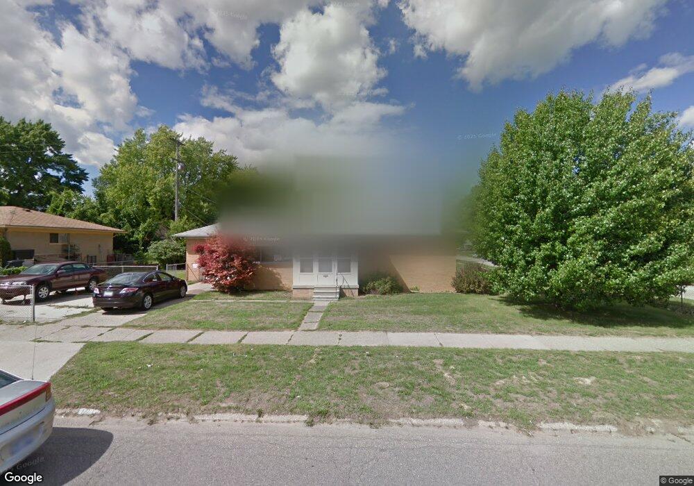
1217 Eldon Baker Dr Flint, MI 48507
Circle Neighborhood NeighborhoodEstimated Value: $86,000 - $97,000
3
Beds
2
Baths
1,127
Sq Ft
$81/Sq Ft
Est. Value
About This Home
This home is located at 1217 Eldon Baker Dr, Flint, MI 48507 and is currently estimated at $91,225, approximately $80 per square foot. 1217 Eldon Baker Dr is a home located in Genesee County with nearby schools including Freeman Elementary School, Flint Southwestern Classical Academy, and Burton Glen Charter Academy.
Ownership History
Date
Name
Owned For
Owner Type
Purchase Details
Closed on
Jun 13, 2025
Sold by
Premier Properties Holdings Llc
Bought by
Johnson Ashley
Current Estimated Value
Home Financials for this Owner
Home Financials are based on the most recent Mortgage that was taken out on this home.
Original Mortgage
$89,351
Outstanding Balance
$89,047
Interest Rate
6.86%
Mortgage Type
FHA
Estimated Equity
$2,178
Purchase Details
Closed on
Jul 11, 2024
Sold by
Helkowski Daniel
Bought by
Premier Properties Holdings Llc
Home Financials for this Owner
Home Financials are based on the most recent Mortgage that was taken out on this home.
Original Mortgage
$138,500
Interest Rate
7.03%
Mortgage Type
New Conventional
Purchase Details
Closed on
Jun 9, 2017
Sold by
Bank Of America Na
Bought by
Helkowski Daniel
Purchase Details
Closed on
Sep 17, 2015
Sold by
The Secretary Of Housing & Urban Develop
Bought by
Bank Of America Na
Purchase Details
Closed on
Jul 3, 2013
Sold by
Hall Barbara A
Bought by
Bank Of America Na
Create a Home Valuation Report for This Property
The Home Valuation Report is an in-depth analysis detailing your home's value as well as a comparison with similar homes in the area
Home Values in the Area
Average Home Value in this Area
Purchase History
| Date | Buyer | Sale Price | Title Company |
|---|---|---|---|
| Johnson Ashley | $91,000 | Crossroads Title | |
| Premier Properties Holdings Llc | -- | Stewart Title Guaranty Company | |
| Helkowski Daniel | $14,500 | None Available | |
| Bank Of America Na | -- | None Available | |
| Bank Of America Na | $68,465 | None Available |
Source: Public Records
Mortgage History
| Date | Status | Borrower | Loan Amount |
|---|---|---|---|
| Open | Johnson Ashley | $89,351 | |
| Previous Owner | Premier Properties Holdings Llc | $138,500 |
Source: Public Records
Tax History
| Year | Tax Paid | Tax Assessment Tax Assessment Total Assessment is a certain percentage of the fair market value that is determined by local assessors to be the total taxable value of land and additions on the property. | Land | Improvement |
|---|---|---|---|---|
| 2025 | $1,341 | $37,600 | $0 | $0 |
| 2024 | $1,238 | $33,200 | $0 | $0 |
| 2023 | $1,206 | $25,700 | $0 | $0 |
| 2022 | $0 | $18,700 | $0 | $0 |
| 2021 | $1,225 | $15,500 | $0 | $0 |
| 2020 | $1,122 | $14,100 | $0 | $0 |
| 2019 | $1,094 | $12,800 | $0 | $0 |
| 2018 | $1,157 | $13,400 | $0 | $0 |
| 2017 | $1,030 | $0 | $0 | $0 |
| 2016 | $1,022 | $0 | $0 | $0 |
| 2015 | -- | $0 | $0 | $0 |
| 2014 | -- | $0 | $0 | $0 |
| 2012 | -- | $16,600 | $0 | $0 |
Source: Public Records
Map
Nearby Homes
- 3209 Shawnee Ave
- 2910 Shawnee Ave
- 3505 Comanche Ave
- 3115 Circle Dr
- 3222 Chambers St
- 3056 Shaw St
- 630 Buckingham Ave
- 621 Burroughs Ave
- 1111 Lochhead Ave
- 3128 Ludwig St
- 3277 Sayre Ct
- 621 Lochhead Ave
- 4424 Cheyenne Ave
- 818 Dell Ave
- 2210 S Term St
- 802 McKeighan Ave
- 416 Burroughs Ave
- 617 McKeighan Ave
- 361 Buckingham Ave
- 4127 Custer Ave
- 3210 Menominee Ave
- 1201 Eldon Baker Dr
- 3206 Menominee Ave
- 3209 Cheyenne Ave
- 3202 Menominee Ave
- 1301 Eldon Baker Dr
- 3209 Menominee Ave
- 3201 Cheyenne Ave
- 3205 Menominee Ave
- 3118 Menominee Ave
- 3117 Cheyenne Ave
- 3201 Menominee Ave
- 3214 Cheyenne Ave
- 3114 Menominee Ave
- 3210 Cheyenne Ave
- 3117 Menominee Ave
- 3206 Cheyenne Ave
- 3202 Cheyenne Ave
- 3110 Menominee Ave
- 3113 Menominee Ave
Your Personal Tour Guide
Ask me questions while you tour the home.