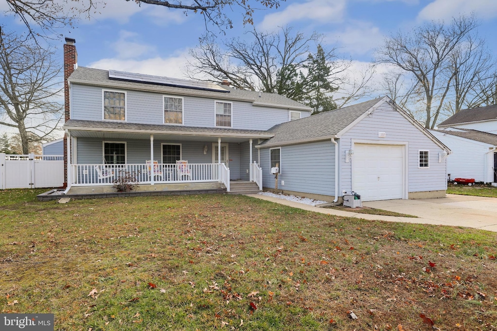
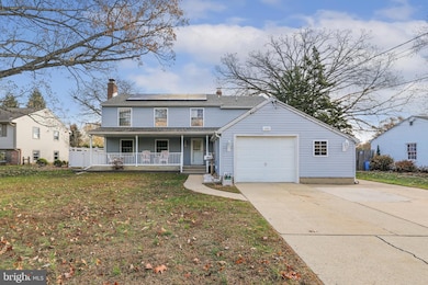
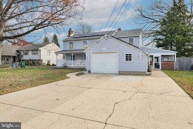
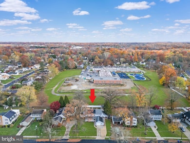
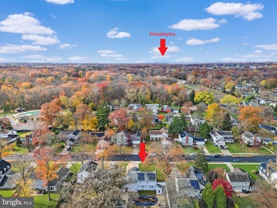
1217 Forge Rd Cherry Hill, NJ 08034
Estimated payment $4,267/month
Highlights
- Heated In Ground Pool
- Colonial Architecture
- No HOA
- A. Russell Knight Elementary School Rated A-
- Attic
- Home Office
About This Home
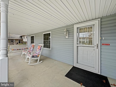
Welcome to 1217 Forge Road, nestled in the highly sought-after Barclay section of Cherry Hill, a neighborhood known for its charm, tree-lined streets, and sense of community. This beautifully maintained 4-bedroom, 3.5-bath home offers the perfect blend of character, comfort, and thoughtful updates throughout. Step up to the open front porch then through the front door and youll be greeted by a spacious formal living room with original wood floors that exude warmth and timeless appeal. The formal dining room is ideal for hosting gatherings, flowing seamlessly into the updated kitchen (2022) featuring crisp white shaker cabinets, butcher block countertops, and soft-close drawers. All appliances, including the microwave, are included making it truly move-in ready. Just off the kitchen, the sunken family room invites you to relax and unwind, with partial heated floors adding cozy comfort in cooler months. Beyond the family room, a versatile home office provides the perfect remote work or creative space, complete with heated floors and a walk-in closet/pantry area that offers extra storage flexibility. Upstairs, you’ll find two spacious primary suites, each with an updated full bathroom. The main primary bath, renovated in 2022, features in-floor heating, a lighted vanity mirror, and a custom walk-in closet with built-in organizers all included. The second primary suite offers two walk-in closets and its own modernized bath, providing a rare level of comfort and privacy for guests or family members. Two additional bedrooms and a beautifully updated hall bath (2022) complete the upper level, all with brand new carpet throughout. Outside, enjoy year-round entertaining in the screened-in patio, which easily converts for colder weather with included plastic panels. The large backyard is an oasis, featuring a heated in-ground pool, poolside gazebo, and outdoor furniture all staying with the home. Enjoy the added convenience of a backyard storage shed, perfect for keeping gardening tools, seasonal décor, or outdoor equipment neatly organized. This home has been lovingly maintained with numerous important updates, including New water heater (2023), New sump pump (2023), HVAC motor replacement (2024). New siding and windows (2005) with old asbestos removed, new insulation, sheathing, and wrap installed. Solar system (to be paid off in full at settlement) with Renewable Energy Credits transferring to the new owner. 1217 Forge Road offers everything today’s buyer is looking for, space, style, energy efficiency, and peace of mind. Don’t miss your chance to make this exceptional home yours. Schedule your private tour today and discover why Barclay living is truly special.
Listing Agent
(856) 429-7700 boblatigona@icloud.com Century 21 Alliance-Cherry Hill Brokerage Phone: 8564297700 License #897724 Listed on: 11/11/2025

Open House Schedule
-
Sunday, February 22, 202612:00 to 3:00 pm2/22/2026 12:00:00 PM +00:002/22/2026 3:00:00 PM +00:00Add to Calendar
Home Details
Home Type
- Single Family
Est. Annual Taxes
- $12,560
Year Built
- Built in 1966 | Remodeled in 2022
Lot Details
- 10,454 Sq Ft Lot
- Property is Fully Fenced
- Level Lot
- Back and Front Yard
Parking
- 1 Car Direct Access Garage
- 4 Driveway Spaces
- Front Facing Garage
Home Design
- Colonial Architecture
- Slab Foundation
- Frame Construction
- Architectural Shingle Roof
- Vinyl Siding
Interior Spaces
- 2,316 Sq Ft Home
- Property has 2 Levels
- Double Pane Windows
- Family Room Off Kitchen
- Living Room
- Combination Kitchen and Dining Room
- Home Office
- Crawl Space
- Attic
Kitchen
- Breakfast Area or Nook
- Eat-In Kitchen
Flooring
- Carpet
- Luxury Vinyl Plank Tile
Bedrooms and Bathrooms
- 4 Bedrooms
- En-Suite Bathroom
- Walk-In Closet
- Bathtub with Shower
Outdoor Features
- Heated In Ground Pool
- Gazebo
- Shed
Location
- Suburban Location
Utilities
- Forced Air Heating and Cooling System
- Heating System Uses Natural Gas
- Radiant Heating System
- Natural Gas Water Heater
- Cable TV Available
Community Details
- No Home Owners Association
- Barclay Subdivision, Salem Floorplan
Listing and Financial Details
- Tax Lot 00019
- Assessor Parcel Number 09-00435 02-00019
Map
Home Values in the Area
Average Home Value in this Area
Tax History
| Year | Tax Paid | Tax Assessment Tax Assessment Total Assessment is a certain percentage of the fair market value that is determined by local assessors to be the total taxable value of land and additions on the property. | Land | Improvement |
|---|---|---|---|---|
| 2025 | $11,914 | $267,200 | $69,800 | $197,400 |
| 2024 | $11,228 | $267,200 | $69,800 | $197,400 |
| 2023 | $11,228 | $267,200 | $69,800 | $197,400 |
| 2022 | $10,918 | $267,200 | $69,800 | $197,400 |
| 2021 | $10,953 | $267,200 | $69,800 | $197,400 |
| 2020 | $10,819 | $267,200 | $69,800 | $197,400 |
| 2019 | $10,814 | $267,200 | $69,800 | $197,400 |
| 2018 | $10,784 | $267,200 | $69,800 | $197,400 |
| 2017 | $10,637 | $267,200 | $69,800 | $197,400 |
| 2016 | $10,496 | $267,200 | $69,800 | $197,400 |
| 2015 | $10,330 | $267,200 | $69,800 | $197,400 |
| 2014 | $10,215 | $267,200 | $69,800 | $197,400 |
Property History
| Date | Event | Price | List to Sale | Price per Sq Ft |
|---|---|---|---|---|
| 01/17/2026 01/17/26 | Price Changed | $620,000 | -0.8% | $268 / Sq Ft |
| 11/11/2025 11/11/25 | For Sale | $625,000 | -- | $270 / Sq Ft |
Purchase History
| Date | Type | Sale Price | Title Company |
|---|---|---|---|
| Deed | $195,000 | -- | |
| Deed | $189,900 | -- |
Mortgage History
| Date | Status | Loan Amount | Loan Type |
|---|---|---|---|
| Open | $175,500 | No Value Available | |
| Previous Owner | $151,900 | No Value Available |
Source: Bright MLS
MLS Number: NJCD2105870
APN: 09-00435-02-00019
Disclaimer: Certain information contained herein is derived from information provided by parties other than Homes.com. All information provided is deemed reliable, but is not guaranteed to be accurate and should be independently verified.
![]() The data relating to real estate for sale on this website appears in part through the BRIGHT Internet Data Exchange program, a voluntary cooperative exchange of property listing data between licensed real estate brokerage firms, and is provided by BRIGHT through a licensing agreement.
The data relating to real estate for sale on this website appears in part through the BRIGHT Internet Data Exchange program, a voluntary cooperative exchange of property listing data between licensed real estate brokerage firms, and is provided by BRIGHT through a licensing agreement.
Listing information is from various brokers who participate in the Bright MLS IDX program and not all listings may be visible on the site.
The property information being provided on or through the website is for the personal, non-commercial use of consumers and such information may not be used for any purpose other than to identify prospective properties consumers may be interested in purchasing.
Some properties which appear for sale on the website may no longer be available because they are for instance, under contract, sold or are no longer being offered for sale.
Property information displayed is deemed reliable but is not guaranteed.
Copyright 2026 Bright MLS, Inc.
- 418 Sherry Way
- 1324 Beaverbrook Dr
- 121 Europa Blvd
- 405 Barclay Towers
- 1840 Frontage Rd Unit 1103
- 113 White Oak Rd
- 21 Teak Ct
- 324 Tuvira Ln
- 908 Chelten Pkwy
- 115 Courtland Rd
- 147 Greenvale Rd
- 124 Edison Rd
- 402 Bruce Rd
- 51 Edison Rd
- 4514 Champions Run Unit 4514
- 4543 Champions Run
- 225 Drake Rd
- 2 Collage Ct
- 103 Greenvale Rd
- 418 Kingston Dr
- 204 Barclay Towers
- 207 Barclay Towers
- 1200 Marlton Pike E
- 364 Tuvira Ln
- 1910-1920 Frontage Rd
- 1305 Churchill Downs Way
- 4525 Champions Run
- 4531 Champions Run
- 100 Park Blvd
- 100 Park Blvd Unit 88 C
- 1001 Kings Hwy N Unit 504
- 1001 Kings Hwy N
- 1356 Brace Rd
- 5242 Palomino Ct
- 3005 Chapel Ave W
- 211 Rhode Island Ave
- 1711 Springdale Rd
- 406 Kings Hwy E
- 162 Tavistock
- 1924 Birchwood Park Dr N