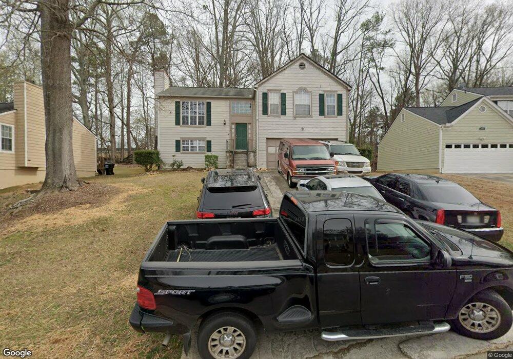
1217 Ling Way Unit 3 Austell, GA 30168
Estimated Value: $276,000 - $350,162
4
Beds
3
Baths
1,234
Sq Ft
$251/Sq Ft
Est. Value
About This Home
This home is located at 1217 Ling Way Unit 3, Austell, GA 30168 and is currently estimated at $309,541, approximately $250 per square foot. 1217 Ling Way Unit 3 is a home located in Cobb County with nearby schools including Bryant Elementary School, Lindley Middle School, and Pebblebrook High School.
Ownership History
Date
Name
Owned For
Owner Type
Purchase Details
Closed on
Dec 19, 1994
Sold by
Homeland Communities Inc
Bought by
Hobson Eddie
Current Estimated Value
Home Financials for this Owner
Home Financials are based on the most recent Mortgage that was taken out on this home.
Original Mortgage
$89,500
Interest Rate
9%
Mortgage Type
VA
Create a Home Valuation Report for This Property
The Home Valuation Report is an in-depth analysis detailing your home's value as well as a comparison with similar homes in the area
Home Values in the Area
Average Home Value in this Area
Purchase History
| Date | Buyer | Sale Price | Title Company |
|---|---|---|---|
| Hobson Eddie | $87,800 | -- |
Source: Public Records
Mortgage History
| Date | Status | Borrower | Loan Amount |
|---|---|---|---|
| Closed | Hobson Eddie | $89,500 |
Source: Public Records
Tax History Compared to Growth
Tax History
| Year | Tax Paid | Tax Assessment Tax Assessment Total Assessment is a certain percentage of the fair market value that is determined by local assessors to be the total taxable value of land and additions on the property. | Land | Improvement |
|---|---|---|---|---|
| 2025 | $2,434 | $110,264 | $16,000 | $94,264 |
| 2024 | $2,436 | $110,264 | $16,000 | $94,264 |
| 2023 | $1,893 | $110,264 | $16,000 | $94,264 |
| 2022 | $1,635 | $72,728 | $8,000 | $64,728 |
| 2021 | $1,635 | $72,728 | $8,000 | $64,728 |
| 2020 | $1,329 | $58,780 | $8,000 | $50,780 |
| 2019 | $1,329 | $58,780 | $8,000 | $50,780 |
| 2018 | $1,072 | $47,036 | $8,000 | $39,036 |
| 2017 | $851 | $38,872 | $5,600 | $33,272 |
| 2016 | $852 | $38,872 | $5,600 | $33,272 |
| 2015 | $874 | $38,872 | $5,600 | $33,272 |
| 2014 | $362 | $21,028 | $0 | $0 |
Source: Public Records
Map
Nearby Homes
- 1211 Ling Way
- 1163 Park Center Cir
- Redbud-Townhome Plan at Park Center Pointe - Hometown Series
- Bayberry-Townhome Plan at Park Center Pointe - Hometown Series
- 1311 Park Center Cir
- Wisteria-Townhome Plan at Park Center Pointe - Hometown Series
- 1395 Ling Dr Unit 2
- 1243 Blairs Pointe Dr Unit 3
- 1182 Park Center Cir
- 1186 Park Center Cir
- 1195 Park Center Cir
- 1199 Park Center Cir
- 1203 Park Center Cir
- 1507 Locust Log Way
- 7254 Silverton Trail
- 6810 Panda Dr Unit B
- 6811 Panda Dr Unit A
- 6736 Ivy Log Dr
- 1215 Ling Way
- 1219 Ling Way
- 1221 Ling Way
- 1213 Ling Way
- 1212 Ling Way Unit 2
- 7051 Grinder Ct
- 1214 Ling Way Unit 2
- 1223 Ling Way Unit 2
- 7053 Grinder Ct
- 1216 Ling Way
- 1209 Ling Way
- 1206 Ling Way
- 1206 Ling Way
- 7055 Grinder Ct
- 1330 Blair Bridge Rd
- N Ling Way
- 7115 Ling Ct
- 1350 Oak Ridge Rd
- 2665 Ravencliff Dr
- 1218 Ling Way Unit 2