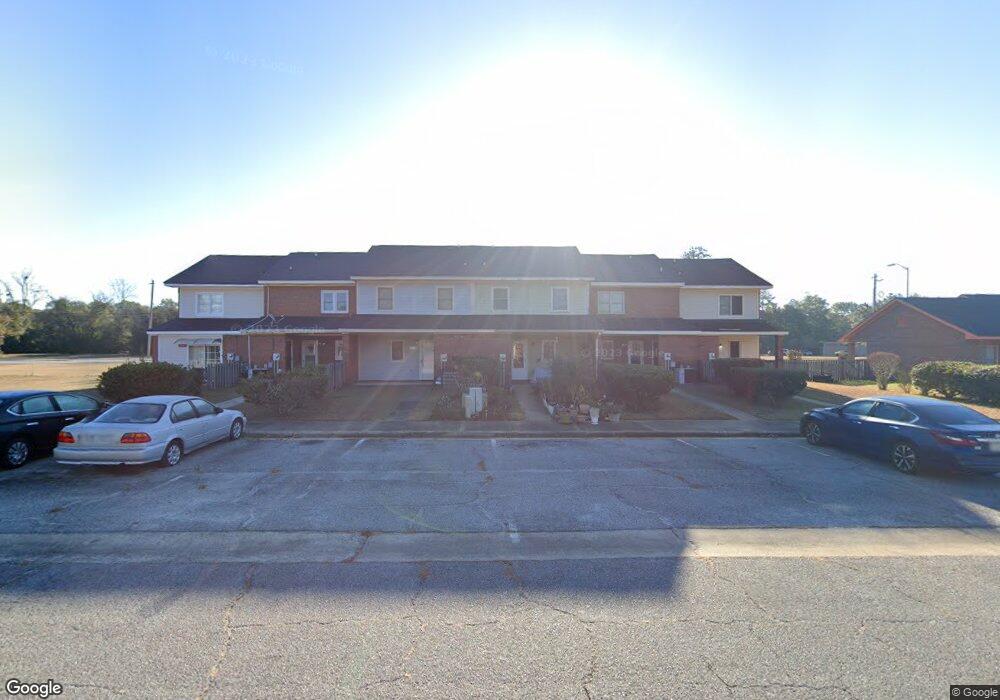
1217 Newton Rd Albany, GA 31701
Estimated Value: $78,000 - $103,029
3
Beds
2
Baths
1,200
Sq Ft
$72/Sq Ft
Est. Value
About This Home
This home is located at 1217 Newton Rd, Albany, GA 31701 and is currently estimated at $86,007, approximately $71 per square foot. 1217 Newton Rd is a home located in Dougherty County with nearby schools including Alice Coachman Elementary School, Southside Middle School, and Monroe High School.
Ownership History
Date
Name
Owned For
Owner Type
Purchase Details
Closed on
May 16, 2007
Sold by
City Of Albany
Bought by
Lewis Lucinda
Current Estimated Value
Purchase Details
Closed on
Apr 29, 2005
Sold by
The City Of Albany
Bought by
Lewis Lucinda
Home Financials for this Owner
Home Financials are based on the most recent Mortgage that was taken out on this home.
Original Mortgage
$41,900
Interest Rate
5.98%
Mortgage Type
New Conventional
Purchase Details
Closed on
Aug 6, 2004
Sold by
Spruell Julia
Bought by
City Of Albany
Purchase Details
Closed on
Mar 31, 1994
Sold by
Albany City Of
Bought by
Spruell Julia
Purchase Details
Closed on
Jan 1, 1991
Bought by
City Of Albany
Create a Home Valuation Report for This Property
The Home Valuation Report is an in-depth analysis detailing your home's value as well as a comparison with similar homes in the area
Home Values in the Area
Average Home Value in this Area
Purchase History
| Date | Buyer | Sale Price | Title Company |
|---|---|---|---|
| Lewis Lucinda | -- | -- | |
| Lewis Lucinda | $41,900 | -- | |
| City Of Albany | $36,000 | -- | |
| Spruell Julia | $42,200 | -- | |
| City Of Albany | $2,500 | -- |
Source: Public Records
Mortgage History
| Date | Status | Borrower | Loan Amount |
|---|---|---|---|
| Previous Owner | Lewis Lucinda | $41,900 |
Source: Public Records
Tax History Compared to Growth
Tax History
| Year | Tax Paid | Tax Assessment Tax Assessment Total Assessment is a certain percentage of the fair market value that is determined by local assessors to be the total taxable value of land and additions on the property. | Land | Improvement |
|---|---|---|---|---|
| 2024 | $746 | $21,900 | $60 | $21,840 |
| 2023 | $0 | $21,900 | $60 | $21,840 |
| 2022 | $931 | $21,900 | $60 | $21,840 |
| 2021 | $863 | $21,900 | $60 | $21,840 |
| 2020 | $865 | $21,900 | $60 | $21,840 |
| 2019 | $868 | $21,900 | $60 | $21,840 |
| 2018 | $872 | $21,900 | $60 | $21,840 |
| 2017 | $812 | $21,900 | $60 | $21,840 |
| 2016 | $813 | $21,900 | $60 | $21,840 |
| 2015 | $815 | $21,900 | $60 | $21,840 |
| 2014 | $923 | $22,840 | $1,000 | $21,840 |
Source: Public Records
Map
Nearby Homes
- 404 Cedar Ave
- 604 Jefferies Ave
- 1505 Mcarthur St
- 512 Cherry Ave
- 807 Corn Ave
- 612 Louis Ave
- 420 Cotton Ave
- 1627 Mcarthur St
- 903 Dorsett Ave
- 418 Cotton Ave
- 611 Albert Ct
- 906 Holloway Ave
- 704 W Lincoln Ave
- 600 W Lincoln Ave
- 417 Cotton Ave
- 415 Cotton Ave
- 1207 S Cleveland St
- 2504 S Madison St
- 1407 S Cleveland St
- 515 W Lincoln Ave
- 1215 Newton Rd
- 1219 Newton Rd
- 1213 Newton Rd
- 1221 Newton Rd
- 1211 Newton Rd
- 1225 Newton Rd
- 1227 Newton Rd
- 1201 Hampton Ct
- 622 Dorsett Ave
- 626 Dorsett Ave
- 1203 Hampton Ct
- 1205 Hampton Ct
- 628 Dorsett Ave
- 1303 Newton Rd
- 1207 Hampton Ct
- 630 Dorsett Ave
- 1305 Newton Rd
- 1211 Hampton Ct
- 623 Dorsett Ave
- 627 Dorsett Ave