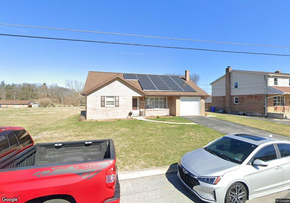
1217 Scott St Reading, PA 19611
Liggett NeighborhoodEstimated Value: $253,264 - $335,000
3
Beds
1
Bath
1,736
Sq Ft
$166/Sq Ft
Est. Value
About This Home
This home is located at 1217 Scott St, Reading, PA 19611 and is currently estimated at $287,816, approximately $165 per square foot. 1217 Scott St is a home located in Berks County with nearby schools including Millmont Elementary School, Central Middle School, and Reading Senior High School.
Ownership History
Date
Name
Owned For
Owner Type
Purchase Details
Closed on
Mar 13, 2018
Sold by
Evans Linda D and Dobrzyn Ests Eugene F
Bought by
Ayala Michael A and Ayala Lisa M
Current Estimated Value
Home Financials for this Owner
Home Financials are based on the most recent Mortgage that was taken out on this home.
Original Mortgage
$120,000
Interest Rate
4.44%
Mortgage Type
New Conventional
Create a Home Valuation Report for This Property
The Home Valuation Report is an in-depth analysis detailing your home's value as well as a comparison with similar homes in the area
Home Values in the Area
Average Home Value in this Area
Purchase History
| Date | Buyer | Sale Price | Title Company |
|---|---|---|---|
| Ayala Michael A | -- | None Available |
Source: Public Records
Mortgage History
| Date | Status | Borrower | Loan Amount |
|---|---|---|---|
| Previous Owner | Ayala Michael A | $120,000 |
Source: Public Records
Tax History Compared to Growth
Tax History
| Year | Tax Paid | Tax Assessment Tax Assessment Total Assessment is a certain percentage of the fair market value that is determined by local assessors to be the total taxable value of land and additions on the property. | Land | Improvement |
|---|---|---|---|---|
| 2025 | $2,405 | $88,600 | $25,700 | $62,900 |
| 2024 | $3,934 | $88,600 | $25,700 | $62,900 |
| 2023 | $3,873 | $88,600 | $25,700 | $62,900 |
| 2022 | $3,873 | $88,600 | $25,700 | $62,900 |
| 2021 | $3,873 | $88,600 | $25,700 | $62,900 |
| 2020 | $3,834 | $88,600 | $25,700 | $62,900 |
| 2019 | $3,834 | $88,600 | $25,700 | $62,900 |
| 2018 | $3,834 | $88,600 | $25,700 | $62,900 |
| 2017 | $3,809 | $88,600 | $25,700 | $62,900 |
| 2016 | $1,225 | $88,600 | $25,700 | $62,900 |
| 2015 | $2,176 | $88,600 | $25,700 | $62,900 |
| 2014 | $2,002 | $88,600 | $25,700 | $62,900 |
Source: Public Records
Map
Nearby Homes
- 1355 Liggett Ave
- 1145 Gregg Ave
- 1020 Meade St
- 524 Pershing Blvd
- 1530 Liggett Ave
- 1501 Gregg Ave
- 1407 Lancaster Ave
- 1100 Wyomissing Blvd
- 1202 Old Mill Rd
- 1020 Wyomissing Blvd
- 15 Bare Ave
- 619 Gregg Ave
- 1234 Brooke Blvd
- 979 New Holland Rd
- 1617 Meadowlark Rd
- 1028 Broadway Blvd
- 1 Vireo Dr
- 202 Gregg Ave
- 429 Devon Terrace
- 602 Harding Ave
- 1209 Scott St
- 1221 Scott St
- 1207 Scott St
- 1205 Scott St
- 514 Margaret St
- 503 Kenhorst Blvd
- 511 Kenhorst Blvd
- 1212 Scott St
- 519 Kenhorst Blvd
- 1218 Scott St
- 1206 Pershing Blvd
- 1214 Pershing Blvd
- 1206 Scott St
- 401 Kenhorst Blvd
- 1204 Scott St
- 525 Kenhorst Blvd
- 505 Margaret St
- 513 Margaret St
- 1240 Pershing Blvd
- 517 Margaret St