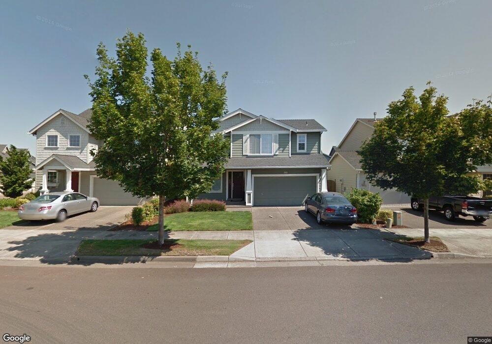
1217 SE Brookside Way Corvallis, OR 97333
South Corvallis NeighborhoodEstimated Value: $533,420 - $558,000
4
Beds
3
Baths
1,982
Sq Ft
$277/Sq Ft
Est. Value
About This Home
This home is located at 1217 SE Brookside Way, Corvallis, OR 97333 and is currently estimated at $548,605, approximately $276 per square foot. 1217 SE Brookside Way is a home located in Benton County with nearby schools including Lincoln Elementary School, Linus Pauling Middle School, and Corvallis High School.
Ownership History
Date
Name
Owned For
Owner Type
Purchase Details
Closed on
Jun 27, 2011
Sold by
Wallace Mary Ann and Iyer Md Mary Ann
Bought by
Reehoorn Jon P and Reehoorn Meghan D
Current Estimated Value
Home Financials for this Owner
Home Financials are based on the most recent Mortgage that was taken out on this home.
Original Mortgage
$251,410
Outstanding Balance
$173,858
Interest Rate
4.62%
Mortgage Type
FHA
Estimated Equity
$374,747
Purchase Details
Closed on
May 13, 2003
Sold by
Matrix Development Corp
Bought by
Wallace Mary Ann
Home Financials for this Owner
Home Financials are based on the most recent Mortgage that was taken out on this home.
Original Mortgage
$50,000
Interest Rate
5.57%
Mortgage Type
Purchase Money Mortgage
Create a Home Valuation Report for This Property
The Home Valuation Report is an in-depth analysis detailing your home's value as well as a comparison with similar homes in the area
Home Values in the Area
Average Home Value in this Area
Purchase History
| Date | Buyer | Sale Price | Title Company |
|---|---|---|---|
| Reehoorn Jon P | $257,950 | Fidelity Natl Title Co Of Or | |
| Wallace Mary Ann | $198,800 | Lawyers Title Ins |
Source: Public Records
Mortgage History
| Date | Status | Borrower | Loan Amount |
|---|---|---|---|
| Open | Reehoorn Jon P | $251,410 | |
| Previous Owner | Wallace Mary Ann | $50,000 |
Source: Public Records
Tax History Compared to Growth
Tax History
| Year | Tax Paid | Tax Assessment Tax Assessment Total Assessment is a certain percentage of the fair market value that is determined by local assessors to be the total taxable value of land and additions on the property. | Land | Improvement |
|---|---|---|---|---|
| 2024 | $5,324 | $277,153 | -- | -- |
| 2023 | $5,013 | $269,081 | $0 | $0 |
| 2022 | $4,867 | $261,244 | $0 | $0 |
| 2021 | $4,706 | $253,635 | $0 | $0 |
| 2020 | $4,680 | $246,248 | $0 | $0 |
| 2019 | $4,314 | $239,076 | $0 | $0 |
| 2018 | $4,336 | $232,113 | $0 | $0 |
| 2017 | $4,012 | $225,352 | $0 | $0 |
| 2016 | $3,943 | $218,788 | $0 | $0 |
| 2015 | $3,814 | $212,416 | $0 | $0 |
| 2014 | $3,733 | $206,229 | $0 | $0 |
| 2012 | -- | $194,390 | $0 | $0 |
Source: Public Records
Map
Nearby Homes
- 1249 SE Rivergreen Ave
- 824 SE Bayshore Cir
- 3361 SE Summerfield Dr
- 3565 SE Shoreline Dr
- 3321 SE Summerfield Dr
- 3301 SE Summerfield Dr
- 3247 SE Hathaway Dr
- 300 SE Goodnight Av (#31) Ave Unit 31
- 300 SE Goodnight Ave Unit 21
- 300 SE Goodnight Ave
- 3676 SW 3rd St
- 255 SE Jensen Ave
- 245 SE Jensen Ave
- 235 SE Jensen Ave
- 1465-2 Plan at Beverly Gleanns - Townhomes
- 1614-1 Plan at Beverly Gleanns - Detached Homes
- 1625-2 Plan at Beverly Gleanns - Townhomes
- 585 SE Firefly Ave
- 565 SE Firefly Ave
- 545 SE Firefly Ave
- 1225 SE Brookside Way
- 1205 SE Brookside Way
- 1235 SE Brookside Way
- 1218 SE Centerpointe Dr
- 1232 SE Centerpointe Dr
- 1204 SE Centerpointe Dr
- 1239 SE Brookside Way
- 1240 SE Centerpointe Dr
- 3391 SE Midvale Dr
- 3405 SE Midvale Dr
- 1200 SE Centerpointe Dr
- 3379 SE Midvale Dr
- 3407 SE Midvale Dr
- 3367 SE Midvale Dr
- 1220 SE Brookside Way
- 1250 SE Centerpointe Dr
- 1257 SE Brookside Way
- 1230 SE Brookside Way
- 3353 SE Midvale Dr
- 3409 SE Midvale Dr