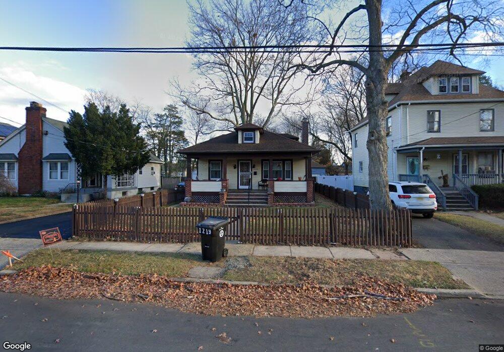
1217 W 5th St Unit 19 Plainfield, NJ 07063
Estimated Value: $302,000 - $413,000
--
Bed
--
Bath
952
Sq Ft
$372/Sq Ft
Est. Value
About This Home
This home is located at 1217 W 5th St Unit 19, Plainfield, NJ 07063 and is currently estimated at $354,455, approximately $372 per square foot. 1217 W 5th St Unit 19 is a home located in Union County with nearby schools including Clinton School, Hubbard Middle School, and Plainfield High School.
Ownership History
Date
Name
Owned For
Owner Type
Purchase Details
Closed on
Oct 12, 2018
Sold by
Rodgers Norman and Rodgers Pamela
Bought by
Westry Rodger Pamela L
Current Estimated Value
Purchase Details
Closed on
Mar 7, 1997
Sold by
Snyder Ronald
Bought by
Rodgers Norman and Rodgers Pamela
Create a Home Valuation Report for This Property
The Home Valuation Report is an in-depth analysis detailing your home's value as well as a comparison with similar homes in the area
Home Values in the Area
Average Home Value in this Area
Purchase History
| Date | Buyer | Sale Price | Title Company |
|---|---|---|---|
| Westry Rodger Pamela L | -- | Foundation Title Llc | |
| Rodgers Norman | $69,900 | -- |
Source: Public Records
Tax History Compared to Growth
Tax History
| Year | Tax Paid | Tax Assessment Tax Assessment Total Assessment is a certain percentage of the fair market value that is determined by local assessors to be the total taxable value of land and additions on the property. | Land | Improvement |
|---|---|---|---|---|
| 2025 | $7,387 | $84,600 | $36,800 | $47,800 |
| 2024 | $7,315 | $84,600 | $36,800 | $47,800 |
| 2023 | $7,315 | $84,600 | $36,800 | $47,800 |
| 2022 | $7,156 | $84,600 | $36,800 | $47,800 |
| 2021 | $7,094 | $84,600 | $36,800 | $47,800 |
| 2020 | $7,073 | $84,600 | $36,800 | $47,800 |
| 2019 | $7,073 | $84,600 | $36,800 | $47,800 |
| 2018 | $6,925 | $84,600 | $36,800 | $47,800 |
| 2017 | $6,756 | $84,600 | $36,800 | $47,800 |
| 2016 | $6,618 | $84,600 | $36,800 | $47,800 |
| 2015 | $6,423 | $84,600 | $36,800 | $47,800 |
| 2014 | -- | $84,600 | $36,800 | $47,800 |
Source: Public Records
Map
Nearby Homes
- 1227 W 6th St
- 355 Bergen St
- 318 Halsey St Unit 20
- 333 Mcdowell St Unit 35
- 338 Manson Place Unit 40
- 1408 W 5th St
- 318-20 Manson Place
- 1222 W 3rd St Unit 24
- 312 Monroe Ave Unit 14
- 1637 S 2nd St
- 950 W 6th St Unit 52
- 4 Rauer Ct
- 954 W 4th St
- 525 Pleasant Ave
- 223 Monroe Ave
- 667 S 2nd St
- 325-29 Stebbins Place Unit 4
- 1357-1403 S 2nd St Unit 2
- 1357-1403 S 2nd St
- 405 Wall St
- 1213 W 5th St Unit 15
- 1221 W 5th St Unit 23
- 1211 W 5th St
- 1225 W 5th St Unit 27
- 1216 W 5th St Unit 18
- 1229 W 5th St Unit 31
- 1205 W 5th St Unit 9
- 1220 W 5th St Unit 22
- 1233 W 5th St Unit 35
- 1212 W 5th St Unit 14
- 1224 W 5th St Unit 26
- 1214 W 6th St
- 1216 W 6th St
- 1208 W 5th St Unit 10
- 1210 W 6th St Unit 12
- 1218 W 6th St
- 1153 W 5th St Unit 1203
- 1228 W 5th St Unit 30
- 1208 W 6th St
- 1204 W 5th St Unit 6