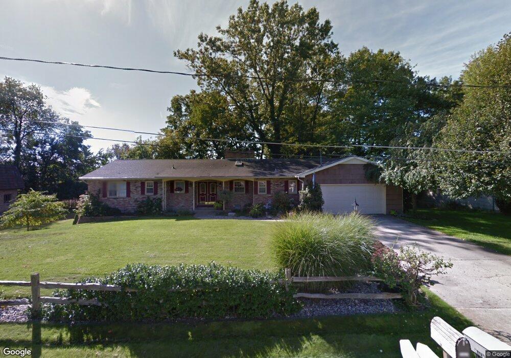
1217 W Frank Dr Greenville, MI 48838
Estimated Value: $263,000 - $323,803
--
Bed
--
Bath
--
Sq Ft
0.25
Acres
About This Home
This home is located at 1217 W Frank Dr, Greenville, MI 48838 and is currently estimated at $298,951. 1217 W Frank Dr is a home located in Montcalm County with nearby schools including Greenville Senior High School, Flat River Academy - Middle/High School, and Grattan Academy - Elementary.
Ownership History
Date
Name
Owned For
Owner Type
Purchase Details
Closed on
May 12, 2004
Sold by
Sorensen Carol A
Bought by
Sorensen Carol A and Carol A Sorensen Revocable Living Trust
Current Estimated Value
Home Financials for this Owner
Home Financials are based on the most recent Mortgage that was taken out on this home.
Original Mortgage
$70,000
Interest Rate
5.85%
Mortgage Type
Credit Line Revolving
Purchase Details
Closed on
Mar 13, 2004
Sold by
Sorensen Christopher N
Bought by
Sorensen Carol A and Carol A Sorensen Trust
Home Financials for this Owner
Home Financials are based on the most recent Mortgage that was taken out on this home.
Original Mortgage
$70,000
Interest Rate
5.85%
Mortgage Type
Credit Line Revolving
Purchase Details
Closed on
Jan 28, 2004
Sold by
Sorensen Carol Ann and Peter Sorensen N
Bought by
Sorensen Carol A
Create a Home Valuation Report for This Property
The Home Valuation Report is an in-depth analysis detailing your home's value as well as a comparison with similar homes in the area
Home Values in the Area
Average Home Value in this Area
Purchase History
| Date | Buyer | Sale Price | Title Company |
|---|---|---|---|
| Sorensen Carol A | -- | Title Source Inc | |
| Sorensen Carol A | -- | Title Source Inc | |
| Sorensen Carol A | -- | -- | |
| Sorensen Carol A | -- | -- |
Source: Public Records
Mortgage History
| Date | Status | Borrower | Loan Amount |
|---|---|---|---|
| Closed | Sorensen Carol A | $70,000 |
Source: Public Records
Tax History Compared to Growth
Tax History
| Year | Tax Paid | Tax Assessment Tax Assessment Total Assessment is a certain percentage of the fair market value that is determined by local assessors to be the total taxable value of land and additions on the property. | Land | Improvement |
|---|---|---|---|---|
| 2025 | $3,652 | $166,300 | $0 | $0 |
| 2024 | $3,613 | $154,200 | $0 | $0 |
| 2023 | -- | $137,700 | $0 | $0 |
| 2022 | -- | $114,800 | $0 | $0 |
| 2021 | -- | $105,400 | $0 | $0 |
| 2020 | -- | -- | $0 | $0 |
| 2019 | -- | -- | $0 | $0 |
| 2018 | -- | -- | $0 | $0 |
| 2017 | -- | -- | $0 | $0 |
| 2016 | -- | -- | $0 | $0 |
| 2015 | -- | -- | $0 | $0 |
| 2014 | -- | -- | $0 | $0 |
Source: Public Records
Map
Nearby Homes
- VL W Washington St
- 409 S Luray St
- 212 S Hillcrest St
- 927 S Alexander St
- 1010 W Orange St
- 0 S Greenville Dr W Unit 24031080
- 923 W Grove St
- 614 W South St
- Lot 31 W High St
- Lot 32 W High St
- 522 W Cass St
- 315 S Cross St
- 605 W Montcalm St
- Elements 2390 Plan at Baldwin Woods
- 1309 Grosvenor Dr
- 510 W Oak Ridge
- 605 S Franklin St
- 215 W Grove St
- 7493 Youngman Rd
- 919 S Lafayette St
- 1221 W Frank Dr
- 1211 W Frank Dr
- 622 S David Dr
- 1218 W Frank Dr
- 617 S David Dr
- 1225 W Frank Dr
- 1224 W Frank Dr
- 611 S David Dr
- 610 S Nelson St
- 623 S Nelson St
- 619 S Nelson St
- 607 S David Dr
- 606 S Nelson St
- 615 S Nelson St
- 608 S David Dr
- 609 S Nelson St
- 1217 W Oak St
- 601 S David Dr
- 1223 W Oak St
- 605 S Nelson St