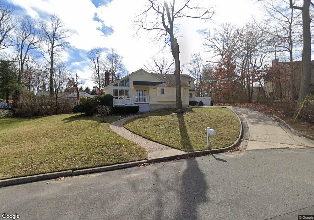
1217 W Union Ln Manasquan, NJ 08736
Estimated Value: $1,010,000 - $1,124,943
3
Beds
2
Baths
3,116
Sq Ft
$343/Sq Ft
Est. Value
About This Home
This home is located at 1217 W Union Ln, Manasquan, NJ 08736 and is currently estimated at $1,069,736, approximately $343 per square foot. 1217 W Union Ln is a home located in Monmouth County with nearby schools including Wall High School, The Brookside School, and St. Peter School.
Ownership History
Date
Name
Owned For
Owner Type
Purchase Details
Closed on
Aug 13, 2014
Sold by
Abrecht Jeffrey and Abrecht Lori A
Bought by
Abrehct Jeffrey
Current Estimated Value
Home Financials for this Owner
Home Financials are based on the most recent Mortgage that was taken out on this home.
Original Mortgage
$360,000
Interest Rate
4.09%
Mortgage Type
New Conventional
Create a Home Valuation Report for This Property
The Home Valuation Report is an in-depth analysis detailing your home's value as well as a comparison with similar homes in the area
Home Values in the Area
Average Home Value in this Area
Purchase History
| Date | Buyer | Sale Price | Title Company |
|---|---|---|---|
| Abrehct Jeffrey | -- | None Available |
Source: Public Records
Mortgage History
| Date | Status | Borrower | Loan Amount |
|---|---|---|---|
| Closed | Abrehct Jeffrey | $360,000 |
Source: Public Records
Tax History Compared to Growth
Tax History
| Year | Tax Paid | Tax Assessment Tax Assessment Total Assessment is a certain percentage of the fair market value that is determined by local assessors to be the total taxable value of land and additions on the property. | Land | Improvement |
|---|---|---|---|---|
| 2025 | $12,770 | $605,200 | $257,000 | $348,200 |
| 2024 | $12,388 | $605,200 | $257,000 | $348,200 |
| 2023 | $12,388 | $605,200 | $257,000 | $348,200 |
| 2022 | $12,086 | $605,200 | $257,000 | $348,200 |
| 2021 | $12,086 | $605,200 | $257,000 | $348,200 |
| 2020 | $11,941 | $605,200 | $257,000 | $348,200 |
| 2019 | $11,795 | $605,200 | $257,000 | $348,200 |
| 2018 | $11,692 | $605,200 | $257,000 | $348,200 |
| 2017 | $11,462 | $605,200 | $257,000 | $348,200 |
| 2016 | $11,220 | $605,200 | $257,000 | $348,200 |
| 2015 | $11,744 | $398,100 | $132,900 | $265,200 |
| 2014 | $11,369 | $394,200 | $129,000 | $265,200 |
Source: Public Records
Map
Nearby Homes
- 1307 W Union Ln Unit A4
- 142 Oval Rd
- 5 Hickory Ct Unit B
- 1207 Bayberry Rd
- 1210 Bayberry Rd
- Kensington Plan at The Monmouth - The Villas 55+
- 308 South St
- 203 Lenape Trail
- 816 Rathjen Rd
- 642 Rankin Rd
- 41 Poplar Ct Unit C
- 14 Lebanon Dr
- 2573 Curriers Place
- 2578 Collier Rd
- 23 Mulberry Ct Unit D
- 29 Mulberry Ct Unit D
- 31 Mulberry Ct Unit A
- 846 William Dr
- 1422 Lakewood Rd
- 619 Park Ave
- 1215 W Union Ln
- 1218 W Union Ln
- 1220 W Union Ln
- 706 Old Bridge Rd
- 1208 W Union Ln
- 2591 Crestview Rd
- 1222 W Union Ln
- 2588 Crestview Rd
- 704 Old Bridge Rd
- 1301 W Union Ln
- 1301 W Union Ln Unit C1
- 1301 W Union Ln Unit G2
- 1301 W Union Ln Unit E4
- 1301 W Union Ln Unit G1
- 1301 W Union Ln Unit D1
- 1301 W Union Ln Unit D3
- 1301 W Union Ln Unit F4
- 1301 W Union Ln Unit G4
- 1301 W Union Ln Unit E3
- 1301 W Union Ln Unit G3