Estimated Value: $268,866 - $372,000
3
Beds
4
Baths
2,039
Sq Ft
$164/Sq Ft
Est. Value
About This Home
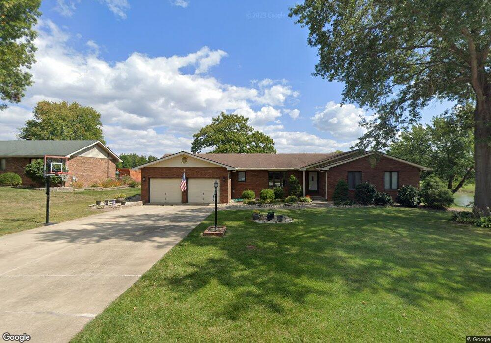
This home is located at 1217 W Woodfield Dr, Alton, IL 62002 and is currently estimated at $334,717, approximately $164 per square foot. 1217 W Woodfield Dr is a home located in Madison County with nearby schools including Eunice Smith Elementary School, Alton Middle School, and Alton High School.
Ownership History
Date
Name
Owned For
Owner Type
Purchase Details
Closed on
Oct 3, 2014
Sold by
Waters Phyllis A and Waters Donald A
Bought by
Baird Robert R and Baird Jennifer S
Current Estimated Value
Home Financials for this Owner
Home Financials are based on the most recent Mortgage that was taken out on this home.
Original Mortgage
$162,400
Outstanding Balance
$124,366
Interest Rate
4.07%
Mortgage Type
New Conventional
Estimated Equity
$210,351
Create a Home Valuation Report for This Property
The Home Valuation Report is an in-depth analysis detailing your home's value as well as a comparison with similar homes in the area
Home Values in the Area
Average Home Value in this Area
Purchase History
| Date | Buyer | Sale Price | Title Company |
|---|---|---|---|
| Baird Robert R | $203,000 | Serenity Title & Escrow Ltd |
Source: Public Records
Mortgage History
| Date | Status | Borrower | Loan Amount |
|---|---|---|---|
| Open | Baird Robert R | $162,400 |
Source: Public Records
Tax History Compared to Growth
Tax History
| Year | Tax Paid | Tax Assessment Tax Assessment Total Assessment is a certain percentage of the fair market value that is determined by local assessors to be the total taxable value of land and additions on the property. | Land | Improvement |
|---|---|---|---|---|
| 2024 | $5,354 | $86,450 | $12,380 | $74,070 |
| 2023 | $5,354 | $79,810 | $11,430 | $68,380 |
| 2022 | $5,032 | $72,980 | $10,450 | $62,530 |
| 2021 | $4,534 | $68,640 | $9,830 | $58,810 |
| 2020 | $4,519 | $67,160 | $9,620 | $57,540 |
| 2019 | $4,625 | $65,410 | $9,370 | $56,040 |
| 2018 | $4,540 | $62,620 | $8,970 | $53,650 |
| 2017 | $4,349 | $62,620 | $8,970 | $53,650 |
| 2016 | $4,245 | $62,620 | $8,970 | $53,650 |
| 2015 | $3,473 | $60,650 | $8,690 | $51,960 |
| 2014 | $3,473 | $60,650 | $8,690 | $51,960 |
| 2013 | $3,473 | $60,650 | $8,690 | $51,960 |
Source: Public Records
Map
Nearby Homes
- 77 Deerfield Cir
- 79 Deerfield Cir
- 81 Deerfield Cir
- 78 Deerfield Cir
- 80 Deerfield Cir
- 48 E Woodfield Dr
- 49 E Woodfield Dr
- 84 Foxwood Cir
- 86 Foxwood Cir
- 87 Foxwood Cir
- 85 Foxwood Cir
- 100 & 101 Sheffield Place
- 6002 Wenzel Rd
- 7005 Ivy Ln
- 5328 Seminary Rd
- 15 Tra Lin Ridge
- 4245 Seminary Rd
- 0 Lake Dr
- 2362 Briarcliff Dr
- 0 Woodland Hills Dr Unit MIS25054215
- 1215 W Woodfield Dr
- 1213 W Woodfield Dr
- 1228 W Woodfield Dr
- 1226 W Woodfield Dr
- 1224 W Woodfield Dr
- 1211 W Woodfield Dr
- 1222 W Woodfield Dr
- 1220 W Woodfield Dr
- 1209 W Woodfield Dr
- 8357 Lois Ln
- 1218 W Woodfield Dr
- 1207 W Woodfield Dr
- 1404 Elmwood Dr
- 1406 Elmwood Dr
- 1402 Elmwood Dr
- 1212 W Woodfield Dr
- 1214 W Woodfield Dr
- 1216 W Woodfield Dr
- 1205 W Woodfield Dr
- 1208 W Woodfield Dr