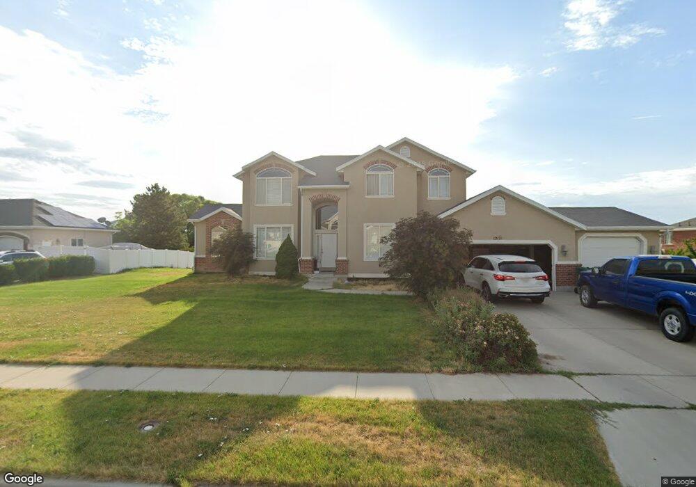
12171 S 4320 W Riverton, UT 84096
Estimated Value: $789,575 - $1,048,000
4
Beds
3
Baths
2,660
Sq Ft
$329/Sq Ft
Est. Value
About This Home
This home is located at 12171 S 4320 W, Riverton, UT 84096 and is currently estimated at $874,144, approximately $328 per square foot. 12171 S 4320 W is a home located in Salt Lake County with nearby schools including Midas Creek Elementary School, Oquirrh Hills Middle School, and Riverton High School.
Ownership History
Date
Name
Owned For
Owner Type
Purchase Details
Closed on
Mar 30, 2022
Sold by
David Brown Stephen
Bought by
Brown Stephen D and Brown Susan K
Current Estimated Value
Home Financials for this Owner
Home Financials are based on the most recent Mortgage that was taken out on this home.
Original Mortgage
$361,000
Outstanding Balance
$295,114
Interest Rate
3.63%
Mortgage Type
New Conventional
Estimated Equity
$579,030
Purchase Details
Closed on
Sep 5, 2002
Sold by
Brown Stephen
Bought by
Brown Stephen David and Brown Susan Kolena
Home Financials for this Owner
Home Financials are based on the most recent Mortgage that was taken out on this home.
Original Mortgage
$252,000
Interest Rate
6.37%
Purchase Details
Closed on
Jul 23, 2002
Sold by
Brown Stephen D and Brown Susan K
Bought by
Brown Stephen D
Home Financials for this Owner
Home Financials are based on the most recent Mortgage that was taken out on this home.
Original Mortgage
$252,000
Interest Rate
6.37%
Purchase Details
Closed on
Mar 4, 2002
Sold by
The Theurer Co
Bought by
Brown Stephen D and Brown Susan K
Home Financials for this Owner
Home Financials are based on the most recent Mortgage that was taken out on this home.
Original Mortgage
$266,000
Interest Rate
6.8%
Purchase Details
Closed on
Oct 15, 2001
Sold by
Kfp Corp
Bought by
The Theurer Co
Create a Home Valuation Report for This Property
The Home Valuation Report is an in-depth analysis detailing your home's value as well as a comparison with similar homes in the area
Home Values in the Area
Average Home Value in this Area
Purchase History
| Date | Buyer | Sale Price | Title Company |
|---|---|---|---|
| Brown Stephen D | -- | Meridian Title | |
| Brown Stephen David | -- | Meridian Title | |
| Brown Stephen | -- | Meridian Title | |
| Brown Stephen D | -- | Meridian Title | |
| Brown Stephen D | -- | Meridian Title | |
| The Theurer Co | -- | Meridian Title | |
| Kfp Corp | -- | Meridian Title |
Source: Public Records
Mortgage History
| Date | Status | Borrower | Loan Amount |
|---|---|---|---|
| Open | Brown Stephen D | $361,000 | |
| Previous Owner | Brown Stephen | $252,000 | |
| Previous Owner | Brown Stephen D | $266,000 | |
| Closed | Brown Stephen | $25,000 |
Source: Public Records
Tax History Compared to Growth
Tax History
| Year | Tax Paid | Tax Assessment Tax Assessment Total Assessment is a certain percentage of the fair market value that is determined by local assessors to be the total taxable value of land and additions on the property. | Land | Improvement |
|---|---|---|---|---|
| 2025 | $3,961 | $718,200 | $263,000 | $455,200 |
| 2024 | $3,961 | $685,500 | $251,000 | $434,500 |
| 2023 | $4,109 | $670,400 | $281,400 | $389,000 |
| 2022 | $4,277 | $684,600 | $275,800 | $408,800 |
| 2021 | $3,711 | $528,800 | $216,200 | $312,600 |
| 2020 | $3,481 | $462,500 | $216,200 | $246,300 |
| 2019 | $3,413 | $445,800 | $216,200 | $229,600 |
| 2018 | $3,311 | $425,800 | $187,900 | $237,900 |
| 2017 | $3,355 | $420,500 | $187,900 | $232,600 |
| 2016 | $3,264 | $392,600 | $132,300 | $260,300 |
| 2015 | $3,282 | $382,700 | $141,100 | $241,600 |
| 2014 | $2,917 | $333,500 | $124,700 | $208,800 |
Source: Public Records
Map
Nearby Homes
- 12159 Swensen Cir
- 12339 Black Foot St
- 4091 W Swensen Farm Dr
- 12693 S Lincoln Peak Ln
- 12687 S Lincoln Peak Ln Unit 126
- 12687 S Lincoln Peak Ln
- 12671 S Lincoln Peak Ln Unit 131
- 12671 S Lincoln Peak Ln
- 12667 S Lincoln Peak Ln Unit 132
- 12667 S Lincoln Peak Ln Unit 125
- 12667 S Lincoln Peak Ln
- 12694 S Lincoln Peak Ln Unit 116
- 12694 S Lincoln Peak Ln
- 12688 S Lincoln Peak Ln Unit 115
- 12688 S Lincoln Peak Ln
- 12686 Lincoln Peak Ln
- 12682 S Lincoln Peak Ln
- 12682 S Lincoln Peak Ln Unit 113
- 12676 S Lincoln Peak Ln
- 12676 S Lincoln Peak Ln Unit 112
- 12157 S 4320 W
- 12191 S 4320 W
- 12184 S Wheat Meadow Ct
- 12158 Wheat Meadow Ct
- 12174 S 4320 W
- 12207 Huron Rd
- 12188 S 4320 W
- 12152 S 4320 W
- 4298 W Swensen Farm Dr
- 4298 W Swensen Farm Dr
- 4314 Swensen Farm Dr
- 12193 Wheat Meadow Ct
- 12193 S Wheat Meadow Ct
- 12124 S 4250 W
- 12237 S Huron Rd
- 12137 Swensen Cir
- 12181 Swensen Cir
- 12181 Wheat Meadow Ct
- 4338 Swensen Farm Dr
- 4338 W Swensen Farm Dr