Estimated Value: $233,680 - $262,000
3
Beds
2
Baths
1,120
Sq Ft
$220/Sq Ft
Est. Value
About This Home
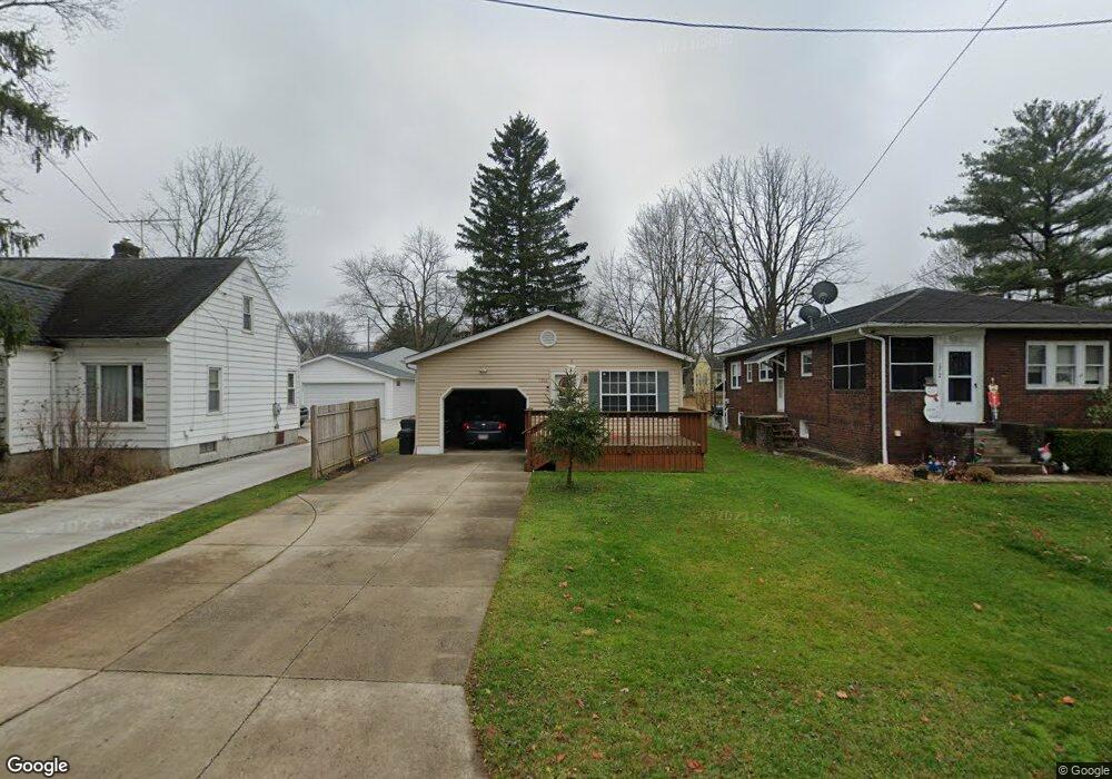
This home is located at 1218 Chestnut Dr, Stow, OH 44224 and is currently estimated at $246,170, approximately $219 per square foot. 1218 Chestnut Dr is a home located in Summit County with nearby schools including Stow-Munroe Falls High School, Primrose School of Hudson, and Holy Family Elementary School.
Ownership History
Date
Name
Owned For
Owner Type
Purchase Details
Closed on
Jan 7, 2020
Sold by
Brown Jeffrey A
Bought by
Brown Jeffrey A and Dong Lili
Current Estimated Value
Purchase Details
Closed on
Aug 10, 2004
Sold by
Rolenz David and Rolenz Joanna L
Bought by
Brown Jeffrey A
Home Financials for this Owner
Home Financials are based on the most recent Mortgage that was taken out on this home.
Original Mortgage
$129,564
Interest Rate
6.34%
Mortgage Type
FHA
Create a Home Valuation Report for This Property
The Home Valuation Report is an in-depth analysis detailing your home's value as well as a comparison with similar homes in the area
Home Values in the Area
Average Home Value in this Area
Purchase History
| Date | Buyer | Sale Price | Title Company |
|---|---|---|---|
| Brown Jeffrey A | -- | None Listed On Document | |
| Brown Jeffrey A | $131,600 | -- |
Source: Public Records
Mortgage History
| Date | Status | Borrower | Loan Amount |
|---|---|---|---|
| Previous Owner | Brown Jeffrey A | $129,564 |
Source: Public Records
Tax History
| Year | Tax Paid | Tax Assessment Tax Assessment Total Assessment is a certain percentage of the fair market value that is determined by local assessors to be the total taxable value of land and additions on the property. | Land | Improvement |
|---|---|---|---|---|
| 2024 | $4,037 | $71,401 | $7,487 | $63,914 |
| 2023 | $4,037 | $71,401 | $7,487 | $63,914 |
| 2022 | $3,393 | $52,889 | $5,544 | $47,345 |
| 2021 | $3,039 | $52,889 | $5,544 | $47,345 |
| 2020 | $2,987 | $52,890 | $5,540 | $47,350 |
| 2019 | $2,127 | $34,900 | $8,330 | $26,570 |
| 2018 | $2,093 | $34,900 | $8,330 | $26,570 |
| 2017 | $2,151 | $34,900 | $8,330 | $26,570 |
| 2016 | $2,213 | $34,900 | $8,330 | $26,570 |
| 2015 | $2,151 | $34,900 | $8,330 | $26,570 |
| 2014 | $2,153 | $34,900 | $8,330 | $26,570 |
| 2013 | $2,174 | $35,490 | $8,330 | $27,160 |
Source: Public Records
Map
Nearby Homes
- 0 Hibbard Dr
- 4891 Cedar Crest Ln
- 1525 Spruce Hill Dr
- 1664 Cypress Ct
- V/L Housley Rd
- 4634 Cox Dr Unit A
- 1620 Sapphire Dr
- 4630 Red Willow Rd
- 2279 Becket Cir
- 5406 Towbridge Dr
- 1514 & 1516 Robin Ln
- 734 Barlow Rd
- V/L Norton Rd
- 5114 Bayside Lake Blvd
- 2188 Duxbury
- 5131 Bayside Lake Blvd
- 4173 Ellsworth Rd
- V/L Diplomat Dr
- 2221 Crockett Cir
- 4424 Timberdale Dr Unit 4428
- 1222 Chestnut Dr
- 1212 Chestnut Dr
- 1208 Chestnut Dr
- 1230 Chestnut Dr
- 1213 Meadowbrook Blvd
- 1217 Meadowbrook Blvd
- 1200 Chestnut Dr
- 1236 Chestnut Dr
- 1213 Chestnut Dr
- 1219 Chestnut Dr
- 1199 Meadowbrook Blvd
- 1209 Chestnut Dr
- 1223 Chestnut Dr
- 1229 Chestnut Dr
- 1231 Meadowbrook Blvd
- 1233 Chestnut Dr
- 1201 Chestnut Dr
- 1244 Chestnut Dr
- 1237 Chestnut Dr
- 1195 Meadowbrook Blvd