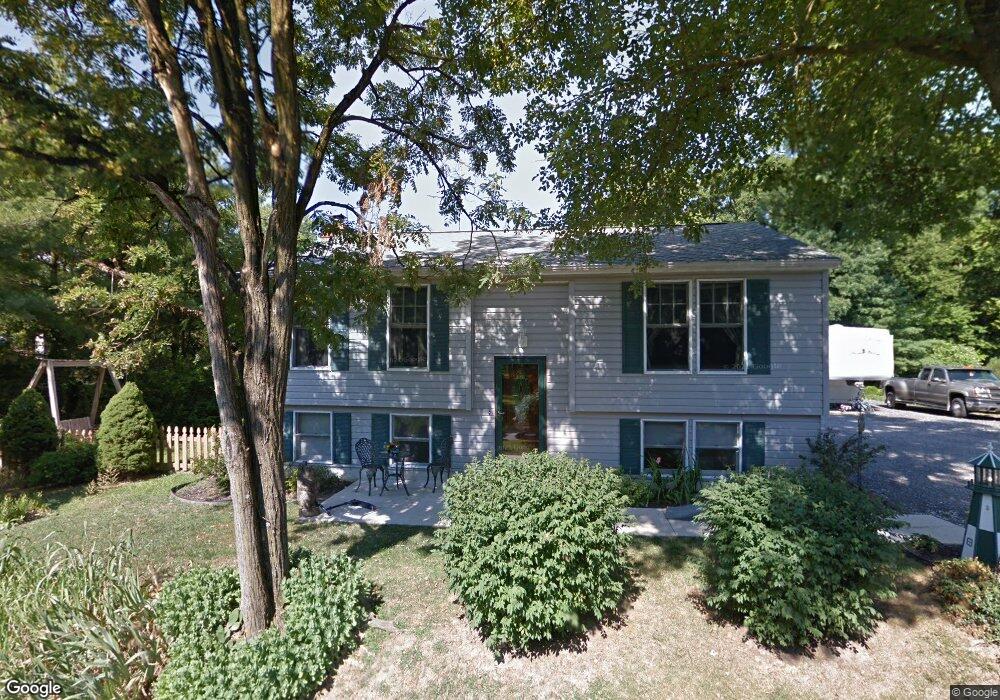
1218 Mckinstrys Mill Rd Union Bridge, MD 21791
Estimated Value: $297,414 - $415,000
Studio
2
Baths
1,304
Sq Ft
$288/Sq Ft
Est. Value
About This Home
This home is located at 1218 Mckinstrys Mill Rd, Union Bridge, MD 21791 and is currently estimated at $375,354, approximately $287 per square foot. 1218 Mckinstrys Mill Rd is a home located in Carroll County with nearby schools including Elmer A. Wolfe Elementary School, Northwest Middle School, and Francis Scott Key High School.
Ownership History
Date
Name
Owned For
Owner Type
Purchase Details
Closed on
Jun 18, 2003
Sold by
Meredith Robert T
Bought by
Meredith Robert T and Meredith Tina L
Current Estimated Value
Purchase Details
Closed on
Jul 15, 1988
Sold by
Chioce Development Corp
Bought by
Meredith Robert T
Create a Home Valuation Report for This Property
The Home Valuation Report is an in-depth analysis detailing your home's value as well as a comparison with similar homes in the area
Purchase History
| Date | Buyer | Sale Price | Title Company |
|---|---|---|---|
| Meredith Robert T | -- | -- | |
| Meredith Robert T | $80,000 | -- |
Source: Public Records
Tax History
| Year | Tax Paid | Tax Assessment Tax Assessment Total Assessment is a certain percentage of the fair market value that is determined by local assessors to be the total taxable value of land and additions on the property. | Land | Improvement |
|---|---|---|---|---|
| 2025 | $3,196 | $280,000 | $0 | $0 |
| 2024 | $2,835 | $247,800 | $0 | $0 |
| 2023 | $2,474 | $215,600 | $79,000 | $136,600 |
| 2022 | $2,446 | $213,067 | $0 | $0 |
| 2021 | $4,998 | $210,533 | $0 | $0 |
| 2020 | $2,389 | $208,000 | $79,000 | $129,000 |
| 2019 | $2,343 | $202,033 | $0 | $0 |
| 2018 | $2,256 | $196,067 | $0 | $0 |
| 2017 | $2,189 | $190,100 | $0 | $0 |
| 2016 | -- | $190,100 | $0 | $0 |
| 2015 | -- | $190,100 | $0 | $0 |
| 2014 | -- | $192,100 | $0 | $0 |
Source: Public Records
Map
Nearby Homes
- 403 E Thomas St
- 10301 Mckinstry Mill Rd
- 314 E Broadway St
- 312 E Broadway St
- 244 Stem Rd
- 285 Stem Rd
- 0 Stem Rd
- 9630 B Clemsonville Rd
- 3190 Vista Ct
- 57B Hoff Rd
- Lot 6, South Parsonage Ln
- 118 S Clear Ridge Rd
- 1038 Green Valley Rd
- 221 Main St
- 227 Main St
- 414 High St
- 13411 Rabbit Run Terrace
- 15030 New Windsor Rd
- 2810 Town View Cir
- 2833 Town View Cir
- 1220 Mckinstrys Mill Rd
- 1190 Mckinstrys Mill Rd
- 1236 Mckinstrys Mill Rd
- 1170 Mckinstrys Mill Rd
- 4400 Mill Race Dr
- 1240 Mckinstrys Mill Rd
- 1207 Mckinstrys Mill Rd
- 1241 Mckinstrys Mill Rd
- 4396 Mill Race Dr
- 1171 Mckinstrys Mill Rd
- 0 Mckinstrys Mill Rd Unit 1000081395
- 0 Mckinstrys Mill Rd Unit 1000080773
- 0 Mckinstrys Mill Rd Unit 1006956124
- 0 Mckinstrys Mill Rd Unit 1006561716
- 0 Mckinstrys Mill Rd Unit 1003455782
- 0 Mckinstrys Mill Rd Unit CR7610431
- 0 Mckinstrys Mill Rd Unit CR7939093
- 0 Mckinstrys Mill Rd Unit CR8422542
- 0 Mckinstrys Mill Rd Unit 1007723314
- 0 Mckinstrys Mill Rd Unit 1009384706
Your Personal Tour Guide
Ask me questions while you tour the home.