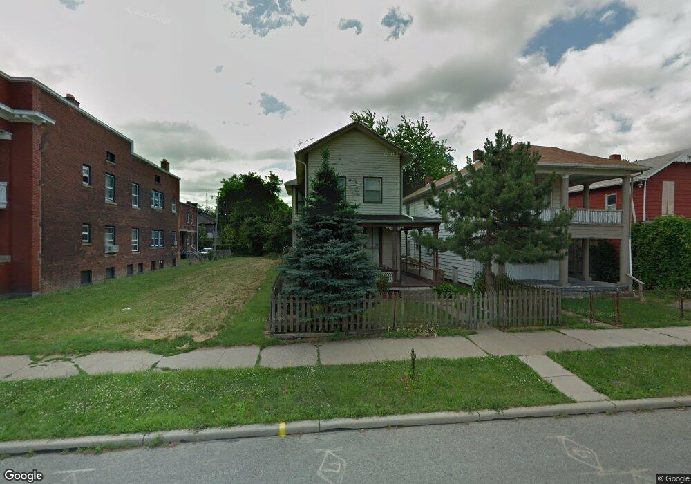
1218 N Huron St Toledo, OH 43604
Lagrange NeighborhoodEstimated Value: $65,000 - $94,000
4
Beds
1
Bath
1,976
Sq Ft
$42/Sq Ft
Est. Value
About This Home
This home is located at 1218 N Huron St, Toledo, OH 43604 and is currently estimated at $83,794, approximately $42 per square foot. 1218 N Huron St is a home located in Lucas County with nearby schools including Riverside Elementary School, Woodward High School, and The Maritime Academy of Toledo.
Ownership History
Date
Name
Owned For
Owner Type
Purchase Details
Closed on
May 23, 2015
Sold by
Price Jeanie A and Devore Jeanie A
Bought by
Devore Virginia L
Current Estimated Value
Purchase Details
Closed on
Oct 27, 1994
Sold by
Itt Financial Services
Bought by
Garner James H and Garner Mary C
Purchase Details
Closed on
Feb 21, 1990
Sold by
Massengill James D
Purchase Details
Closed on
Mar 22, 1988
Sold by
Villarreal Villarreal L L and Villarreal P
Create a Home Valuation Report for This Property
The Home Valuation Report is an in-depth analysis detailing your home's value as well as a comparison with similar homes in the area
Home Values in the Area
Average Home Value in this Area
Purchase History
| Date | Buyer | Sale Price | Title Company |
|---|---|---|---|
| Devore Virginia L | -- | None Available | |
| Garner James H | $12,278 | -- | |
| -- | $16,200 | -- | |
| -- | $18,500 | -- |
Source: Public Records
Tax History Compared to Growth
Tax History
| Year | Tax Paid | Tax Assessment Tax Assessment Total Assessment is a certain percentage of the fair market value that is determined by local assessors to be the total taxable value of land and additions on the property. | Land | Improvement |
|---|---|---|---|---|
| 2024 | $451 | $13,195 | $2,240 | $10,955 |
| 2023 | $600 | $7,665 | $1,295 | $6,370 |
| 2022 | $607 | $7,665 | $1,295 | $6,370 |
| 2021 | $609 | $7,665 | $1,295 | $6,370 |
| 2020 | $582 | $6,370 | $1,085 | $5,285 |
| 2019 | $577 | $6,370 | $1,085 | $5,285 |
| 2018 | $514 | $6,370 | $1,085 | $5,285 |
| 2017 | $476 | $4,550 | $1,575 | $2,975 |
| 2016 | $468 | $13,000 | $4,500 | $8,500 |
| 2015 | $461 | $13,000 | $4,500 | $8,500 |
| 2014 | -- | $4,560 | $1,580 | $2,980 |
| 2013 | -- | $4,560 | $1,580 | $2,980 |
Source: Public Records
Map
Nearby Homes
- 1114 N Superior St
- 1238 N Ontario St
- 1449 N Superior St
- 522 Locust St
- 624 Bush St
- 1463 N Ontario St
- 809 Bush St
- 811 Bush St
- 1431 N Michigan St
- 721 Stickney Ave
- 1631 N Erie St
- 326 Ash St
- 124 Maryland Ave
- 1510 Walnut St
- 132 Elgin Ave
- 128 Carbon St
- 1029 Sherman St
- 1873 N Superior St
- 1219 Peck St
- 1320 Mott Ave
- 1216 N Huron St
- 1212 N Huron St
- 1202 N Huron St
- 525 Mulberry St
- 529 Mulberry St
- 1227 N Superior St
- 1227 N Superior St Unit 4
- 1219 N Huron St
- 1211 N Huron St
- 1231 N Superior St
- 1207 N Huron St
- 1201 N Huron St
- 1205 N Huron St
- 1233 N Superior St
- 1239 N Superior St
- 1136 N Huron St
- 515 Chestnut St
- 513 Chestnut St
- 512 Mulberry St
- 1133 N Huron St