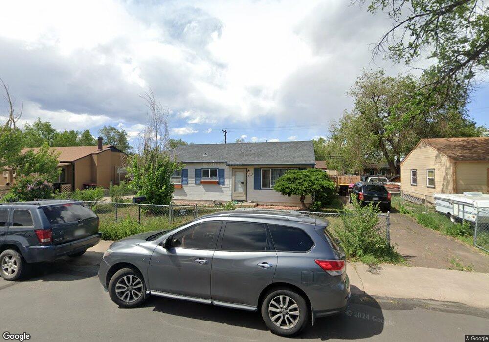
1218 Richards Ave Colorado Springs, CO 80905
Stratton Meadows NeighborhoodEstimated Value: $277,646 - $296,000
2
Beds
1
Bath
894
Sq Ft
$320/Sq Ft
Est. Value
About This Home
This home is located at 1218 Richards Ave, Colorado Springs, CO 80905 and is currently estimated at $285,912, approximately $319 per square foot. 1218 Richards Ave is a home located in El Paso County with nearby schools including Stratton Meadows Elementary School, Fox Meadow Middle School, and Harrison High School.
Ownership History
Date
Name
Owned For
Owner Type
Purchase Details
Closed on
Aug 9, 2007
Sold by
Tcf National Bank
Bought by
Brown Michael K
Current Estimated Value
Home Financials for this Owner
Home Financials are based on the most recent Mortgage that was taken out on this home.
Original Mortgage
$99,250
Outstanding Balance
$62,776
Interest Rate
6.64%
Mortgage Type
Unknown
Estimated Equity
$223,136
Purchase Details
Closed on
Jan 23, 2006
Sold by
May John R
Bought by
1218 Richards Avenue Residential Land Tr
Purchase Details
Closed on
Sep 30, 1998
Sold by
Price Joseph D V
Bought by
May John R and May Billy R
Home Financials for this Owner
Home Financials are based on the most recent Mortgage that was taken out on this home.
Original Mortgage
$75,000
Interest Rate
6.92%
Mortgage Type
VA
Purchase Details
Closed on
Sep 1, 1981
Bought by
Brown Michael K
Create a Home Valuation Report for This Property
The Home Valuation Report is an in-depth analysis detailing your home's value as well as a comparison with similar homes in the area
Home Values in the Area
Average Home Value in this Area
Purchase History
| Date | Buyer | Sale Price | Title Company |
|---|---|---|---|
| Brown Michael K | $104,500 | None Available | |
| 1218 Richards Avenue Residential Land Tr | $86,800 | None Available | |
| May John R | $75,000 | -- | |
| Brown Michael K | -- | -- |
Source: Public Records
Mortgage History
| Date | Status | Borrower | Loan Amount |
|---|---|---|---|
| Open | Brown Michael K | $99,250 | |
| Previous Owner | May John R | $75,000 |
Source: Public Records
Tax History Compared to Growth
Tax History
| Year | Tax Paid | Tax Assessment Tax Assessment Total Assessment is a certain percentage of the fair market value that is determined by local assessors to be the total taxable value of land and additions on the property. | Land | Improvement |
|---|---|---|---|---|
| 2025 | $904 | $20,120 | -- | -- |
| 2024 | $676 | $19,470 | $3,030 | $16,440 |
| 2022 | $695 | $12,880 | $2,430 | $10,450 |
| 2021 | $742 | $13,250 | $2,500 | $10,750 |
| 2020 | $678 | $10,400 | $2,150 | $8,250 |
| 2019 | $657 | $10,400 | $2,150 | $8,250 |
| 2018 | $536 | $8,170 | $1,730 | $6,440 |
| 2017 | $409 | $8,170 | $1,730 | $6,440 |
| 2016 | $385 | $7,220 | $1,510 | $5,710 |
| 2015 | $385 | $7,220 | $1,510 | $5,710 |
| 2014 | $372 | $6,880 | $1,510 | $5,370 |
Source: Public Records
Map
Nearby Homes
- 1216 Norwood Ave
- 1304 Pando Ave
- 1309 Florence Ave
- 1205 Montrose Ave
- 1315 Pando Ave
- 1224 La Junta Ave
- 1117 Montrose Ave
- 1222 Bristol Ave
- 2127 S Corona Ave
- 1117 Mount Werner Cir
- 916 Tenderfoot Hill Rd Unit 101
- 2768 La Strada Grande Heights
- 846 Tenderfoot Hill Rd Unit 104
- 1923 S Sheridan Ave
- 840 Tenderfoot Hill Rd
- 840 Tenderfoot Hill Rd Unit 201
- 1052 Florence Ave
- 850 Tenderfoot Hill Rd Unit 103
- 2415 Byers Ave
- 1033 Mount Werner Cir
- 1216 Richards Ave
- 1220 Richards Ave
- 1217 Florence Ave
- 1215 Florence Ave
- 1219 Florence Ave
- 1214 Richards Ave
- 1222 Richards Ave
- 1219 Florence Ave
- 1217 Richards Ave
- 1213 Florence Ave
- 1215 Richards Ave
- 1219 Richards Ave
- 1221 Florence Ave
- 1212 Richards Ave
- 1221 Richards Ave
- 1224 Richards Ave
- 1213 Richards Ave
- 1211 Florence Ave
- 1223 Florence Ave
- 1223 Richards Ave