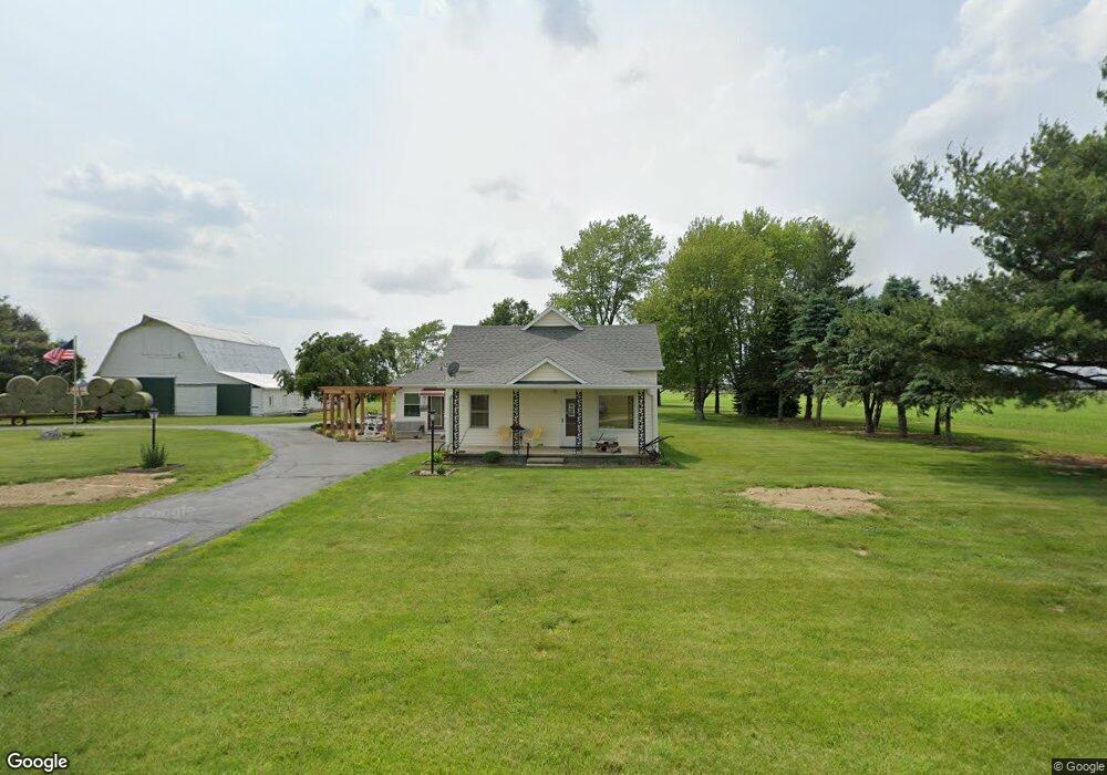
1218 S 700 E Franklin, IN 46131
Estimated Value: $296,000 - $404,000
2
Beds
1
Bath
1,526
Sq Ft
$235/Sq Ft
Est. Value
About This Home
This home is located at 1218 S 700 E, Franklin, IN 46131 and is currently estimated at $357,915, approximately $234 per square foot. 1218 S 700 E is a home located in Johnson County with nearby schools including Needham Elementary School, Franklin Community Middle School, and Custer Baker Intermediate School.
Ownership History
Date
Name
Owned For
Owner Type
Purchase Details
Closed on
Aug 18, 2023
Sold by
Mitchell Robert D
Bought by
Gill Family Farms Llc
Current Estimated Value
Purchase Details
Closed on
Apr 20, 2020
Sold by
Mitchell Robert D and Smith Kimberly D
Bought by
Mitchell Robert D
Create a Home Valuation Report for This Property
The Home Valuation Report is an in-depth analysis detailing your home's value as well as a comparison with similar homes in the area
Home Values in the Area
Average Home Value in this Area
Purchase History
| Date | Buyer | Sale Price | Title Company |
|---|---|---|---|
| Gill Family Farms Llc | -- | Franklin Title | |
| Mitchell Robert D | -- | None Available |
Source: Public Records
Tax History
| Year | Tax Paid | Tax Assessment Tax Assessment Total Assessment is a certain percentage of the fair market value that is determined by local assessors to be the total taxable value of land and additions on the property. | Land | Improvement |
|---|---|---|---|---|
| 2025 | $3,491 | $222,800 | $45,900 | $176,900 |
| 2024 | $3,491 | $183,800 | $46,600 | $137,200 |
| 2023 | $1,909 | $180,700 | $43,300 | $137,400 |
| 2022 | $2,158 | $180,900 | $43,300 | $137,600 |
| 2021 | $1,839 | $153,900 | $37,400 | $116,500 |
| 2020 | $1,689 | $143,200 | $33,400 | $109,800 |
| 2019 | $1,642 | $144,500 | $34,600 | $109,900 |
| 2018 | $1,548 | $141,900 | $34,800 | $107,100 |
| 2017 | $1,500 | $139,800 | $35,800 | $104,000 |
| 2016 | $1,535 | $134,600 | $36,300 | $98,300 |
| 2014 | $1,469 | $135,800 | $36,700 | $99,100 |
| 2013 | $1,469 | $114,600 | $35,400 | $79,200 |
Source: Public Records
Map
Nearby Homes
- 5495 E Greensburg Rd
- 6227 E State Road 44
- 150 E South St
- 3366 S 800 E
- 863 S 450 E
- W S 900 W
- 3301 S 550 E
- 409 Paris Dr
- 2080 Fairway Lakes Dr
- 1810 E Jefferson St
- 3664 S 550 E
- 2310 Fox Dr
- 2073 S Us Highway 31
- 1083 Beechtree Ln
- 17 Morning Dr
- 1185 Beechtree Ln
- 1682 Millpond Ln
- 1636 Millpond Ln
- 1679 Millpond Ln
- 1663 Millpond Ln
- 0 S 700 E Unit 21246242
- 0 S 700 E Unit 21431317
- 0 S 700 E Unit MBR2364829
- 0 S 700 E Unit 21604253
- 1443 S 700 E
- 1484 S 700 E
- 7141 E 100 S
- 1497 S 700 E
- 1589 S 700 E
- 1489 S 700 E
- 7559 E 100 S
- 6844 E 50 S
- 6950 E 50 S
- 6632 E 50 S
- 6534 E 50 S
- 334 S 700 E
- 6546 E 50 S
- 285 S 700 E
- 7004 E Greensburg Rd
- 6919 E Greensburg Rd
Your Personal Tour Guide
Ask me questions while you tour the home.