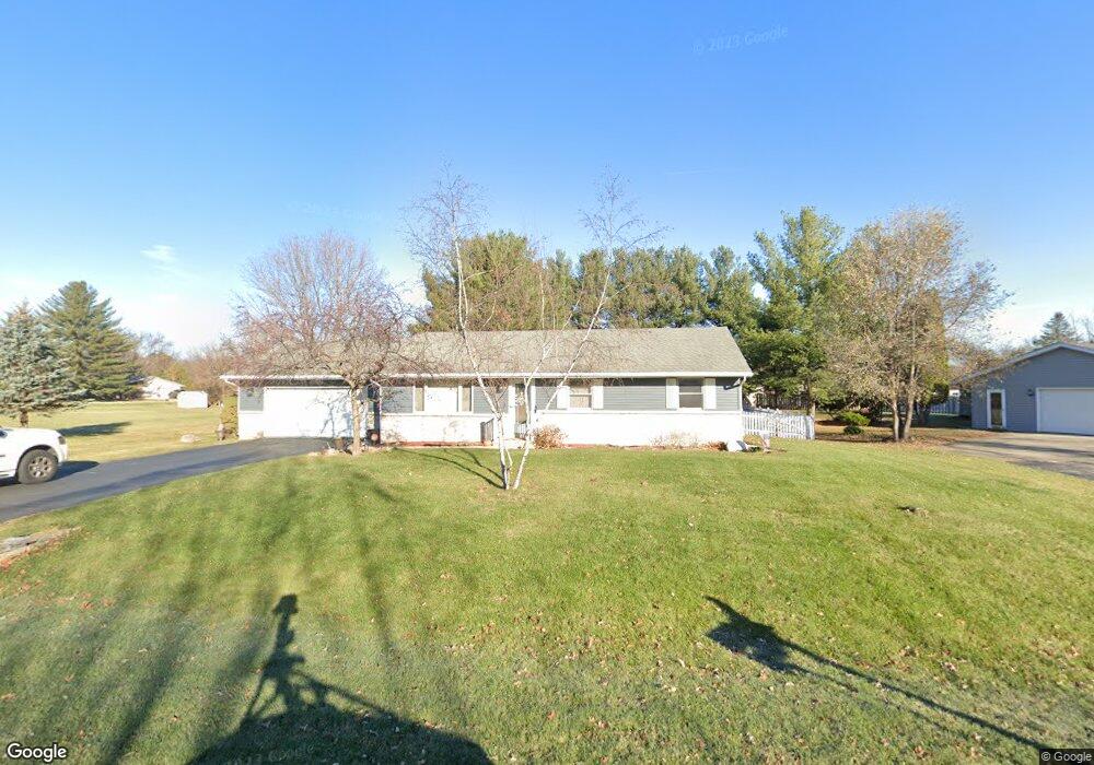
12180 Rae Ann Rd Roscoe, IL 61073
Estimated Value: $251,000 - $276,000
3
Beds
2
Baths
1,456
Sq Ft
$184/Sq Ft
Est. Value
About This Home
This home is located at 12180 Rae Ann Rd, Roscoe, IL 61073 and is currently estimated at $268,443, approximately $184 per square foot. 12180 Rae Ann Rd is a home located in Winnebago County with nearby schools including Ledgewood Elementary School, Kinnikinnick School, and Stone Creek School.
Ownership History
Date
Name
Owned For
Owner Type
Purchase Details
Closed on
Jul 1, 2021
Sold by
Hyser Family Revocable Trust
Bought by
Hyser Robert P and Hyser Angela S
Current Estimated Value
Home Financials for this Owner
Home Financials are based on the most recent Mortgage that was taken out on this home.
Original Mortgage
$132,000
Outstanding Balance
$100,386
Interest Rate
2.63%
Mortgage Type
New Conventional
Estimated Equity
$168,057
Purchase Details
Closed on
Mar 5, 2008
Sold by
May Robert J
Bought by
Hyser Robert D and Hyser Jean F
Create a Home Valuation Report for This Property
The Home Valuation Report is an in-depth analysis detailing your home's value as well as a comparison with similar homes in the area
Home Values in the Area
Average Home Value in this Area
Purchase History
| Date | Buyer | Sale Price | Title Company |
|---|---|---|---|
| Hyser Robert P | $165,000 | None Listed On Document | |
| Hyser Robert D | $19,000 | Attorney Only |
Source: Public Records
Mortgage History
| Date | Status | Borrower | Loan Amount |
|---|---|---|---|
| Open | Hyser Robert P | $132,000 |
Source: Public Records
Tax History Compared to Growth
Tax History
| Year | Tax Paid | Tax Assessment Tax Assessment Total Assessment is a certain percentage of the fair market value that is determined by local assessors to be the total taxable value of land and additions on the property. | Land | Improvement |
|---|---|---|---|---|
| 2024 | $5,555 | $73,349 | $17,398 | $55,951 |
| 2023 | $5,143 | $65,825 | $15,613 | $50,212 |
| 2022 | $4,888 | $60,175 | $14,273 | $45,902 |
| 2021 | $4,196 | $56,529 | $13,408 | $43,121 |
| 2020 | $4,092 | $54,475 | $12,921 | $41,554 |
| 2019 | $3,950 | $52,034 | $12,342 | $39,692 |
| 2018 | $3,639 | $49,999 | $11,859 | $38,140 |
| 2017 | $3,776 | $48,224 | $11,438 | $36,786 |
| 2016 | $3,610 | $47,451 | $11,255 | $36,196 |
| 2015 | $3,380 | $46,096 | $10,934 | $35,162 |
| 2014 | $3,167 | $45,514 | $10,796 | $34,718 |
Source: Public Records
Map
Nearby Homes
- 367 Timothy Turn
- 0 Oak Way
- 9.41 Acres Bluestem Rd
- 10380 Rose Way
- 11264 Cedarbrook Rd
- 12954 Portsmough Ln
- 11373 Valerian Way
- 11364 Valerian Way
- 11350 Lemon Grass Ln
- 4227 Berkshire Way
- 4830 Crown Point Cir
- 11847 River Hills Pkwy
- 11577 Old River Rd
- 11008 Chicory Ridge Way
- 10971 Borage Trail
- 144 Bristlewood Ct
- 1531 Torch Pine Dr
- 4205 Glenmore Rd
- 12222 Rae Ann Rd
- 12248 Rae Ann Rd
- 3725 Doreen Dr
- 12173 Rae Ann Rd
- 12195 Rae Ann Rd
- 12260 Rae Ann Rd
- 3767 Doreen Dr
- 12157 Rae Ann Rd
- 12205 Rae Ann Rd
- 4093 Valerie Rd
- 12223 Rae Ann Rd
- 12139 Rae Ann Rd
- 12237 Rae Ann Rd
- 4127 Valerie Rd
- 3746 Doreen Dr
- 12255 Rae Ann Rd
- 4075 Valerie Rd
- 3728 Doreen Dr
- 3758 Doreen Dr
- 3671 Doreen Dr