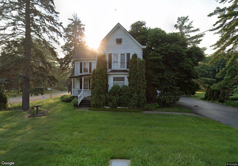
12182 Snider Rd Cincinnati, OH 45249
Highpoint NeighborhoodEstimated Value: $405,039
3
Beds
2
Baths
1,846
Sq Ft
$219/Sq Ft
Est. Value
About This Home
This home is located at 12182 Snider Rd, Cincinnati, OH 45249 and is currently estimated at $405,039, approximately $219 per square foot. 12182 Snider Rd is a home located in Hamilton County with nearby schools including Edwin H Greene Intermediate Middle School, Sycamore Junior High School, and Sycamore High School.
Ownership History
Date
Name
Owned For
Owner Type
Purchase Details
Closed on
Oct 27, 2022
Sold by
Poniske Amy J
Bought by
Board Of Commissioners Hamilton County Ohio
Current Estimated Value
Purchase Details
Closed on
Jul 25, 2003
Sold by
Watts James A and Watts Pamela J
Bought by
Poniske Amy J
Home Financials for this Owner
Home Financials are based on the most recent Mortgage that was taken out on this home.
Original Mortgage
$152,000
Interest Rate
5.3%
Mortgage Type
Unknown
Purchase Details
Closed on
Feb 27, 1996
Sold by
Wehrle Robert A and Turner Thomas E
Bought by
Watts James A and Watts Pamela J
Home Financials for this Owner
Home Financials are based on the most recent Mortgage that was taken out on this home.
Original Mortgage
$158,650
Interest Rate
7.07%
Create a Home Valuation Report for This Property
The Home Valuation Report is an in-depth analysis detailing your home's value as well as a comparison with similar homes in the area
Home Values in the Area
Average Home Value in this Area
Purchase History
| Date | Buyer | Sale Price | Title Company |
|---|---|---|---|
| Board Of Commissioners Hamilton County Ohio | -- | -- | |
| Board Of Commissioners Hamilton County Ohio | -- | None Listed On Document | |
| Poniske Amy J | $190,000 | -- | |
| Watts James A | -- | -- |
Source: Public Records
Mortgage History
| Date | Status | Borrower | Loan Amount |
|---|---|---|---|
| Previous Owner | Poniske Amy J | $152,000 | |
| Previous Owner | Watts James A | $158,650 |
Source: Public Records
Tax History
| Year | Tax Paid | Tax Assessment Tax Assessment Total Assessment is a certain percentage of the fair market value that is determined by local assessors to be the total taxable value of land and additions on the property. | Land | Improvement |
|---|---|---|---|---|
| 2025 | $27 | $81,536 | $28,000 | $53,536 |
| 2024 | $15 | $81,536 | $28,000 | $53,536 |
| 2023 | $17 | $81,536 | $28,000 | $53,536 |
| 2022 | $3,154 | $52,941 | $30,240 | $22,701 |
| 2021 | $3,093 | $52,941 | $30,240 | $22,701 |
| 2020 | $3,118 | $52,941 | $30,240 | $22,701 |
| 2019 | $3,007 | $49,021 | $28,000 | $21,021 |
| 2018 | $2,892 | $49,021 | $28,000 | $21,021 |
| 2017 | $2,713 | $49,021 | $28,000 | $21,021 |
| 2016 | $2,473 | $42,963 | $24,150 | $18,813 |
| 2015 | $2,217 | $42,963 | $24,150 | $18,813 |
| 2014 | $2,202 | $42,963 | $24,150 | $18,813 |
| 2013 | $1,976 | $37,359 | $21,000 | $16,359 |
Source: Public Records
Map
Nearby Homes
- 9907 Kensington Ln
- 8469 Fields Ertel Rd
- 9867 Kensington Ln
- 12102 Paulmeadows Dr
- 12173 Crestfield Ct
- 9671 Fox Run Dr
- 12168 Crestfield Ct
- 6526 Hawk Ct
- 5686 Farm Field Dr
- 12152 7th Ave
- 5850 Homecrest Ln
- 5449 Old Farm Dr
- 11756 Thayer Ln
- 11753 Thayer Ln
- 9665 New Castle Ct
- 9720 Cedar Knoll Dr
- 12152 3rd Ave
- 11762 Gable Glen Ln Unit 603
- 12121 3rd Ave
- 7812 Cincinnati Ave
- 8327 Fields Ertel Rd
- 5954 Fields Ertel Rd
- 12170 Paulmeadows Dr
- 12138 Paulmeadows Dr
- 5896 Fields Ertel Rd
- 5896 Fields Ertel Rd Unit L
- 5896 Fields Ertel Rd
- 8285 Fields Ertel Rd
- 8341 Fields Ertel Rd
- 12132 Paulmeadows Dr
- 12185 Snider Rd
- 5872 Fields Ertel Rd
- 12175 Snider Rd
- 5974 Fields Ertel Rd
- 5934 Fields Ertel Rd
- 8290 Fields Ertel Rd
- 12165 Snider Rd
- A Fields Ertel Rd
- 61 Fields Ertel Rd
- 61 Fields Ertel Rd Unit Lt 61
Your Personal Tour Guide
Ask me questions while you tour the home.