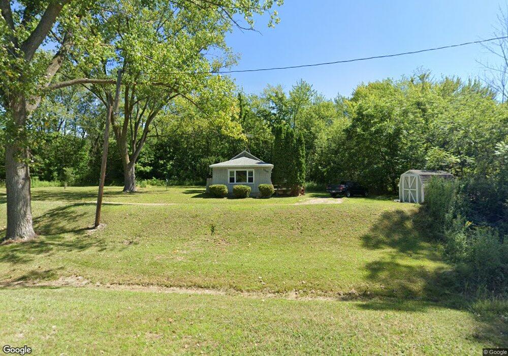
12189 Flynn Rd Sawyer, MI 49125
Estimated Value: $209,761 - $359,000
2
Beds
1
Bath
819
Sq Ft
$334/Sq Ft
Est. Value
About This Home
This home is located at 12189 Flynn Rd, Sawyer, MI 49125 and is currently estimated at $273,440, approximately $333 per square foot. 12189 Flynn Rd is a home located in Berrien County with nearby schools including Chikaming Elementary School, Three Oaks Elementary School, and River Valley Middle/High School.
Ownership History
Date
Name
Owned For
Owner Type
Purchase Details
Closed on
Sep 25, 2006
Sold by
Payne Keith
Bought by
Payne Keith and Burwell Lawrence
Current Estimated Value
Purchase Details
Closed on
Mar 9, 2006
Sold by
Payne Keith
Bought by
Chemical Bank Shoreline and Chemical Bank
Purchase Details
Closed on
Jul 18, 1995
Purchase Details
Closed on
Jul 13, 1994
Purchase Details
Closed on
Jan 4, 1989
Purchase Details
Closed on
Oct 4, 1986
Purchase Details
Closed on
May 29, 1981
Purchase Details
Closed on
Sep 9, 1977
Purchase Details
Closed on
Jun 1, 1975
Create a Home Valuation Report for This Property
The Home Valuation Report is an in-depth analysis detailing your home's value as well as a comparison with similar homes in the area
Home Values in the Area
Average Home Value in this Area
Purchase History
| Date | Buyer | Sale Price | Title Company |
|---|---|---|---|
| Payne Keith | -- | None Available | |
| Chemical Bank Shoreline | $48,720 | None Available | |
| -- | $53,000 | -- | |
| -- | $40,000 | -- | |
| -- | $34,900 | -- | |
| -- | $21,000 | -- | |
| -- | $12,200 | -- | |
| -- | $11,000 | -- | |
| -- | $9,500 | -- |
Source: Public Records
Tax History Compared to Growth
Tax History
| Year | Tax Paid | Tax Assessment Tax Assessment Total Assessment is a certain percentage of the fair market value that is determined by local assessors to be the total taxable value of land and additions on the property. | Land | Improvement |
|---|---|---|---|---|
| 2025 | $952 | $75,600 | $0 | $0 |
| 2024 | $713 | $51,700 | $0 | $0 |
| 2023 | $680 | $61,500 | $0 | $0 |
| 2022 | $647 | $57,100 | $0 | $0 |
| 2021 | $799 | $50,100 | $21,800 | $28,300 |
| 2020 | $790 | $49,000 | $0 | $0 |
| 2019 | $747 | $46,300 | $14,600 | $31,700 |
| 2018 | $727 | $46,300 | $0 | $0 |
| 2017 | $715 | $47,000 | $0 | $0 |
| 2016 | $657 | $90,300 | $0 | $0 |
| 2015 | $653 | $87,800 | $0 | $0 |
| 2014 | $522 | $90,300 | $0 | $0 |
Source: Public Records
Map
Nearby Homes
- 5831 Browntown Rd
- 5407 Browntown Rd
- 12435 Sandpiper Ln
- 6056 Clary Ct
- 12370 Dunes Rd
- 0 Tower Hill Dr
- 12856 Flynn Rd
- 6265 Elm Dr
- 5650 Lily Ln
- 6490 E Chikaming
- 12980 Crestview Dr
- 6440 Sweetbriar Ct
- 6454 Sweetbriar Ct
- 13025 Red Arrow Hwy
- 13176 Red Arrow Hwy
- ABC Greenbush Ct
- 4509 Hanover Rd
- 10617 Baldwin Rd
- Unit 4 Jane Way
- VL # 1 + 3 S Dune Rd
- 12121 Flynn Rd
- 12241 Flynn Rd
- 12255 Flynn Rd
- 5590 Browntown Rd
- 12248 Flynn Rd
- 5758 Browntown Rd
- 5615 Browntown Rd
- 12275 Flynn Rd
- 5607 Browntown Rd
- 12265 Flynn Rd
- 5802 Browntown Rd
- 5802 Browntown Rd
- 12260 Flynn Rd
- 12274 Flynn Rd
- 12291 Flynn Rd
- 12069 Maple St
- 5587 Browntown Rd
- 12292 Flynn Rd
- 12055 Maple St
- 12311 Flynn Rd