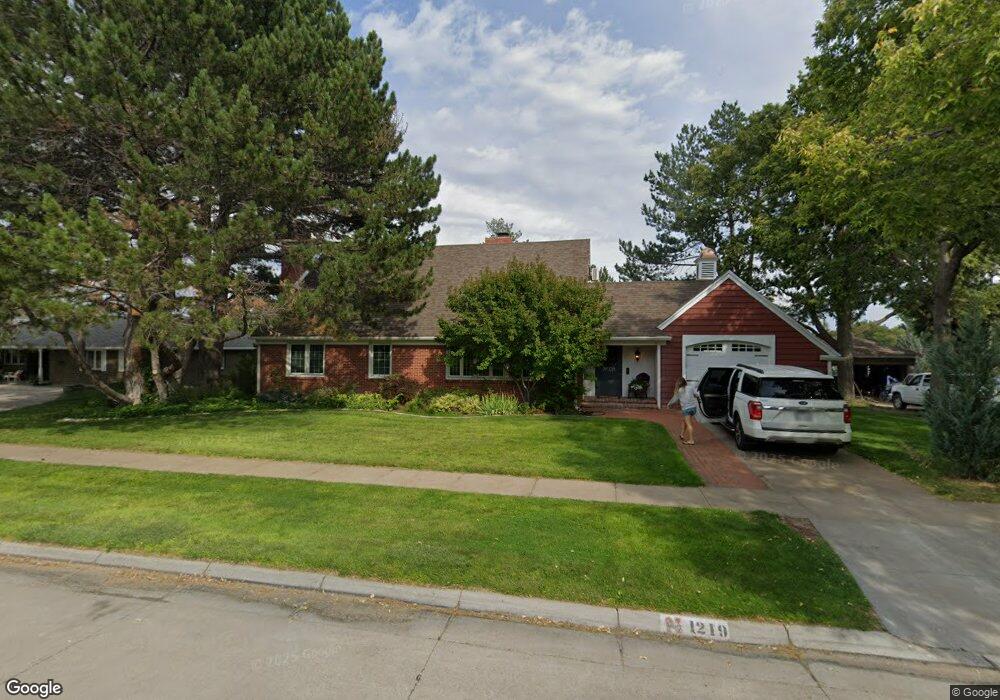
1219 Box Butte Ave Alliance, NE 69301
Estimated Value: $238,000 - $326,000
3
Beds
3
Baths
2,354
Sq Ft
$125/Sq Ft
Est. Value
About This Home
This home is located at 1219 Box Butte Ave, Alliance, NE 69301 and is currently estimated at $293,160, approximately $124 per square foot. 1219 Box Butte Ave is a home located in Box Butte County with nearby schools including Alliance High School, St. Agnes Academy, and Immanuel Evangelical Lutheran School.
Ownership History
Date
Name
Owned For
Owner Type
Purchase Details
Closed on
Sep 16, 2020
Sold by
Nollette Jim D
Bought by
Peltz Jake and Peltz Anne
Current Estimated Value
Home Financials for this Owner
Home Financials are based on the most recent Mortgage that was taken out on this home.
Original Mortgage
$240,000
Outstanding Balance
$169,757
Interest Rate
2.5%
Mortgage Type
New Conventional
Estimated Equity
$123,403
Purchase Details
Closed on
Sep 3, 2020
Sold by
Faucher James Leslie and Faucher Julianna
Bought by
Peltz Jake and Peitz Anne
Home Financials for this Owner
Home Financials are based on the most recent Mortgage that was taken out on this home.
Original Mortgage
$240,000
Outstanding Balance
$169,757
Interest Rate
2.5%
Mortgage Type
New Conventional
Estimated Equity
$123,403
Purchase Details
Closed on
Mar 2, 2018
Sold by
Bunce William W
Bought by
Peltz Jake and Peltz Anne
Purchase Details
Closed on
Dec 12, 2016
Sold by
Girard James W
Bought by
Faucher James Leslie and Faucher Julianna
Create a Home Valuation Report for This Property
The Home Valuation Report is an in-depth analysis detailing your home's value as well as a comparison with similar homes in the area
Home Values in the Area
Average Home Value in this Area
Purchase History
| Date | Buyer | Sale Price | Title Company |
|---|---|---|---|
| Peltz Jake | $300,000 | -- | |
| Peltz Jake | -- | None Listed On Document | |
| Peltz Jake | $325,000 | -- | |
| Faucher James Leslie | $300,000 | -- |
Source: Public Records
Mortgage History
| Date | Status | Borrower | Loan Amount |
|---|---|---|---|
| Open | Peltz Jake | $240,000 |
Source: Public Records
Tax History Compared to Growth
Tax History
| Year | Tax Paid | Tax Assessment Tax Assessment Total Assessment is a certain percentage of the fair market value that is determined by local assessors to be the total taxable value of land and additions on the property. | Land | Improvement |
|---|---|---|---|---|
| 2024 | $3,678 | $293,700 | $14,000 | $279,700 |
| 2023 | $5,049 | $293,700 | $14,000 | $279,700 |
| 2022 | $5,215 | $286,365 | $12,600 | $273,765 |
| 2021 | $5,278 | $286,365 | $12,600 | $273,765 |
| 2020 | $5,264 | $286,365 | $12,600 | $273,765 |
| 2019 | $5,141 | $286,365 | $12,600 | $273,765 |
| 2018 | $5,116 | $286,365 | $12,600 | $273,765 |
| 2017 | $3,762 | $202,704 | $9,100 | $193,604 |
| 2016 | $3,719 | $202,704 | $9,100 | $193,604 |
| 2015 | $3,559 | $191,745 | $9,100 | $182,645 |
| 2014 | $3,559 | $183,715 | $9,100 | $174,615 |
Source: Public Records
Map
Nearby Homes
- 1019 Laramie Ave
- 1239 Toluca Ave
- 904 Laramie Ave
- 1004 Missouri Ave
- 924 Big Horn Ave
- 917 Missouri Ave
- 907 Toluca Ave
- 911 Emerson Ave
- 1120 Potash Ave
- 719 Toluca Ave
- 615 Sweetwater Ave
- 936 Platte Ave
- 2039 Niobrara Ave
- 667 E 9th St
- 621 Emerson Ave
- 819 Black Hills Ave
- 613 Mississippi Ave
- 420 Laramie Ave
- 20th St Emerson Ave To Colorado Ave
- 719 E 8th St
- 1215 Box Butte Ave
- 1225 Box Butte Ave
- 1203 Box Butte Ave
- 1239 Box Butte Ave
- 1220 Box Butte Ave
- 1228 Box Butte Ave
- 1212 Box Butte Ave
- 1208 Box Butte Ave
- 1232 Box Butte Ave
- 1204 Box Butte Ave
- 1123 Box Butte Ave
- 1124 Niobrara Ave
- 1244 Box Butte Ave
- 1119 Box Butte Ave
- 1219 Laramie Ave
- 1223 Laramie Ave
- 1215 Laramie Ave
- 1227 Laramie Ave
- 1120 Niobrara Ave
- 1209 Laramie Ave