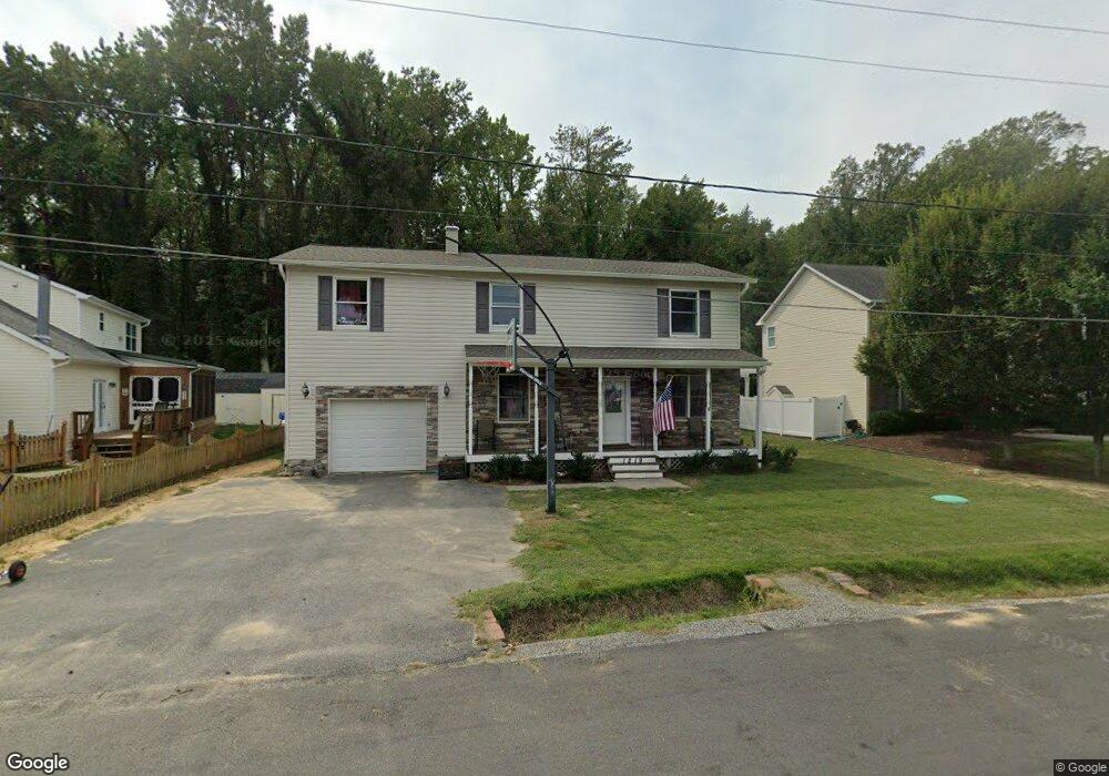
1219 Cedar Ln Edgewater, MD 21037
Estimated Value: $558,801 - $675,000
4
Beds
3
Baths
1,816
Sq Ft
$335/Sq Ft
Est. Value
About This Home
This home is located at 1219 Cedar Ln, Edgewater, MD 21037 and is currently estimated at $608,950, approximately $335 per square foot. 1219 Cedar Ln is a home located in Anne Arundel County with nearby schools including Mayo Elementary School, Central Middle School, and South River High School.
Ownership History
Date
Name
Owned For
Owner Type
Purchase Details
Closed on
Nov 16, 2009
Sold by
Rager Dennis P
Bought by
Burke Christopher T and Burke Melissa M
Current Estimated Value
Home Financials for this Owner
Home Financials are based on the most recent Mortgage that was taken out on this home.
Original Mortgage
$384,084
Outstanding Balance
$251,943
Interest Rate
5.09%
Mortgage Type
VA
Estimated Equity
$357,007
Create a Home Valuation Report for This Property
The Home Valuation Report is an in-depth analysis detailing your home's value as well as a comparison with similar homes in the area
Home Values in the Area
Average Home Value in this Area
Purchase History
| Date | Buyer | Sale Price | Title Company |
|---|---|---|---|
| Burke Christopher T | $376,000 | -- |
Source: Public Records
Mortgage History
| Date | Status | Borrower | Loan Amount |
|---|---|---|---|
| Open | Burke Christopher T | $384,084 |
Source: Public Records
Tax History
| Year | Tax Paid | Tax Assessment Tax Assessment Total Assessment is a certain percentage of the fair market value that is determined by local assessors to be the total taxable value of land and additions on the property. | Land | Improvement |
|---|---|---|---|---|
| 2025 | $4,746 | $405,300 | -- | -- |
| 2024 | $4,746 | $387,500 | $0 | $0 |
| 2023 | $4,511 | $369,700 | $206,200 | $163,500 |
| 2022 | $4,262 | $366,667 | $0 | $0 |
| 2021 | $2,179 | $363,633 | $0 | $0 |
| 2020 | $4,159 | $360,600 | $206,200 | $154,400 |
| 2019 | $3,990 | $344,100 | $0 | $0 |
| 2018 | $3,322 | $327,600 | $0 | $0 |
| 2017 | $3,553 | $311,100 | $0 | $0 |
| 2016 | -- | $296,567 | $0 | $0 |
| 2015 | -- | $282,033 | $0 | $0 |
| 2014 | -- | $267,500 | $0 | $0 |
Source: Public Records
Map
Nearby Homes
- 1443 Rehling Dr
- 1403 (Lot 70) Old Ct
- Lot 71 Old Ct
- 1407 (Lot 72) Old Ct
- 3725 Ramsey Dr
- 3727 Ramsey Dr
- 3963 Bayside Dr
- 4005 Dark Horse Way
- 3744 Parke Dr
- 3738 Bay Dr
- 3728 Bay Dr
- 1110 Murray Dr
- 4119 Waterview Dr
- 1546 Ridgely Dr
- 1533 Wakefield Rd
- 1545 Wakefield Rd
- 1055 Old Turkey Point Rd
- 0 Mayo Rd Unit MDAA2113152
- 0 Mayo Rd Unit MDAA2138894
- 0 Old Turkey Point Rd
- 1217 Cedar Ln
- 1221 Cedar Ln
- 1213 Cedar Ln
- 3924 Shoreham Beach Rd
- 1218 Cedar Ln
- 1216 Cedar Ln
- 1211 Cedar Ln
- 1214 Cedar Ln
- 3920 Shoreham Beach Rd
- 1209 Cedar Ln
- 1207 Locust Ln
- 1212 Cedar Ln
- 1205 Locust Ln
- 3925 Shoreham Beach Rd
- 1207 Cedar Ln
- 1210 Cedar Ln
- 1201 Locust Ln
- 1205 Cedar Ln
- 1208 Locust Ln
- 1206 Locust Ln
Your Personal Tour Guide
Ask me questions while you tour the home.