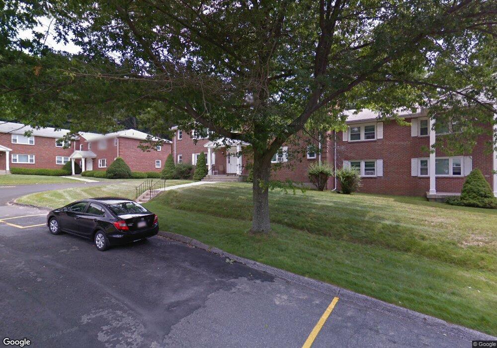
1219 Dalton Ave Unit ALL Pittsfield, MA 01201
Estimated Value: $265,000 - $385,000
8
Beds
5
Baths
5,169
Sq Ft
$64/Sq Ft
Est. Value
About This Home
This home is located at 1219 Dalton Ave Unit ALL, Pittsfield, MA 01201 and is currently estimated at $328,609, approximately $63 per square foot. 1219 Dalton Ave Unit ALL is a home located in Berkshire County with nearby schools including Allendale Elementary School, John T. Reid Middle School, and St. Agnes Academy.
Ownership History
Date
Name
Owned For
Owner Type
Purchase Details
Closed on
Aug 31, 2021
Sold by
Scalise Sandra E
Bought by
Forrest Kimberly A and Sommerkamp Jayross P
Current Estimated Value
Purchase Details
Closed on
Mar 6, 2020
Sold by
Scalise Joseph J and Scalise Sandra E
Bought by
Scalise Sandra E
Purchase Details
Closed on
Aug 20, 2009
Sold by
Scalise Joseph J
Bought by
Scalise Joseph J and Scalise Sandra E
Home Financials for this Owner
Home Financials are based on the most recent Mortgage that was taken out on this home.
Original Mortgage
$126,000
Interest Rate
5.19%
Mortgage Type
Purchase Money Mortgage
Create a Home Valuation Report for This Property
The Home Valuation Report is an in-depth analysis detailing your home's value as well as a comparison with similar homes in the area
Home Values in the Area
Average Home Value in this Area
Purchase History
| Date | Buyer | Sale Price | Title Company |
|---|---|---|---|
| Forrest Kimberly A | $211,000 | None Available | |
| Forrest Kimberly A | $211,000 | None Available | |
| Forrest Kimberly A | $211,000 | None Available | |
| Scalise Sandra E | -- | None Available | |
| Scalise Sandra E | -- | None Available | |
| Scalise Sandra E | -- | None Available | |
| Scalise Joseph J | -- | -- | |
| Scalise Joseph J | -- | -- | |
| Scalise Joseph J | -- | -- |
Source: Public Records
Mortgage History
| Date | Status | Borrower | Loan Amount |
|---|---|---|---|
| Previous Owner | Scalise Joseph J | $126,000 | |
| Previous Owner | Scalise Joseph J | $110,000 |
Source: Public Records
Tax History Compared to Growth
Tax History
| Year | Tax Paid | Tax Assessment Tax Assessment Total Assessment is a certain percentage of the fair market value that is determined by local assessors to be the total taxable value of land and additions on the property. | Land | Improvement |
|---|---|---|---|---|
| 2025 | $4,469 | $249,100 | $79,900 | $169,200 |
| 2024 | $4,129 | $223,800 | $79,900 | $143,900 |
| 2023 | $3,862 | $210,800 | $79,900 | $130,900 |
| 2022 | $3,775 | $203,400 | $79,900 | $123,500 |
| 2021 | $4,023 | $209,000 | $79,900 | $129,100 |
| 2020 | $3,871 | $196,400 | $69,900 | $126,500 |
| 2019 | $4,063 | $209,200 | $67,900 | $141,300 |
| 2018 | $3,888 | $204,200 | $67,900 | $136,300 |
| 2017 | $3,879 | $197,600 | $64,900 | $132,700 |
| 2016 | $3,842 | $204,800 | $64,900 | $139,900 |
| 2015 | $3,699 | $204,800 | $64,900 | $139,900 |
Source: Public Records
Map
Nearby Homes
- 0 Crane Ave
- 9 Crane Ave
- 144 Kittredge Rd
- 82 Williamsburg Terrace
- 66 Oak Street Extension
- 90 Cheshire Rd
- 18 Chestnut St
- 17 Kittredge Rd
- 63 Asci Dr
- 68 Howe Rd
- 16 2nd St
- 321 High St
- 386 Cheshire Rd
- 0 Cheshire Rd
- 1 Pondview Dr Unit C3
- 134 Oak Hill Rd
- 127 Oak Hill Rd
- 1106 South St
- 750 Main St
- 774 Main St
- 1219 Dalton Ave
- 1217 Dalton Ave
- 1217 Dalton Ave Unit 2
- 1215 Dalton Ave
- 1 Boulder Rd
- 1230 Dalton Ave
- 1226 Dalton Ave
- 5 Highview Dr Unit 95D highview drive
- 5 Highview Dr Unit 123 Highview Dr
- 5 Highview Dr Unit 95 highview Drive
- 1 Main St
- 1244 Dalton Ave
- 11 Main St
- 11 Main St
- Lot 3 Lynda Ct
- 4 Main St
- 18 Main St
- 26 Main St
- 50 Main St Unit 52
- 69 Main St