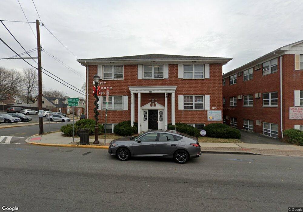
1219 Liberty Ave Hillside, NJ 07205
Estimated Value: $597,000
--
Bed
--
Bath
--
Sq Ft
0.25
Acres
About This Home
This home is located at 1219 Liberty Ave, Hillside, NJ 07205 and is currently estimated at $597,000. 1219 Liberty Ave is a home with nearby schools including Abram P. Morris-Saybrook Elementary School, Hurden Looker School, and Ola Edwards Community School.
Ownership History
Date
Name
Owned For
Owner Type
Purchase Details
Closed on
Nov 8, 2019
Sold by
Ginger Investments Llc
Bought by
A & J Elite Properties Llc
Current Estimated Value
Purchase Details
Closed on
Sep 18, 2007
Sold by
Jacobson Ronald E and Jaron Realty Co
Bought by
Casel Hillside Associates Llc
Home Financials for this Owner
Home Financials are based on the most recent Mortgage that was taken out on this home.
Original Mortgage
$880,000
Interest Rate
6.59%
Mortgage Type
Commercial
Create a Home Valuation Report for This Property
The Home Valuation Report is an in-depth analysis detailing your home's value as well as a comparison with similar homes in the area
Home Values in the Area
Average Home Value in this Area
Purchase History
| Date | Buyer | Sale Price | Title Company |
|---|---|---|---|
| A & J Elite Properties Llc | $80,000 | North American Title Ins Co | |
| Casel Hillside Associates Llc | $980,000 | None Available |
Source: Public Records
Mortgage History
| Date | Status | Borrower | Loan Amount |
|---|---|---|---|
| Previous Owner | Casel Hillside Associates Llc | $880,000 |
Source: Public Records
Tax History Compared to Growth
Tax History
| Year | Tax Paid | Tax Assessment Tax Assessment Total Assessment is a certain percentage of the fair market value that is determined by local assessors to be the total taxable value of land and additions on the property. | Land | Improvement |
|---|---|---|---|---|
| 2025 | $23,306 | $282,400 | $138,600 | $143,800 |
| 2024 | $22,629 | $282,400 | $138,600 | $143,800 |
| 2023 | $22,629 | $282,400 | $138,600 | $143,800 |
| 2022 | $22,420 | $282,400 | $138,600 | $143,800 |
| 2021 | $22,273 | $282,400 | $138,600 | $143,800 |
| 2020 | $22,143 | $282,400 | $138,600 | $143,800 |
| 2019 | $21,714 | $282,400 | $138,600 | $143,800 |
| 2018 | $21,496 | $282,400 | $138,600 | $143,800 |
| 2017 | $21,366 | $282,400 | $138,600 | $143,800 |
| 2016 | $21,341 | $282,400 | $138,600 | $143,800 |
| 2015 | $21,152 | $282,400 | $138,600 | $143,800 |
| 2014 | $20,819 | $282,400 | $138,600 | $143,800 |
Source: Public Records
Map
Nearby Homes
- 257 Herbert Ave
- 292 Crann St
- 507 Locust Ave
- 393 Harvard Ave
- 220 Silver Ave
- 314 Fitzpatrick St
- 149 Baltimore Ave
- 155 Silver Ave
- 1048 Chester St
- 525 Us Highway 22
- 553 Harvard Ave
- 628 Us Highway 22 and 3
- 1322 Marcella Dr
- 537 Us Highway 22
- 1282 Baker St
- 557 Yale Ave
- 1290 Baker St
- 542 Leo St
- 1393 Cornell Place
- 346 Florence Ave
- 289 Herbert Ave
- 280 Herbert Ave
- 285 Herbert Ave
- 1193A Liberty Ave
- 1193B Liberty Ave
- 267 Bloy St Unit 267
- 1216 Liberty Ave
- 1236 Liberty Ave
- 265 Bloy St Unit 265
- 1205B Liberty Ave
- 281 Herbert Ave
- 276 Herbert Ave
- 263 Bloy St Unit 263
- 368 Columbia Ave
- 261 Bloy St Unit 261
- 363 Columbia Ave
- 1210 Liberty Ave
- 277 Herbert Ave
- 259 Bloy St
- 292 Millard Ave