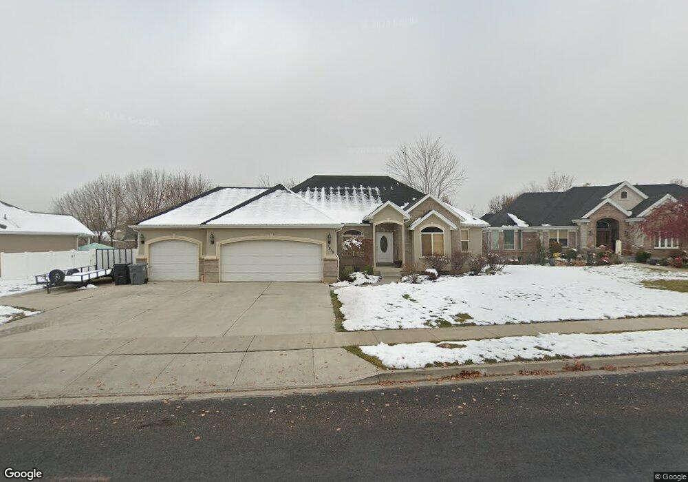
1219 N 1190 E American Fork, UT 84003
Estimated Value: $759,000 - $832,762
4
Beds
3
Baths
4,006
Sq Ft
$200/Sq Ft
Est. Value
About This Home
This home is located at 1219 N 1190 E, American Fork, UT 84003 and is currently estimated at $799,254, approximately $199 per square foot. 1219 N 1190 E is a home located in Utah County with nearby schools including Deerfield Elementary School, Mountain Ridge Junior High School, and American Fork High School.
Ownership History
Date
Name
Owned For
Owner Type
Purchase Details
Closed on
Nov 11, 2020
Sold by
Orton Daniel A and Orton Elizabeth A
Bought by
Orton Daniel A
Current Estimated Value
Purchase Details
Closed on
Dec 1, 2003
Sold by
Orton Daniel A
Bought by
Orton Daniel A and Orton Elizabeth A
Home Financials for this Owner
Home Financials are based on the most recent Mortgage that was taken out on this home.
Original Mortgage
$210,400
Outstanding Balance
$98,584
Interest Rate
6.04%
Mortgage Type
Purchase Money Mortgage
Estimated Equity
$700,670
Purchase Details
Closed on
Aug 14, 2003
Sold by
Cope David and Mortgage Electronic Registrati
Bought by
Federal National Mortgage Association
Purchase Details
Closed on
Feb 15, 2002
Sold by
Holdaway Jeff
Bought by
Cope David
Home Financials for this Owner
Home Financials are based on the most recent Mortgage that was taken out on this home.
Original Mortgage
$339,000
Interest Rate
11.12%
Purchase Details
Closed on
Apr 30, 2001
Sold by
Brent & Ann Hawker Family Ltd Liability
Bought by
Holdaway Jeff
Create a Home Valuation Report for This Property
The Home Valuation Report is an in-depth analysis detailing your home's value as well as a comparison with similar homes in the area
Home Values in the Area
Average Home Value in this Area
Purchase History
| Date | Buyer | Sale Price | Title Company |
|---|---|---|---|
| Orton Daniel A | -- | 1St Liberty Title Llc | |
| Orton Daniel A | -- | Empire Land Title Company | |
| Orton Daniel A | -- | Empire Land Title Company | |
| Federal National Mortgage Association | $266,343 | Mountain West Title Co | |
| Cope David | -- | Signature Title | |
| Holdaway Jeff | -- | Signature Title |
Source: Public Records
Mortgage History
| Date | Status | Borrower | Loan Amount |
|---|---|---|---|
| Open | Orton Daniel A | $210,400 | |
| Previous Owner | Cope David | $339,000 | |
| Closed | Orton Daniel A | $52,600 |
Source: Public Records
Tax History
| Year | Tax Paid | Tax Assessment Tax Assessment Total Assessment is a certain percentage of the fair market value that is determined by local assessors to be the total taxable value of land and additions on the property. | Land | Improvement |
|---|---|---|---|---|
| 2025 | $3,289 | $398,255 | -- | -- |
| 2024 | $3,289 | $365,475 | $0 | $0 |
| 2023 | $3,063 | $360,855 | $0 | $0 |
| 2022 | $3,074 | $357,390 | $0 | $0 |
| 2021 | $2,700 | $490,300 | $178,400 | $311,900 |
| 2020 | $2,624 | $462,200 | $165,200 | $297,000 |
| 2019 | $2,311 | $420,900 | $153,700 | $267,200 |
| 2018 | $2,373 | $413,200 | $146,000 | $267,200 |
| 2017 | $2,373 | $223,025 | $0 | $0 |
| 2016 | $2,548 | $222,475 | $0 | $0 |
| 2015 | $2,428 | $201,190 | $0 | $0 |
| 2014 | $2,208 | $180,510 | $0 | $0 |
Source: Public Records
Map
Nearby Homes
- 1125 N 1270 E
- 9587 N 4500 W
- 1058 N 930 E Unit 64
- 1089 N 950 E
- 1077 N 950 E
- 9617 N 4500 W
- 1045 N 930 E Unit 58
- 4675 W Ferguson Way
- 9752 N Dorchester Dr
- 4552 W Windsor Cir
- 4531 W Cambridge Dr
- 9506 N 4000 W
- 4979 W Willowbank Dr
- 1121 E 580 N
- 4968 W Evergreen Ln
- 5061 W Evergreen Ln
- 9481 N 3830 W
- 3810 W Valley View Dr
- 9547 N Canyon Rd
- 5034 W Green Ash Ln
- 1253 N 1190 E
- 1197 N 1190 E
- 1175 E 1180 N
- 1234 N 1190 E
- 1234 N 1190 E Unit 94
- 1212 N 1190 E
- 1212 N 1190 E Unit 95
- 1256 N 1190 E
- 1232 N 1150 E
- 1269 N 1190 E
- 1198 N 1190 E
- 1198 N 1190 E Unit 96
- 1196 N 1150 E
- 1268 N 1190 E Unit 92
- 1268 N 1190 E
- 1258 N 1190 E
- 1190 N 1190 E
- 1244 N 1150 E
- 1171 N 1190 E
- 1186 N 1190 E
Your Personal Tour Guide
Ask me questions while you tour the home.