Estimated Value: $136,093 - $173,000
3
Beds
1
Bath
1,264
Sq Ft
$123/Sq Ft
Est. Value
About This Home
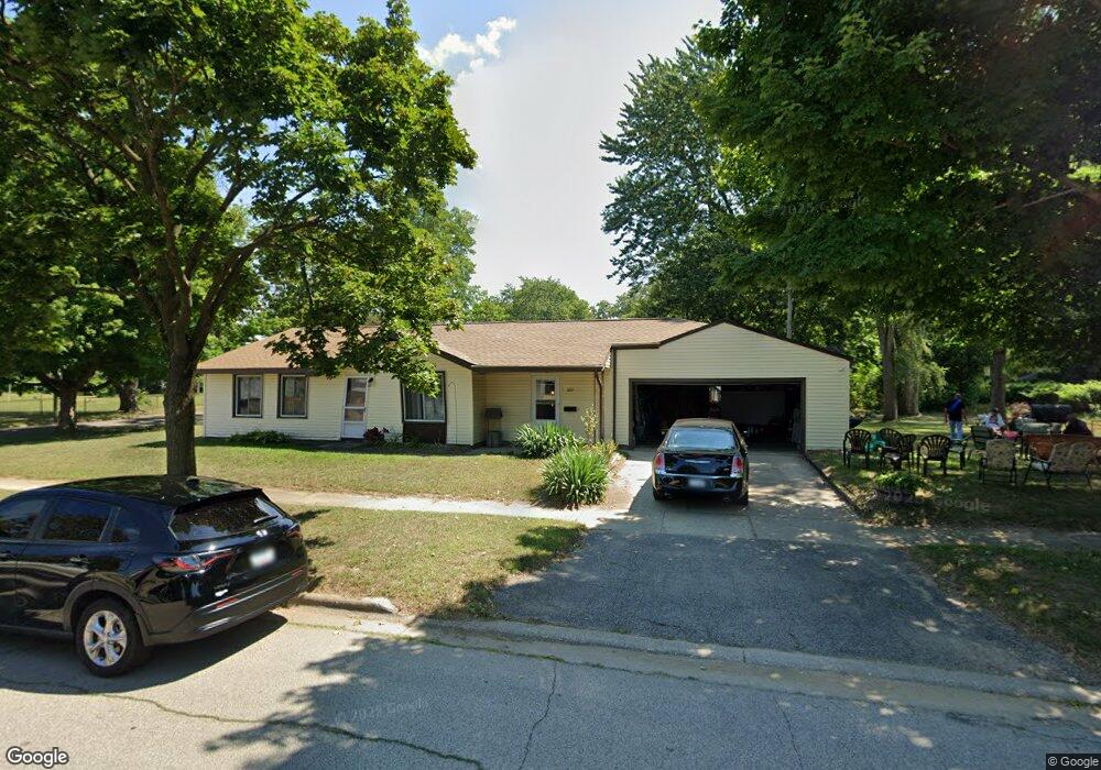
This home is located at 1219 N 14th St, Niles, MI 49120 and is currently estimated at $156,023, approximately $123 per square foot. 1219 N 14th St is a home located in Berrien County with nearby schools including Ballard Elementary School, Ring Lardner Middle School, and Oak Manor Sixth Grade Center.
Ownership History
Date
Name
Owned For
Owner Type
Purchase Details
Closed on
Mar 21, 2003
Sold by
Works Martha S and Works Kim V
Bought by
Moffitt Willie and Moffitt Norma
Current Estimated Value
Home Financials for this Owner
Home Financials are based on the most recent Mortgage that was taken out on this home.
Original Mortgage
$71,334
Interest Rate
5.9%
Mortgage Type
FHA
Purchase Details
Closed on
Apr 14, 1994
Purchase Details
Closed on
Apr 18, 1977
Create a Home Valuation Report for This Property
The Home Valuation Report is an in-depth analysis detailing your home's value as well as a comparison with similar homes in the area
Home Values in the Area
Average Home Value in this Area
Purchase History
| Date | Buyer | Sale Price | Title Company |
|---|---|---|---|
| Moffitt Willie | $72,000 | Meridian Title Corp | |
| -- | $100 | -- | |
| -- | $22,000 | -- |
Source: Public Records
Mortgage History
| Date | Status | Borrower | Loan Amount |
|---|---|---|---|
| Previous Owner | Moffitt Willie | $71,334 |
Source: Public Records
Tax History Compared to Growth
Tax History
| Year | Tax Paid | Tax Assessment Tax Assessment Total Assessment is a certain percentage of the fair market value that is determined by local assessors to be the total taxable value of land and additions on the property. | Land | Improvement |
|---|---|---|---|---|
| 2025 | $1,047 | $53,100 | $0 | $0 |
| 2024 | $813 | $51,900 | $0 | $0 |
| 2023 | $779 | $37,900 | $0 | $0 |
| 2022 | $742 | $28,000 | $0 | $0 |
| 2021 | $917 | $25,000 | $2,300 | $22,700 |
| 2020 | $907 | $24,300 | $0 | $0 |
| 2019 | $896 | $23,000 | $1,600 | $21,400 |
| 2018 | $892 | $23,000 | $0 | $0 |
| 2017 | $934 | $27,200 | $0 | $0 |
| 2016 | $915 | $24,400 | $0 | $0 |
| 2015 | $912 | $24,100 | $0 | $0 |
| 2014 | $728 | $24,400 | $0 | $0 |
Source: Public Records
Map
Nearby Homes
- 1405 Sheffield Ave
- 1630 Forest Trail
- 501 & 505 N Twelfth St
- 645 N 11th St
- 622 N 13th St
- 1603 N 5th St
- 31829 Heritage Place
- 712 Wayne St
- 1610 N 5th St
- 1201 N 6th St
- 2802 Primrose Ct
- 1123 N 9th St
- 1314 Ferry St
- 534 James St
- 810 Ferry St
- 211 N 8th St
- 232 Pokagon St
- 921 Cedar St
- 1642 Cedar St
- 709 Regent St
- 1404 Clarendon Ave
- 1406 Clarendon Ave
- 1414 Clarendon Ave
- 1405 Sheridan Ave
- 1355 Sheridan Ave
- 1413 Sheridan Ave
- 1401 Sheridan Ave
- 1351 Sheridan Ave
- 1422 Clarendon Ave
- 1417 Sheridan Ave
- 1343 Sheridan Ave
- 1426 Clarendon Ave
- 1425 Sheridan Ave
- 1402 Sheridan Ave
- 1406 Sheridan Ave
- 1421 Clarendon Ave
- 1339 Sheridan Ave
- 1425 Clarendon Ave
- 1430 Clarendon Ave
- 1410 Lake St