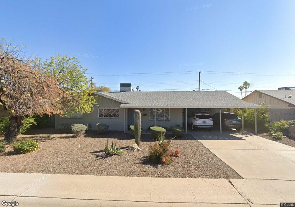
1219 N 71st St Scottsdale, AZ 85257
South Scottsdale NeighborhoodEstimated Value: $550,412 - $682,000
--
Bed
2
Baths
1,984
Sq Ft
$321/Sq Ft
Est. Value
About This Home
This home is located at 1219 N 71st St, Scottsdale, AZ 85257 and is currently estimated at $637,353, approximately $321 per square foot. 1219 N 71st St is a home located in Maricopa County with nearby schools including Tonalea Middle School, Coronado High School, and South Pointe Elementary School.
Ownership History
Date
Name
Owned For
Owner Type
Purchase Details
Closed on
May 15, 2019
Sold by
Maz Mcknight Llc
Bought by
Frenkel Max and Frenkel Joelle
Current Estimated Value
Home Financials for this Owner
Home Financials are based on the most recent Mortgage that was taken out on this home.
Original Mortgage
$311,250
Outstanding Balance
$272,534
Interest Rate
4%
Mortgage Type
New Conventional
Estimated Equity
$364,819
Purchase Details
Closed on
Oct 16, 2018
Sold by
8250 Rose Lane Llc
Bought by
Max Mcknight Llc
Purchase Details
Closed on
Jan 9, 2018
Sold by
Viergutz Robert Charles
Bought by
8250 Rose Lane Llc
Purchase Details
Closed on
Mar 23, 2009
Sold by
Viergutz Robert Charles
Bought by
Viergutz Robert Charles
Create a Home Valuation Report for This Property
The Home Valuation Report is an in-depth analysis detailing your home's value as well as a comparison with similar homes in the area
Home Values in the Area
Average Home Value in this Area
Purchase History
| Date | Buyer | Sale Price | Title Company |
|---|---|---|---|
| Frenkel Max | -- | Pioneer Title Agency Inc | |
| Max Mcknight Llc | $364,311 | Pioneer Title Agency Inc | |
| 8250 Rose Lane Llc | $270,000 | Pioneer Title Agency Inc | |
| Viergutz Robert Charles | -- | None Available |
Source: Public Records
Mortgage History
| Date | Status | Borrower | Loan Amount |
|---|---|---|---|
| Open | Frenkel Max | $311,250 |
Source: Public Records
Tax History Compared to Growth
Tax History
| Year | Tax Paid | Tax Assessment Tax Assessment Total Assessment is a certain percentage of the fair market value that is determined by local assessors to be the total taxable value of land and additions on the property. | Land | Improvement |
|---|---|---|---|---|
| 2025 | $1,744 | $25,783 | -- | -- |
| 2024 | $1,724 | $24,556 | -- | -- |
| 2023 | $1,724 | $44,930 | $8,980 | $35,950 |
| 2022 | $1,636 | $31,160 | $6,230 | $24,930 |
| 2021 | $1,738 | $28,850 | $5,770 | $23,080 |
| 2020 | $1,723 | $28,860 | $5,770 | $23,090 |
| 2019 | $1,245 | $24,450 | $4,890 | $19,560 |
| 2018 | $1,205 | $22,550 | $4,510 | $18,040 |
| 2017 | $985 | $19,330 | $3,860 | $15,470 |
| 2016 | $966 | $17,730 | $3,540 | $14,190 |
| 2015 | $928 | $16,570 | $3,310 | $13,260 |
Source: Public Records
Map
Nearby Homes
- 1308 N 71st St
- 1313 N 71st St
- 7031 E Loma Land Dr
- 1337 N 70th St
- 6926 E Culver St
- 6932 E Latham St
- 7232 E Belleview St
- 7234 E Belleview St
- 7231 E Latham St
- 7320 E Latham St
- 6826 E Willetta St
- 6858 E Orion Dr
- 6814 E Belleview St
- 7326 E Portland St
- 440 E Beatryce St
- 6804 E Lyra Dr
- 6802 E Loma Land Dr
- 6850 E Mcdowell Rd Unit 5
- 6850 E Mcdowell Rd Unit 47
- 6909 E Coronado Rd
- 1213 N 71st St
- 1225 N 71st St
- 7056 E Moreland St
- 7055 E Belleview St
- 1207 N 71st St
- 1301 N 71st St
- 7050 E Moreland St
- 7049 E Belleview St
- 1201 N 71st St
- 7055 E Moreland St
- 1302 N 71st St
- 7049 E Moreland St
- 1307 N 71st St
- 7044 E Moreland St
- 7043 E Belleview St
- 1131 N 71st St
- 7050 E Belleview St
- 7056 E Latham St
- 7043 E Moreland St
- 7037 E Belleview St