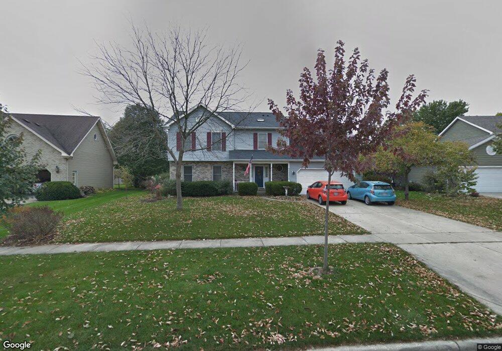
1219 Newton Ave Batavia, IL 60510
Southwest Batavia NeighborhoodEstimated Value: $493,148 - $553,000
4
Beds
--
Bath
2,474
Sq Ft
$216/Sq Ft
Est. Value
About This Home
This home is located at 1219 Newton Ave, Batavia, IL 60510 and is currently estimated at $535,037, approximately $216 per square foot. 1219 Newton Ave is a home located in Kane County with nearby schools including Sam Rotolo Middle School, Batavia Sr High School, and Mooseheart Child City & School.
Ownership History
Date
Name
Owned For
Owner Type
Purchase Details
Closed on
Jul 24, 1998
Sold by
Pikowitz Paul and Pikowitz Paula
Bought by
Garwood Sterling J and Garwood Nancy A
Current Estimated Value
Home Financials for this Owner
Home Financials are based on the most recent Mortgage that was taken out on this home.
Original Mortgage
$193,600
Outstanding Balance
$39,722
Interest Rate
7.03%
Estimated Equity
$495,315
Create a Home Valuation Report for This Property
The Home Valuation Report is an in-depth analysis detailing your home's value as well as a comparison with similar homes in the area
Home Values in the Area
Average Home Value in this Area
Purchase History
| Date | Buyer | Sale Price | Title Company |
|---|---|---|---|
| Garwood Sterling J | $242,000 | -- |
Source: Public Records
Mortgage History
| Date | Status | Borrower | Loan Amount |
|---|---|---|---|
| Open | Garwood Sterling J | $193,600 |
Source: Public Records
Tax History Compared to Growth
Tax History
| Year | Tax Paid | Tax Assessment Tax Assessment Total Assessment is a certain percentage of the fair market value that is determined by local assessors to be the total taxable value of land and additions on the property. | Land | Improvement |
|---|---|---|---|---|
| 2024 | $11,021 | $147,397 | $20,417 | $126,980 |
| 2023 | $10,793 | $133,779 | $18,531 | $115,248 |
| 2022 | $10,393 | $125,027 | $17,319 | $107,708 |
| 2021 | $9,979 | $118,576 | $16,425 | $102,151 |
| 2020 | $9,734 | $116,296 | $16,109 | $100,187 |
| 2019 | $9,576 | $112,179 | $15,539 | $96,640 |
| 2018 | $9,195 | $107,906 | $14,947 | $92,959 |
| 2017 | $8,973 | $104,348 | $14,454 | $89,894 |
| 2016 | $8,782 | $101,309 | $14,033 | $87,276 |
| 2015 | -- | $99,002 | $13,713 | $85,289 |
| 2014 | -- | $95,885 | $13,281 | $82,604 |
| 2013 | -- | $97,270 | $16,278 | $80,992 |
Source: Public Records
Map
Nearby Homes
- 1375 Green Pheasant Ln
- 344 Danforth Dr
- 369 Danforth Dr
- 384 Danforth Dr
- 396 Danforth Dr
- 303 Danforth Dr
- 818 Bernadette Ln
- 1316 Brandywine Cir Unit 4
- 1280 Brandywine Cir
- 1232 S Batavia Ave
- 41 Weirich Way Unit 77005
- 116 Furnas Dr
- 0000 Sec of Kirk Road and Wind Energy Pass
- 33 Weirich Way Unit 77004
- 125 Furnas Dr
- 143 Furnas Dr
- 119 Furnas Dr
- 131 Furnas Dr
- 218 Weirich Way Unit 88001
- 146 Furnas Dr
- 1215 Newton Ave
- 1225 Newton Ave
- 1250 Averill Dr
- 1236 Averill Dr
- 1260 Averill Dr
- 1209 Newton Ave
- 1235 Newton Ave
- 1222 Averill Dr
- 1220 Newton Ave
- 1230 Newton Ave
- 1270 Averill Dr
- 1210 Newton Ave
- 1212 Averill Dr Unit 1
- 1161 Newton Ct
- 1245 Newton Ave
- 1282 Averill Dr
- 1200 Averill Dr Unit 1
- 1241 Averill Dr
- 1251 Averill Dr
- 986 Lockwood Ln