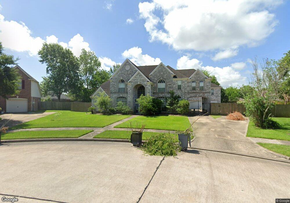
1219 Red Wing Dr Friendswood, TX 77546
Estimated Value: $575,000 - $641,000
--
Bed
4
Baths
3,932
Sq Ft
$157/Sq Ft
Est. Value
About This Home
This home is located at 1219 Red Wing Dr, Friendswood, TX 77546 and is currently estimated at $616,868, approximately $156 per square foot. 1219 Red Wing Dr is a home located in Galveston County with nearby schools including C.W. Cline Elementary School, Windsong Elementary School, and Friendswood Junior High School.
Ownership History
Date
Name
Owned For
Owner Type
Purchase Details
Closed on
Oct 3, 2007
Sold by
Crawford Russell W
Bought by
Crawford Tammy J
Current Estimated Value
Home Financials for this Owner
Home Financials are based on the most recent Mortgage that was taken out on this home.
Original Mortgage
$208,800
Outstanding Balance
$132,665
Interest Rate
6.55%
Mortgage Type
Purchase Money Mortgage
Estimated Equity
$484,203
Purchase Details
Closed on
Jul 16, 2004
Sold by
Loyd Corrine
Bought by
Mccreath Gary Myron and Mccreath Patsy Ann Blackburn
Purchase Details
Closed on
Apr 8, 2001
Sold by
Shamala Attibele R
Bought by
Crawford Russell W and Crawford Tammy J
Home Financials for this Owner
Home Financials are based on the most recent Mortgage that was taken out on this home.
Original Mortgage
$208,800
Interest Rate
6.89%
Mortgage Type
Purchase Money Mortgage
Create a Home Valuation Report for This Property
The Home Valuation Report is an in-depth analysis detailing your home's value as well as a comparison with similar homes in the area
Home Values in the Area
Average Home Value in this Area
Purchase History
| Date | Buyer | Sale Price | Title Company |
|---|---|---|---|
| Crawford Tammy J | -- | None Available | |
| Mccreath Gary Myron | -- | -- | |
| Crawford Russell W | -- | Chicago Title |
Source: Public Records
Mortgage History
| Date | Status | Borrower | Loan Amount |
|---|---|---|---|
| Open | Crawford Tammy J | $208,800 | |
| Previous Owner | Crawford Russell W | $208,800 |
Source: Public Records
Tax History Compared to Growth
Tax History
| Year | Tax Paid | Tax Assessment Tax Assessment Total Assessment is a certain percentage of the fair market value that is determined by local assessors to be the total taxable value of land and additions on the property. | Land | Improvement |
|---|---|---|---|---|
| 2025 | $9,128 | $588,120 | $52,890 | $535,230 |
| 2024 | $9,128 | $559,020 | -- | -- |
| 2023 | $9,128 | $508,200 | $0 | $0 |
| 2022 | $10,176 | $462,000 | $0 | $0 |
| 2021 | $10,020 | $525,290 | $52,890 | $472,400 |
| 2020 | $9,396 | $390,000 | $52,890 | $337,110 |
| 2019 | $9,903 | $390,000 | $52,890 | $337,110 |
| 2018 | $9,962 | $390,000 | $52,890 | $337,110 |
| 2017 | $10,128 | $390,000 | $52,890 | $337,110 |
| 2016 | $9,450 | $387,440 | $52,890 | $334,550 |
| 2015 | $3,005 | $365,960 | $52,890 | $313,070 |
| 2014 | $2,830 | $287,440 | $52,890 | $234,550 |
Source: Public Records
Map
Nearby Homes
- 1217 Red Wing Dr
- 1302 Eagle Lakes Dr
- 1305 Edgewater Dr
- 2202 Calm Pond Ct
- 2120 Lila Sky Ln
- 1906 Blue Quail Dr
- 1532 River Point Dr
- 1556 River Point Dr
- 1673 Birch Lake Bend
- 1572 River Point Dr
- 1568 River Point Dr
- 1588 River Point Dr
- 2220 Lila Sky Ln
- 2124 Lila Sky Ln
- 1010 High Ridge Dr
- 1601 Birch Lake Bend
- 1681 Birch Lake Ln
- 1657 Birch Lake Ln
- 1653 Birch Lake Ln
- 1673 Birch Lake Ln
- 1906 Cloud Croft Dr
- 1220 Peregrine Dr
- 1218 Peregrine Dr
- 1904 Cloud Croft Dr
- 1215 Red Wing Dr
- 1218 Red Wing Dr
- 1222 Peregrine Dr
- 1216 Peregrine Dr
- 1907 Trail View
- 1909 Trail View
- 1905 Trail View
- 1216 Red Wing Dr
- 1902 Cloud Croft Dr
- 1213 Red Wing Dr
- 1903 Trail View
- 1217 Eagle Lakes Dr
- 1214 Peregrine Dr
- 1217 Peregrine Dr
- 1224 Peregrine Dr
- 2001 Trail View