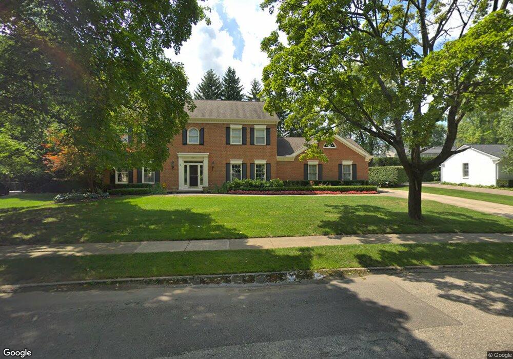
1219 Sandringham Way Bloomfield Hills, MI 48301
Estimated Value: $1,427,962 - $1,712,000
4
Beds
4
Baths
3,625
Sq Ft
$445/Sq Ft
Est. Value
About This Home
This home is located at 1219 Sandringham Way, Bloomfield Hills, MI 48301 and is currently estimated at $1,614,241, approximately $445 per square foot. 1219 Sandringham Way is a home located in Oakland County with nearby schools including Quarton Elementary, Derby Middle School, and Ernest W. Seaholm High School.
Ownership History
Date
Name
Owned For
Owner Type
Purchase Details
Closed on
Jun 7, 2010
Sold by
Fuerst John and Fuerst Sue
Bought by
Sachs Kenneth and Sachs Jessica
Current Estimated Value
Purchase Details
Closed on
Mar 16, 2001
Sold by
Miller Ronald V
Bought by
Fuerst John
Home Financials for this Owner
Home Financials are based on the most recent Mortgage that was taken out on this home.
Original Mortgage
$600,000
Interest Rate
7.05%
Create a Home Valuation Report for This Property
The Home Valuation Report is an in-depth analysis detailing your home's value as well as a comparison with similar homes in the area
Home Values in the Area
Average Home Value in this Area
Purchase History
| Date | Buyer | Sale Price | Title Company |
|---|---|---|---|
| Sachs Kenneth | $610,000 | Interstate Title Inc | |
| Fuerst John | -- | -- |
Source: Public Records
Mortgage History
| Date | Status | Borrower | Loan Amount |
|---|---|---|---|
| Previous Owner | Fuerst John | $600,000 |
Source: Public Records
Tax History Compared to Growth
Tax History
| Year | Tax Paid | Tax Assessment Tax Assessment Total Assessment is a certain percentage of the fair market value that is determined by local assessors to be the total taxable value of land and additions on the property. | Land | Improvement |
|---|---|---|---|---|
| 2024 | $7,795 | $679,660 | $0 | $0 |
| 2023 | $7,481 | $600,330 | $0 | $0 |
| 2022 | $13,190 | $548,860 | $0 | $0 |
| 2021 | $13,300 | $567,880 | $0 | $0 |
| 2020 | $7,186 | $554,030 | $0 | $0 |
| 2019 | $13,259 | $539,090 | $0 | $0 |
| 2018 | $13,118 | $507,880 | $0 | $0 |
| 2017 | $13,119 | $491,640 | $0 | $0 |
| 2016 | $13,193 | $474,150 | $0 | $0 |
| 2015 | -- | $446,110 | $0 | $0 |
| 2014 | -- | $405,000 | $0 | $0 |
| 2011 | -- | $270,000 | $0 | $0 |
Source: Public Records
Map
Nearby Homes
- 1348 Charrington Rd
- 1287 Charrington Rd
- 3546 Bloomfield Club Dr
- 5825 Lahser Rd
- 2579 Amberly Rd
- 1019 N Cranbrook Rd
- 270 Martell Dr
- 3320 Morningview Terrace
- 596 Rudgate Rd
- 375 Dunston Rd
- 100 Overhill Rd
- 956 Westwood Dr
- 692 Bennington Dr
- 231 Wadsworth Ln
- 1120 Lyonhurst St
- 1260 Lyonhurst St
- 1882 Melbourne St
- 345 Kimberly St
- 6580 Red Maple Ln
- 397 S Cranbrook Rd
- 1253 Twin Maples Ln
- 1225 Sandringham Way
- 1211 Sandringham Way
- 1247 Twin Maples Ln
- 1261 Twin Maples Ln
- 1220 Sandringham Way
- 1208 Sandringham Way
- 1228 Sandringham Way
- 1275 Twin Maples Ln
- 1173 W Glengarry Cir
- 1281 Twin Maples Ln
- 1187 W Glengarry Cir
- 1309 Sandringham Way
- 1300 Sandringham Way
- 1267 Twin Maples Ln
- 1293 Twin Maples Ln
- 1157 W Glengarry Cir
- 1285 Twin Maples Ln
- 1221 N Glengarry Rd
- 1310 Sandringham Way