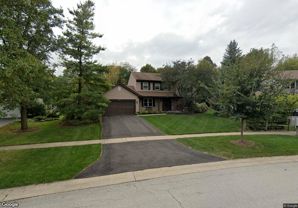
1219 Thrun Dr Unit 2 Batavia, IL 60510
Southeast Batavia NeighborhoodEstimated Value: $432,978 - $482,000
4
Beds
--
Bath
2,084
Sq Ft
$219/Sq Ft
Est. Value
About This Home
This home is located at 1219 Thrun Dr Unit 2, Batavia, IL 60510 and is currently estimated at $455,745, approximately $218 per square foot. 1219 Thrun Dr Unit 2 is a home located in Kane County with nearby schools including Hoover Wood Elementary School, Sam Rotolo Middle School, and Batavia Sr High School.
Ownership History
Date
Name
Owned For
Owner Type
Purchase Details
Closed on
Feb 1, 2013
Sold by
Dixon Roger L and Dixon Marilyn K
Bought by
Dioxon Robert L
Current Estimated Value
Purchase Details
Closed on
Dec 29, 1999
Sold by
Obrien Kevin W and Obrien Susan
Bought by
Dixon Roger L and Dixon Marilyn
Home Financials for this Owner
Home Financials are based on the most recent Mortgage that was taken out on this home.
Original Mortgage
$172,800
Outstanding Balance
$54,573
Interest Rate
7.76%
Estimated Equity
$401,172
Create a Home Valuation Report for This Property
The Home Valuation Report is an in-depth analysis detailing your home's value as well as a comparison with similar homes in the area
Home Values in the Area
Average Home Value in this Area
Purchase History
| Date | Buyer | Sale Price | Title Company |
|---|---|---|---|
| Dioxon Robert L | -- | None Available | |
| Dixon Roger L | $216,000 | Chicago Title Insurance Co |
Source: Public Records
Mortgage History
| Date | Status | Borrower | Loan Amount |
|---|---|---|---|
| Open | Dixon Roger L | $172,800 | |
| Closed | Dixon Roger L | $43,200 |
Source: Public Records
Tax History
| Year | Tax Paid | Tax Assessment Tax Assessment Total Assessment is a certain percentage of the fair market value that is determined by local assessors to be the total taxable value of land and additions on the property. | Land | Improvement |
|---|---|---|---|---|
| 2024 | $9,162 | $131,878 | $22,329 | $109,549 |
| 2023 | $10,271 | $119,693 | $20,266 | $99,427 |
| 2022 | $9,768 | $111,862 | $18,940 | $92,922 |
| 2021 | $9,405 | $106,091 | $17,963 | $88,128 |
| 2020 | $9,183 | $104,052 | $17,618 | $86,434 |
| 2019 | $9,052 | $100,368 | $16,994 | $83,374 |
| 2018 | $8,711 | $96,545 | $16,347 | $80,198 |
| 2017 | $8,518 | $93,361 | $15,808 | $77,553 |
| 2016 | $8,352 | $90,642 | $15,348 | $75,294 |
| 2015 | -- | $88,579 | $14,999 | $73,580 |
| 2014 | -- | $85,791 | $14,527 | $71,264 |
| 2013 | -- | $84,118 | $14,244 | $69,874 |
Source: Public Records
Map
Nearby Homes
- 1012 Edwards Dr
- 1220 Davey Dr
- 1136 Pine Ct
- 1816 Burnell Ct
- 2007 Gillenwater St
- 701 Viking Dr
- 2047 Swan Ln
- 1705 South Ct
- 694 Hart Rd
- 2045 Stuttle Rd
- Lot 4 Manchester Ave
- 570 Violet Ln
- 860 S River St
- 1687 Sauk Dr
- 1011 Napa Ln
- 823 Columbia Cir
- 304 S Prairie St
- 121 S Raddant Rd
- Lot 1 Center St
- 414 Cleveland Ave
- 1213 Thrun Dr
- 1225 Thrun Dr
- 1207 Thrun Dr
- 1231 Thrun Dr
- 1220 Thrun Dr
- 1214 Thrun Dr Unit 2
- 1203 Thrun Dr
- 1208 Thrun Dr
- 1222 Thrun Dr
- 1202 Thrun Dr
- 1201 Thrun Dr
- 1228 Beckman Ln
- 1345 Larkspur Ln
- 1351 Larkspur Ln Unit 1
- 1154 Hanover Dr Unit 1
- 1222 Beckman Ln
- 1131 Hanover Dr
- 1339 Larkspur Ln
- 1204 Anderson Dr
- 1374 Larkspur Ln Unit 2
Your Personal Tour Guide
Ask me questions while you tour the home.