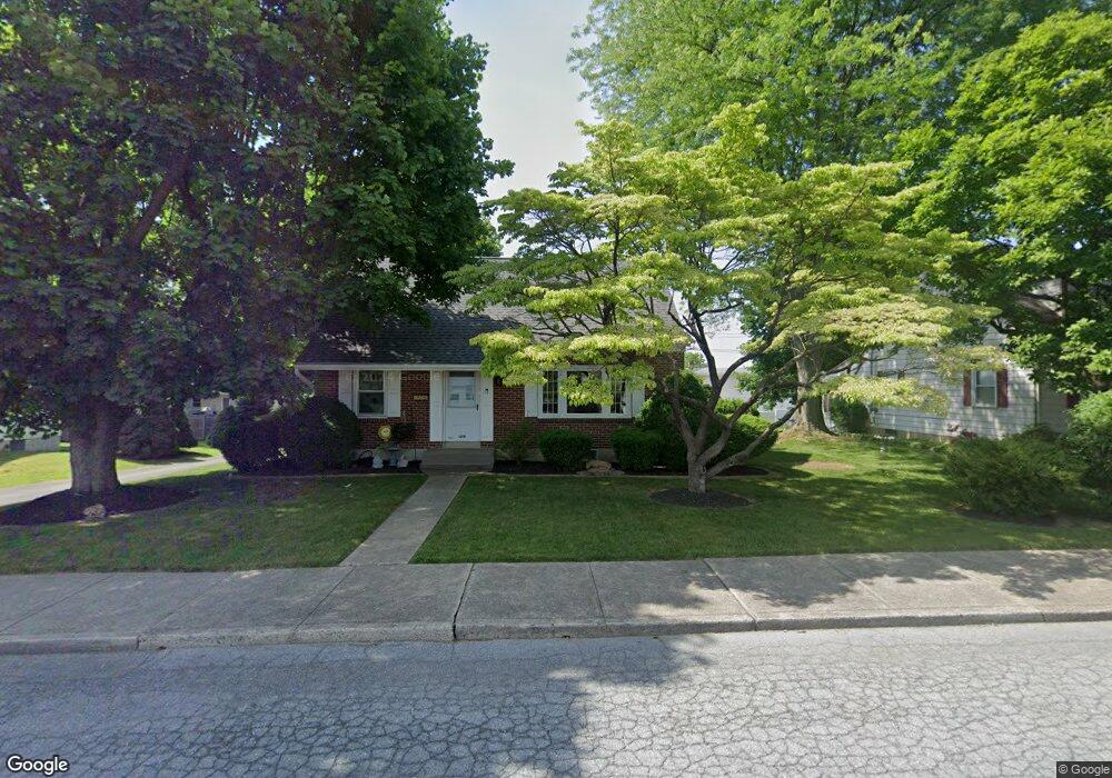
1219 W Broad St Emmaus, PA 18049
Estimated Value: $348,000 - $420,000
2
Beds
2
Baths
2,003
Sq Ft
$190/Sq Ft
Est. Value
About This Home
This home is located at 1219 W Broad St, Emmaus, PA 18049 and is currently estimated at $380,796, approximately $190 per square foot. 1219 W Broad St is a home located in Lehigh County with nearby schools including Jefferson Elementary School, Lower Macungie Middle School, and Emmaus High School.
Ownership History
Date
Name
Owned For
Owner Type
Purchase Details
Closed on
Nov 25, 2009
Sold by
Firstval Properties
Bought by
Lombardo And Sons L P
Current Estimated Value
Purchase Details
Closed on
Dec 26, 2003
Sold by
Forrest Marion R
Bought by
Branson Brian A
Home Financials for this Owner
Home Financials are based on the most recent Mortgage that was taken out on this home.
Original Mortgage
$129,600
Interest Rate
6.01%
Mortgage Type
Purchase Money Mortgage
Purchase Details
Closed on
Sep 10, 1953
Bought by
Forrest William L and Forrest Marion R
Create a Home Valuation Report for This Property
The Home Valuation Report is an in-depth analysis detailing your home's value as well as a comparison with similar homes in the area
Home Values in the Area
Average Home Value in this Area
Purchase History
| Date | Buyer | Sale Price | Title Company |
|---|---|---|---|
| Lombardo And Sons L P | $225,000 | -- | |
| Branson Brian A | $162,000 | -- | |
| Forrest William L | $100 | -- |
Source: Public Records
Mortgage History
| Date | Status | Borrower | Loan Amount |
|---|---|---|---|
| Previous Owner | Branson Brian A | $129,600 |
Source: Public Records
Tax History Compared to Growth
Tax History
| Year | Tax Paid | Tax Assessment Tax Assessment Total Assessment is a certain percentage of the fair market value that is determined by local assessors to be the total taxable value of land and additions on the property. | Land | Improvement |
|---|---|---|---|---|
| 2025 | $7,066 | $200,600 | $28,600 | $172,000 |
| 2024 | $6,472 | $200,600 | $28,600 | $172,000 |
| 2023 | $6,347 | $200,600 | $28,600 | $172,000 |
| 2022 | $6,137 | $200,600 | $172,000 | $28,600 |
| 2021 | $5,984 | $200,600 | $28,600 | $172,000 |
| 2020 | $5,932 | $200,600 | $28,600 | $172,000 |
| 2019 | $5,774 | $200,600 | $28,600 | $172,000 |
| 2018 | $5,556 | $200,600 | $28,600 | $172,000 |
| 2017 | $4,861 | $181,100 | $28,600 | $152,500 |
| 2016 | -- | $181,100 | $28,600 | $152,500 |
| 2015 | -- | $181,100 | $28,600 | $152,500 |
| 2014 | -- | $181,100 | $28,600 | $152,500 |
Source: Public Records
Map
Nearby Homes
- 1262 Arch St
- 339 Delong Ave Unit 343
- 1434 Shimerville Rd
- 3430 Gentlewind Way Unit IC 109
- 4109 Eveningstar Rd
- 3420 Gentlewind Way Unit IC 110
- 4088 Eveningstar Rd
- 3687 Daylily Dr
- 97 Chestnut Hill Rd
- 4115 Charles Rd
- 3623 Daylily Dr
- 3810 Allen St
- 659 Broad St
- 3514 Daylily Dr
- 3941 W Minor St
- 657 Walnut St
- 3892 Mink Rd
- 610 Wood St
- 4435 Benjamin Ct
- 3973 Mink Rd
- 1205 W Broad St
- 1233 W Broad St
- 1220 W Jubilee St
- 1210 W Jubilee St
- 1234 W Jubilee St
- 102 S 12th St
- 1237 W Broad St
- 1139 W Broad St
- 1238 W Jubilee St
- 1140 W Jubilee St
- 1241 W Broad St
- 1236 W Broad St
- 1133 W Broad St
- 110 S 12th St
- 103 S 12th St
- 1128 W Jubilee St
- 1244 W Jubilee St
- 1240 W Broad St
- 1215 W Jubilee St
- 1223 W Jubilee St