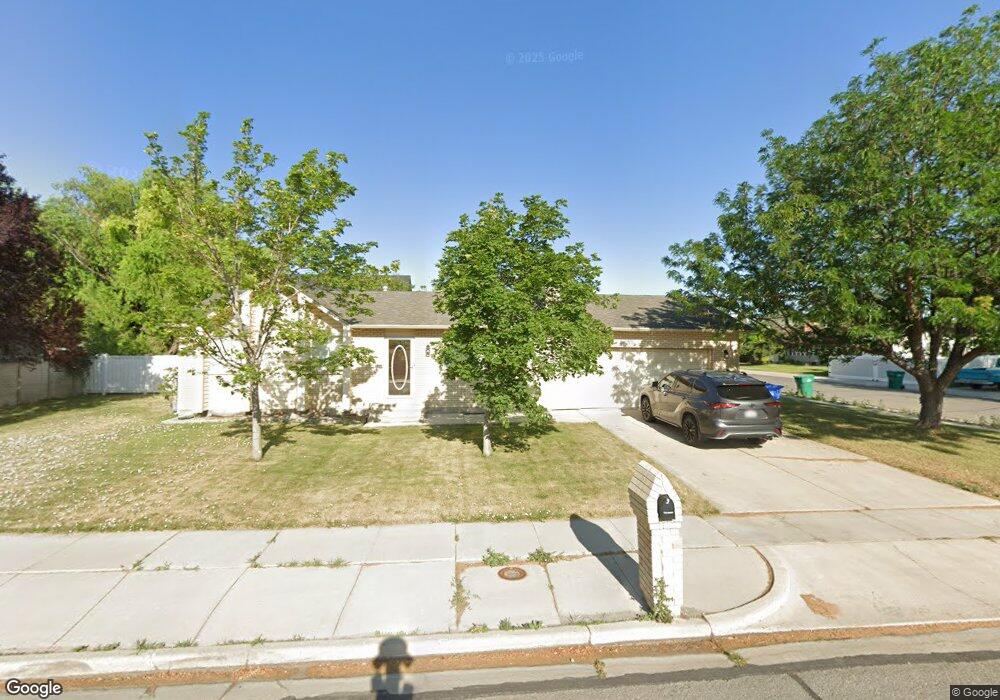
12190 Mcdougal Dr Riverton, UT 84065
Estimated Value: $513,000 - $537,000
5
Beds
2
Baths
2,200
Sq Ft
$240/Sq Ft
Est. Value
About This Home
This home is located at 12190 Mcdougal Dr, Riverton, UT 84065 and is currently estimated at $527,230, approximately $239 per square foot. 12190 Mcdougal Dr is a home located in Salt Lake County with nearby schools including Rosamond Elementary School, Oquirrh Hills Middle School, and Riverton High School.
Ownership History
Date
Name
Owned For
Owner Type
Purchase Details
Closed on
May 30, 2025
Sold by
Monaco Paula
Bought by
Henry Eric and Henry Madeline
Current Estimated Value
Home Financials for this Owner
Home Financials are based on the most recent Mortgage that was taken out on this home.
Original Mortgage
$515,490
Outstanding Balance
$514,172
Interest Rate
6.83%
Mortgage Type
FHA
Estimated Equity
$13,058
Purchase Details
Closed on
Apr 13, 2018
Sold by
Monaco Toby and Toby Monaco Trust
Bought by
Monaco Paula
Home Financials for this Owner
Home Financials are based on the most recent Mortgage that was taken out on this home.
Original Mortgage
$156,000
Interest Rate
4.5%
Mortgage Type
New Conventional
Purchase Details
Closed on
Aug 20, 2014
Sold by
Griffiths Neal and Griffiths Laura
Bought by
Griffiths Neal and Griffiths Laura
Purchase Details
Closed on
Oct 8, 1997
Sold by
Stern Lee H
Bought by
Monaco Toby and Monaco Paula
Home Financials for this Owner
Home Financials are based on the most recent Mortgage that was taken out on this home.
Original Mortgage
$133,575
Interest Rate
7.54%
Mortgage Type
VA
Create a Home Valuation Report for This Property
The Home Valuation Report is an in-depth analysis detailing your home's value as well as a comparison with similar homes in the area
Home Values in the Area
Average Home Value in this Area
Purchase History
| Date | Buyer | Sale Price | Title Company |
|---|---|---|---|
| Henry Eric | -- | Monument Title | |
| Monaco Paula | -- | Surety Title | |
| Monaco Toby | -- | None Available | |
| Griffiths Neal | -- | None Available | |
| Monaco Toby | -- | -- |
Source: Public Records
Mortgage History
| Date | Status | Borrower | Loan Amount |
|---|---|---|---|
| Open | Henry Eric | $515,490 | |
| Closed | Henry Eric | $30,929 | |
| Previous Owner | Monaco Paula | $156,000 | |
| Previous Owner | Monaco Toby | $133,575 |
Source: Public Records
Tax History
| Year | Tax Paid | Tax Assessment Tax Assessment Total Assessment is a certain percentage of the fair market value that is determined by local assessors to be the total taxable value of land and additions on the property. | Land | Improvement |
|---|---|---|---|---|
| 2025 | $2,701 | $475,900 | $214,000 | $261,900 |
| 2024 | $2,701 | $467,500 | $194,200 | $273,300 |
| 2023 | $2,701 | $463,800 | $192,300 | $271,500 |
| 2022 | $2,828 | $452,700 | $188,500 | $264,200 |
| 2021 | $2,390 | $340,600 | $122,300 | $218,300 |
| 2020 | $2,334 | $310,100 | $122,300 | $187,800 |
| 2019 | $2,330 | $304,400 | $122,300 | $182,100 |
| 2018 | $2,137 | $274,800 | $114,100 | $160,700 |
| 2017 | $1,889 | $236,800 | $114,100 | $122,700 |
| 2016 | $2,001 | $240,700 | $114,100 | $126,600 |
| 2015 | $1,115 | $234,900 | $113,100 | $121,800 |
| 2014 | $1,039 | $221,600 | $107,600 | $114,000 |
Source: Public Records
Map
Nearby Homes
- 2127 Silver Tree Cir
- 2356 W Montcalm Dr
- 2329 W Myers Ln
- 12332 S 2700 W
- 12501 Falls Creek Rd
- 11788 S Myers Park Ln Unit 101
- 1719 W 12050 S
- 11718 S Myers Park Ln Unit 105
- 11710 S Myers Park Ln Unit 106
- 2511 W 11730 S
- 12317 S Redwood Rd
- 12325 S Redwood Rd
- 1661 W Madison View Dr
- 12341 S Redwood Rd
- 2853 W 12075 S
- 1733 W Shade Ln
- 1644 W Madison Ridge Ln
- 1721 W Hollow Cedar Ln Unit 1
- 1924 W Trail Heights Dr
- 11716 S 2610 W
- 12210 Mcdougal Dr
- 12210 S 2240 W
- 2287 W 12175 S
- 12162 Mcdougal Dr
- 2268 W 12175 S
- 12215 S 2240 W
- 2307 W 12175 S
- 12232 Mcdougal Dr
- 12177 Mcdougal Dr
- 12246 S 2240 W
- 12146 Mcdougal Dr
- 12231 S 2240 W
- 2268 W 12250 S
- 2284 W 12175 S
- 2311 W 12175 S Unit 609
- 2207 W 12145 S
- 12244 Mcdougal Dr
- 12245 S 2240 W
- 12161 Mcdougal Dr
- 2302 W 12175 S
Your Personal Tour Guide
Ask me questions while you tour the home.