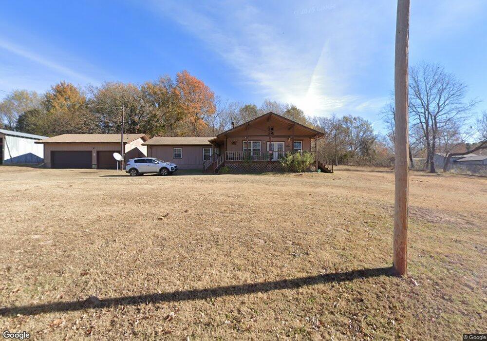
121983 S 4109 Rd Eufaula, OK 74432
Estimated Value: $179,129 - $366,000
3
Beds
2
Baths
1,832
Sq Ft
$153/Sq Ft
Est. Value
About This Home
This home is located at 121983 S 4109 Rd, Eufaula, OK 74432 and is currently estimated at $279,782, approximately $152 per square foot. 121983 S 4109 Rd is a home located in McIntosh County with nearby schools including Eufaula Elementary School, Eufaula Middle School, and Eufaula High School.
Ownership History
Date
Name
Owned For
Owner Type
Purchase Details
Closed on
Nov 6, 2015
Sold by
The Bank Of New York Mellon
Bought by
Prescott Alan M and Prescott Donna J
Current Estimated Value
Purchase Details
Closed on
Nov 3, 2006
Sold by
White Barabara C
Bought by
Mcinturff Daniel A and Mcinturff Corrine A
Home Financials for this Owner
Home Financials are based on the most recent Mortgage that was taken out on this home.
Original Mortgage
$62,400
Interest Rate
6.28%
Mortgage Type
New Conventional
Create a Home Valuation Report for This Property
The Home Valuation Report is an in-depth analysis detailing your home's value as well as a comparison with similar homes in the area
Purchase History
| Date | Buyer | Sale Price | Title Company |
|---|---|---|---|
| Prescott Alan M | $44,500 | None Available | |
| Mcinturff Daniel A | $78,000 | None Available |
Source: Public Records
Mortgage History
| Date | Status | Borrower | Loan Amount |
|---|---|---|---|
| Previous Owner | Mcinturff Daniel A | $62,400 |
Source: Public Records
Tax History
| Year | Tax Paid | Tax Assessment Tax Assessment Total Assessment is a certain percentage of the fair market value that is determined by local assessors to be the total taxable value of land and additions on the property. | Land | Improvement |
|---|---|---|---|---|
| 2025 | $542 | $6,199 | $330 | $5,869 |
| 2024 | $516 | $6,199 | $330 | $5,869 |
| 2023 | $516 | $5,623 | $330 | $5,293 |
| 2022 | $466 | $5,623 | $330 | $5,293 |
| 2021 | $497 | $5,924 | $330 | $5,594 |
| 2020 | $497 | $5,924 | $330 | $5,594 |
| 2019 | $481 | $5,684 | $330 | $5,354 |
| 2018 | $473 | $5,683 | $330 | $5,353 |
| 2017 | $473 | $5,683 | $330 | $5,353 |
| 2016 | $476 | $5,683 | $330 | $5,353 |
| 2015 | $750 | $9,085 | $330 | $8,755 |
| 2014 | $730 | $8,901 | $323 | $8,578 |
Source: Public Records
Map
Nearby Homes
- 121780 S 4109 Cir
- 410863 E 1211 Rd
- 120662 S 4100 Rd
- 33 E1220 Rd
- 29 E1220 Rd
- 70 E 1220 Rd
- 123765 S 4107 Rd
- 413804 E 1212 Rd
- 410053 E County Rd 1240
- 418391 E1215 Rd
- 410053 E 1240 Rd
- TBD Tulip E 1444 Dr
- 17 Patriot Pointe
- 112 Patriot Pointe
- 66 Pebble Ridge
- 409496 E 1240 Rd
- 39 Holiday St
- 26 E1215 Rd
- 20 E1215 Rd
- 42 Holiday Ln
- 0 E County Road 1220 Rd Unit 1734322
- 0 E County Road 1220 Rd Unit 1808943
- 0 E County Road 1220 Rd Unit 1834162
- 0 E County Road 1220 Rd Unit 1908885
- 0 N 4109 Rd Unit 2030534
- 410902 E 1220 Rd
- 0 E Bk 1220 Rd Unit 1630441
- 0 E Bk 1220 Rd Unit 1630410
- 121896 S 4109 Cir
- 0 S 4109 Rd Unit 2312561
- 0 S 4109 Rd Unit 2235016
- 0 S 4109 Rd Unit 2235012
- 0 S 4109 Rd Unit 2133376
- 0 S 4109 Rd Unit 2133304
- 0 S 4109 Rd Unit 2208803
- 0 S 4109 Rd Unit 2208798
- 121986 S 4109 Rd
- 1605 Ballad Dr
- 44097 SE 1221 Rd
- 7207 N Kickapoo Ave
Your Personal Tour Guide
Ask me questions while you tour the home.