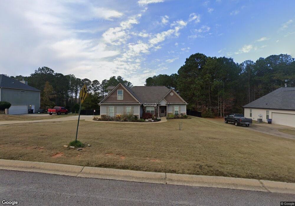
122 Amhurst Dr West Point, GA 31833
Estimated Value: $211,000 - $294,000
3
Beds
3
Baths
1,607
Sq Ft
$167/Sq Ft
Est. Value
About This Home
This home is located at 122 Amhurst Dr, West Point, GA 31833 and is currently estimated at $267,638, approximately $166 per square foot. 122 Amhurst Dr is a home located in Troup County with nearby schools including West Point Elementary School, Long Cane Elementary School, and Whitesville Road Elementary School.
Ownership History
Date
Name
Owned For
Owner Type
Purchase Details
Closed on
Mar 9, 2022
Sold by
Pulliam Gregory John
Bought by
Pulliam Gregory John and Pulliam Kira Lassiter
Current Estimated Value
Home Financials for this Owner
Home Financials are based on the most recent Mortgage that was taken out on this home.
Original Mortgage
$260,000
Interest Rate
4.16%
Mortgage Type
VA
Purchase Details
Closed on
Jul 8, 2020
Sold by
Robinson Chris
Bought by
Pulliam Gregory John
Home Financials for this Owner
Home Financials are based on the most recent Mortgage that was taken out on this home.
Original Mortgage
$197,000
Interest Rate
3.2%
Mortgage Type
VA
Purchase Details
Closed on
Jan 15, 2009
Sold by
Dack Homes East
Bought by
Robinson Chris
Home Financials for this Owner
Home Financials are based on the most recent Mortgage that was taken out on this home.
Original Mortgage
$161,863
Interest Rate
5.24%
Mortgage Type
FHA
Create a Home Valuation Report for This Property
The Home Valuation Report is an in-depth analysis detailing your home's value as well as a comparison with similar homes in the area
Home Values in the Area
Average Home Value in this Area
Purchase History
| Date | Buyer | Sale Price | Title Company |
|---|---|---|---|
| Pulliam Gregory John | -- | -- | |
| Pulliam Gregory John | $197,000 | -- | |
| Robinson Chris | $164,000 | -- | |
| Robinson Chris | $164,000 | -- |
Source: Public Records
Mortgage History
| Date | Status | Borrower | Loan Amount |
|---|---|---|---|
| Previous Owner | Pulliam Gregory John | $260,000 | |
| Previous Owner | Pulliam Gregory John | $197,000 | |
| Previous Owner | Robinson Chris | $161,863 |
Source: Public Records
Tax History Compared to Growth
Tax History
| Year | Tax Paid | Tax Assessment Tax Assessment Total Assessment is a certain percentage of the fair market value that is determined by local assessors to be the total taxable value of land and additions on the property. | Land | Improvement |
|---|---|---|---|---|
| 2024 | $2,432 | $89,160 | $14,000 | $75,160 |
| 2023 | $2,464 | $90,360 | $14,000 | $76,360 |
| 2022 | $2,219 | $79,520 | $10,000 | $69,520 |
| 2021 | $2,377 | $79,320 | $10,000 | $69,320 |
| 2020 | $2,332 | $77,320 | $8,000 | $69,320 |
| 2019 | $2,255 | $74,760 | $6,000 | $68,760 |
| 2018 | $2,255 | $74,760 | $6,000 | $68,760 |
| 2017 | $2,255 | $74,760 | $6,000 | $68,760 |
| 2016 | $2,274 | $75,388 | $6,000 | $69,388 |
| 2015 | $2,277 | $75,388 | $6,000 | $69,388 |
| 2014 | $1,745 | $57,652 | $6,000 | $51,652 |
| 2013 | -- | $48,983 | $6,000 | $42,983 |
Source: Public Records
Map
Nearby Homes
- 4172 Bartley Rd
- 157 Amhurst Cir
- 333 Shoemaker Rd
- 648 Warner Rd
- 203 Harris Walk Unit 21
- 206 Harris Walk Unit 81
- 201 Harris Walk Unit 20
- 205 Harris Walk
- 207 Harris Walk
- 203 Harris Walk
- 201 Harris Walk
- 208 Harris Walk
- 206 Harris Walk
- 202 Harris Walk
- 204 Harris Walk
- 0 Johns Rd Unit 10615130
- 796 Shoemaker Rd
- 3067 Georgia 18
- 0 Sandtown Rd Unit 10255987
- 2790 Bartley Rd
- 120 Amhurst Dr
- 124 Amhurst Dr
- 124 Amhurst Dr Unit 59
- 126 Amhurst Dr
- 0 Amhurst Dr Unit 8704777
- 0 Amhurst Dr Unit 8640719
- 0 Amhurst Dr Unit 8514840
- 0 Amhurst Dr Unit 9038867
- 0 Amhurst Dr Unit 9074202
- 0 Amhurst Dr Unit 8784185
- 0 Amhurst Dr Unit 8821380
- 0 Amhurst Dr Unit 8844607
- 0 Amhurst Dr Unit 8858144
- 0 Amhurst Dr Unit 8859943
- 0 Amhurst Dr Unit 3279397
- 0 Amhurst Dr Unit 7029798
- 0 Amhurst Dr Unit 7077932
- 0 Amhurst Dr Unit 7129478
- 0 Amhurst Dr Unit 7165183
- 0 Amhurst Dr Unit 7180451