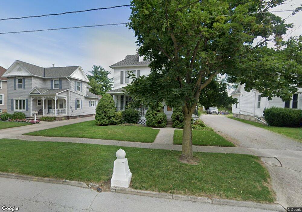
122 Ashford Ave Bellevue, OH 44811
Estimated Value: $147,204 - $173,000
4
Beds
2
Baths
1,828
Sq Ft
$86/Sq Ft
Est. Value
About This Home
This home is located at 122 Ashford Ave, Bellevue, OH 44811 and is currently estimated at $157,051, approximately $85 per square foot. 122 Ashford Ave is a home located in Sandusky County with nearby schools including Bellevue Elementary School, Bellevue Middle School, and Bellevue High School.
Ownership History
Date
Name
Owned For
Owner Type
Purchase Details
Closed on
Jun 20, 2016
Sold by
Weisz John M
Bought by
John M Weisz and Florean B /Surv
Current Estimated Value
Home Financials for this Owner
Home Financials are based on the most recent Mortgage that was taken out on this home.
Interest Rate
3.54%
Purchase Details
Closed on
Oct 30, 2006
Sold by
Reer Rose A and Reer Donald W
Bought by
Weisz John M and Weisz Florean
Home Financials for this Owner
Home Financials are based on the most recent Mortgage that was taken out on this home.
Original Mortgage
$80,000
Interest Rate
6.5%
Mortgage Type
Purchase Money Mortgage
Create a Home Valuation Report for This Property
The Home Valuation Report is an in-depth analysis detailing your home's value as well as a comparison with similar homes in the area
Home Values in the Area
Average Home Value in this Area
Purchase History
| Date | Buyer | Sale Price | Title Company |
|---|---|---|---|
| John M Weisz | -- | -- | |
| Weisz John M | $60,000 | Attorney |
Source: Public Records
Mortgage History
| Date | Status | Borrower | Loan Amount |
|---|---|---|---|
| Closed | John M Weisz | -- | |
| Previous Owner | Weisz John M | $80,000 |
Source: Public Records
Tax History
| Year | Tax Paid | Tax Assessment Tax Assessment Total Assessment is a certain percentage of the fair market value that is determined by local assessors to be the total taxable value of land and additions on the property. | Land | Improvement |
|---|---|---|---|---|
| 2025 | $1,669 | $111,500 | $16,200 | $95,300 |
| 2024 | $1,669 | $39,030 | $5,670 | $33,360 |
| 2023 | $1,669 | $34,870 | $5,080 | $29,790 |
| 2022 | $1,595 | $34,870 | $5,080 | $29,790 |
| 2021 | $1,608 | $34,870 | $5,080 | $29,790 |
| 2020 | $1,516 | $31,050 | $5,080 | $25,970 |
| 2019 | $1,498 | $31,050 | $5,080 | $25,970 |
| 2018 | $1,506 | $31,050 | $5,080 | $25,970 |
| 2017 | $1,498 | $31,050 | $5,080 | $25,970 |
| 2016 | $1,448 | $31,050 | $5,080 | $25,970 |
| 2015 | $1,460 | $31,050 | $5,080 | $25,970 |
| 2014 | $1,518 | $30,910 | $5,040 | $25,870 |
| 2013 | $1,513 | $30,910 | $5,040 | $25,870 |
Source: Public Records
Map
Nearby Homes
- 135 Attwood Terrace
- 209 Pleasant St
- 408 W Main St
- 603 Cr 314
- 111 W Main St
- 140 Crystal Ct
- 266 Southwest St
- 305 Louise Ave
- 134 Walter St
- 400 Southwest St
- 221 Broad St
- 308 E Center St
- 128 East St
- 0 St Rt 4 - B
- 0 County Road 308
- 111 Flat Rock Rd Unit 34
- 0 Hartland Dr
- 102 Roth Ct
- 303 Moore Ave
- 432 High St
- 118 Ashford Ave
- 126 Ashford Ave
- 114 Ashford Ave
- 130 Ashford Ave Unit 130
- 134 Ashford Ave
- 127 Ashford Ave
- 138 Ashford Ave
- 314 Kilbourne St
- 408 Kilbourne St
- 142 Ashford Ave
- 135 Ashford Ave
- 416 Kilbourne St
- 124 Wolf St
- 140 Wolf St
- 306 Kilbourne St
- 146 Ashford Ave Unit 146
- 122 Wolf St
- 143 Ashford Ave
- 131 Ashford Ave
- 150 Ashford Ave
Your Personal Tour Guide
Ask me questions while you tour the home.