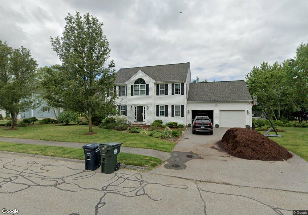
122 Autumn Cir Holden, MA 01520
Estimated Value: $803,050 - $966,000
4
Beds
3
Baths
2,553
Sq Ft
$340/Sq Ft
Est. Value
About This Home
This home is located at 122 Autumn Cir, Holden, MA 01520 and is currently estimated at $868,013, approximately $339 per square foot. 122 Autumn Cir is a home located in Worcester County with nearby schools including Wachusett Regional High School and Bancroft School.
Ownership History
Date
Name
Owned For
Owner Type
Purchase Details
Closed on
Jul 29, 2005
Sold by
Robinson Dana L and Robinson Steven W
Bought by
Jackson Deborah J and Jackson Martin A
Current Estimated Value
Purchase Details
Closed on
Mar 21, 2002
Sold by
Winter Hill Llc
Bought by
Robinson Steven W and Robinson Dana L
Home Financials for this Owner
Home Financials are based on the most recent Mortgage that was taken out on this home.
Original Mortgage
$290,000
Interest Rate
6.91%
Mortgage Type
Purchase Money Mortgage
Create a Home Valuation Report for This Property
The Home Valuation Report is an in-depth analysis detailing your home's value as well as a comparison with similar homes in the area
Home Values in the Area
Average Home Value in this Area
Purchase History
| Date | Buyer | Sale Price | Title Company |
|---|---|---|---|
| Jackson Deborah J | $512,000 | -- | |
| Robinson Steven W | $367,200 | -- |
Source: Public Records
Mortgage History
| Date | Status | Borrower | Loan Amount |
|---|---|---|---|
| Previous Owner | Robinson Steven W | $322,000 | |
| Previous Owner | Robinson Steven W | $290,000 |
Source: Public Records
Tax History Compared to Growth
Tax History
| Year | Tax Paid | Tax Assessment Tax Assessment Total Assessment is a certain percentage of the fair market value that is determined by local assessors to be the total taxable value of land and additions on the property. | Land | Improvement |
|---|---|---|---|---|
| 2025 | $9,824 | $708,800 | $194,100 | $514,700 |
| 2024 | $9,775 | $690,800 | $188,500 | $502,300 |
| 2023 | $9,291 | $619,800 | $163,800 | $456,000 |
| 2022 | $8,921 | $538,700 | $132,600 | $406,100 |
| 2021 | $9,165 | $526,700 | $130,500 | $396,200 |
| 2020 | $8,911 | $524,200 | $124,200 | $400,000 |
| 2019 | $8,681 | $497,500 | $124,200 | $373,300 |
| 2018 | $8,470 | $481,000 | $118,200 | $362,800 |
| 2017 | $8,185 | $465,300 | $122,200 | $343,100 |
| 2016 | $7,091 | $411,100 | $116,300 | $294,800 |
| 2015 | $7,244 | $399,800 | $116,300 | $283,500 |
| 2014 | $7,096 | $399,800 | $116,300 | $283,500 |
Source: Public Records
Map
Nearby Homes
- 27 Tea Party Cir Unit 27
- 2 Explorers Way Unit 2
- 303 Greenwich Ct Unit 303
- 3901 Knightsbridge Close Unit 3901
- 4004 Brompton Cir
- 9 Emily St
- 12 Tattan Farm Rd
- 68 Fisher Rd
- 308 Holden St
- 314 Main St
- 49 Barry Rd
- 770 Salisbury St Unit 201
- 189 Holden St
- 61 Barry Rd
- 23 Gail Dr
- 46 Barry Rd
- 4 Barrows Rd
- 156 Newell Rd
- 527 Salisbury St
- 7 Dubiel Dr