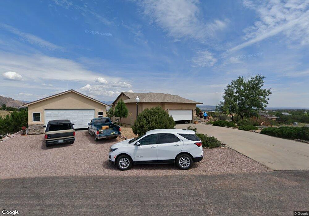
122 Bobwhite Loop Cañon City, CO 81212
Estimated Value: $451,000 - $556,000
5
Beds
3
Baths
1,774
Sq Ft
$294/Sq Ft
Est. Value
About This Home
This home is located at 122 Bobwhite Loop, Cañon City, CO 81212 and is currently estimated at $521,341, approximately $293 per square foot. 122 Bobwhite Loop is a home located in Fremont County with nearby schools including Lincoln School of Science & Technology, Canon City Middle School, and Canon City High School.
Ownership History
Date
Name
Owned For
Owner Type
Purchase Details
Closed on
Mar 29, 2021
Sold by
Dodge Sharon R
Bought by
Broz Mark M and Broz Cathy M
Current Estimated Value
Home Financials for this Owner
Home Financials are based on the most recent Mortgage that was taken out on this home.
Original Mortgage
$250,000
Outstanding Balance
$224,728
Interest Rate
2.73%
Mortgage Type
New Conventional
Estimated Equity
$296,613
Purchase Details
Closed on
Dec 31, 2002
Sold by
Cornella Brothers
Bought by
Cb Builders
Purchase Details
Closed on
Dec 27, 2002
Sold by
Cb Builders
Bought by
Dodge
Purchase Details
Closed on
Feb 19, 2002
Sold by
Dawson Ranch Llc
Bought by
Cornella Brothers Llc
Purchase Details
Closed on
Jun 19, 2000
Sold by
Dawson Ranch Llc
Bought by
Dawson Ranch Llc
Create a Home Valuation Report for This Property
The Home Valuation Report is an in-depth analysis detailing your home's value as well as a comparison with similar homes in the area
Purchase History
| Date | Buyer | Sale Price | Title Company |
|---|---|---|---|
| Broz Mark M | $421,000 | None Available | |
| Cb Builders | -- | -- | |
| Dodge | $246,500 | -- | |
| Cornella Brothers Llc | $55,000 | -- | |
| Dawson Ranch Llc | -- | -- |
Source: Public Records
Mortgage History
| Date | Status | Borrower | Loan Amount |
|---|---|---|---|
| Open | Broz Mark M | $250,000 |
Source: Public Records
Tax History
| Year | Tax Paid | Tax Assessment Tax Assessment Total Assessment is a certain percentage of the fair market value that is determined by local assessors to be the total taxable value of land and additions on the property. | Land | Improvement |
|---|---|---|---|---|
| 2024 | $2,849 | $33,797 | $0 | $0 |
| 2023 | $2,667 | $30,112 | $0 | $0 |
| 2022 | $2,435 | $28,051 | $0 | $0 |
| 2021 | $1,836 | $28,858 | $0 | $0 |
| 2020 | $1,383 | $23,618 | $0 | $0 |
| 2019 | $1,101 | $20,421 | $0 | $0 |
| 2018 | $840 | $17,069 | $0 | $0 |
| 2017 | $782 | $17,069 | $0 | $0 |
| 2016 | $720 | $17,800 | $0 | $0 |
| 2015 | $1,301 | $17,800 | $0 | $0 |
| 2012 | $1,296 | $18,608 | $3,582 | $15,026 |
Source: Public Records
Map
Nearby Homes
- TBD Wild Rose Dr
- 65 Blue Grouse Dr
- 123 Wild Rose Dr
- 29 Kyndra Ct
- 131 Wild Rose Dr
- 135 Wild Rose Dr
- 137 Wild Rose Dr
- 133 Blue Grouse Dr
- 140 N Osprey Ct
- 68 Wild Rose Ct
- 156 Osprey Ct
- 156 S Osprey Ct
- 124 Eagle Crest Loop
- 46 Fox Run Ct
- 206 Wolf Cub Trail
- 304 Storm Ridge Dr
- 424 Empire Rd
- 415 Empire Rd
- 423 Frontier Place
- 425 Miners Rd
- 122 Bobwhite Loop Unit 5
- 111 Wild Rose Dr
- 119 Wild Rose Dr
- 120 Bobwhite Loop Unit n/a
- 120 Bobwhite Loop Unit 4
- 120 Bobwhite Loop
- 116 Wild Rose Dr
- 114 Wild Rose Dr
- 118 Wild Rose Dr
- 121 Bobwhite Loop
- 107 Wild Rose Dr
- 60 Blue Grouse Dr
- 143 Bobwhite Loop
- 119 Bobwhite Loop
- 120 Wild Rose Dr Unit 36
- 120 Wild Rose Dr
- 64 Blue Grouse Dr
- 121 Wild Rose Dr
- 117 Bobwhite Loop
- 122 Wild Rose Dr
Your Personal Tour Guide
Ask me questions while you tour the home.