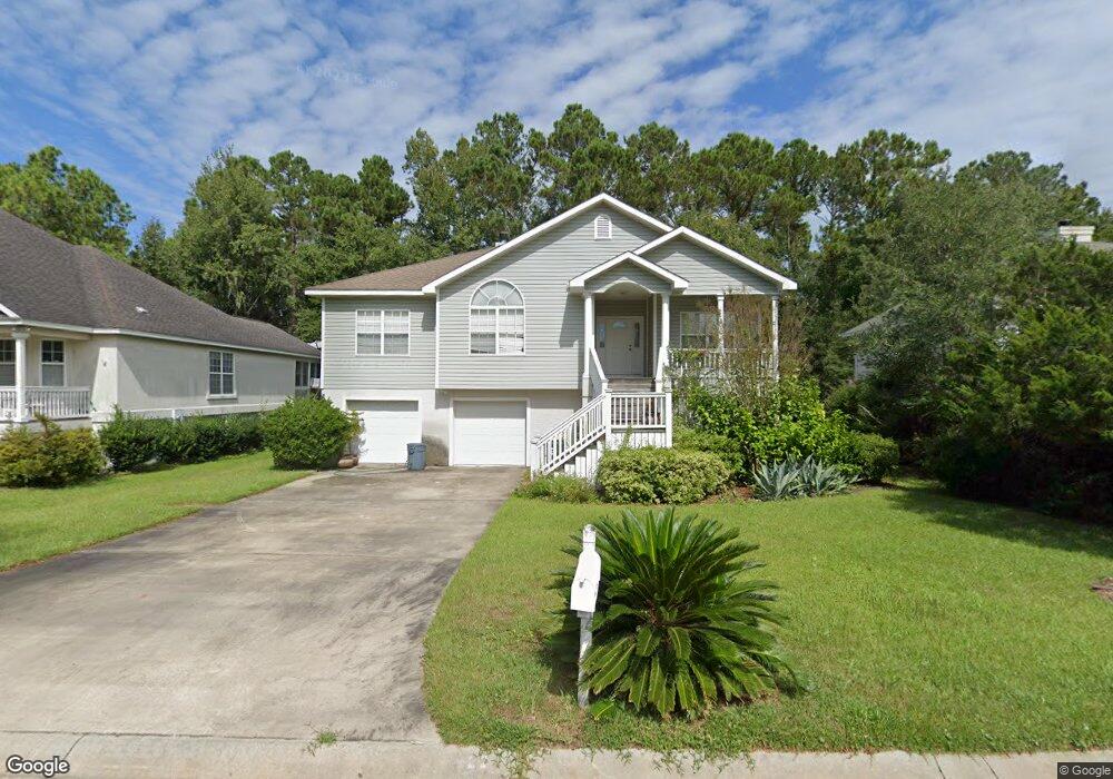
122 Brookfield Trace Saint Simons Island, GA 31522
Estimated Value: $626,000 - $669,000
3
Beds
2
Baths
1,990
Sq Ft
$325/Sq Ft
Est. Value
About This Home
This home is located at 122 Brookfield Trace, Saint Simons Island, GA 31522 and is currently estimated at $646,330, approximately $324 per square foot. 122 Brookfield Trace is a home located in Glynn County with nearby schools including Oglethorpe Point Elementary School, Glynn Middle School, and Glynn Academy.
Ownership History
Date
Name
Owned For
Owner Type
Purchase Details
Closed on
Apr 30, 2024
Sold by
Rogers Patty M
Bought by
Patty M Rogers Revocable Trust Dated Apr and Rogers Patty M Tr
Current Estimated Value
Create a Home Valuation Report for This Property
The Home Valuation Report is an in-depth analysis detailing your home's value as well as a comparison with similar homes in the area
Home Values in the Area
Average Home Value in this Area
Purchase History
| Date | Buyer | Sale Price | Title Company |
|---|---|---|---|
| Patty M Rogers Revocable Trust Dated Apr | -- | -- |
Source: Public Records
Tax History Compared to Growth
Tax History
| Year | Tax Paid | Tax Assessment Tax Assessment Total Assessment is a certain percentage of the fair market value that is determined by local assessors to be the total taxable value of land and additions on the property. | Land | Improvement |
|---|---|---|---|---|
| 2025 | $5,559 | $221,640 | $92,000 | $129,640 |
| 2024 | $5,398 | $215,240 | $92,000 | $123,240 |
| 2023 | $2,570 | $215,240 | $92,000 | $123,240 |
| 2022 | $3,011 | $178,600 | $80,000 | $98,600 |
| 2021 | $3,101 | $133,360 | $38,000 | $95,360 |
| 2020 | $3,128 | $133,360 | $38,000 | $95,360 |
| 2019 | $3,128 | $133,360 | $38,000 | $95,360 |
| 2018 | $3,060 | $117,440 | $38,000 | $79,440 |
| 2017 | $2,851 | $109,440 | $30,000 | $79,440 |
| 2016 | $2,641 | $109,440 | $30,000 | $79,440 |
| 2015 | $2,451 | $109,440 | $30,000 | $79,440 |
| 2014 | $2,451 | $101,120 | $30,000 | $71,120 |
Source: Public Records
Map
Nearby Homes
- 112 Brookfield Trace
- 18 Canopy Ct
- 24 Canopy Ct
- 3 Canopy Ct
- 8 Canopy Ct
- LOT 18 Canopy Ct
- LOT 3 Canopy Ct
- LOT 1 Canopy Ct
- LOT 24 Canopy Ct
- LOT 8 Canopy Ct
- 512 Brockinton S
- 110 Pirates Cove
- 131 Shadow Wood Bend
- 129 Shadow Wood Bend
- 123 Shadow Wood Bend
- 622 Brockinton Point
- 361 Brockinton Marsh
- 104 Ashwood Way
- 103 Travellers Way
- 258 Saint James Ave
- 120 Brookfield Trace
- 124 Brookfield Trace
- 125 Brookfield Trace
- 118 Brookfield Trace
- 119 Brookfield Trace
- 164 Shadow Wood Bend
- 123 Brookfield Trace
- 160 Shadow Wood Bend
- 111 Brookfield Trace
- 116 Brookfield Trace
- 11 Canopy Ct
- 10 Canopy Ct
- 6 Canopy Ct
- 00 Shadow Wood Bend
- 158 Shadow Wood Bend
- 103 Canopy Ct
- 105 Canopy Ct
- 114 Brookfield Trace
- 0 Brookfield Trace
- 109 Brookfield Trace