Estimated Value: $176,000 - $205,749
3
Beds
2
Baths
1,444
Sq Ft
$134/Sq Ft
Est. Value
About This Home
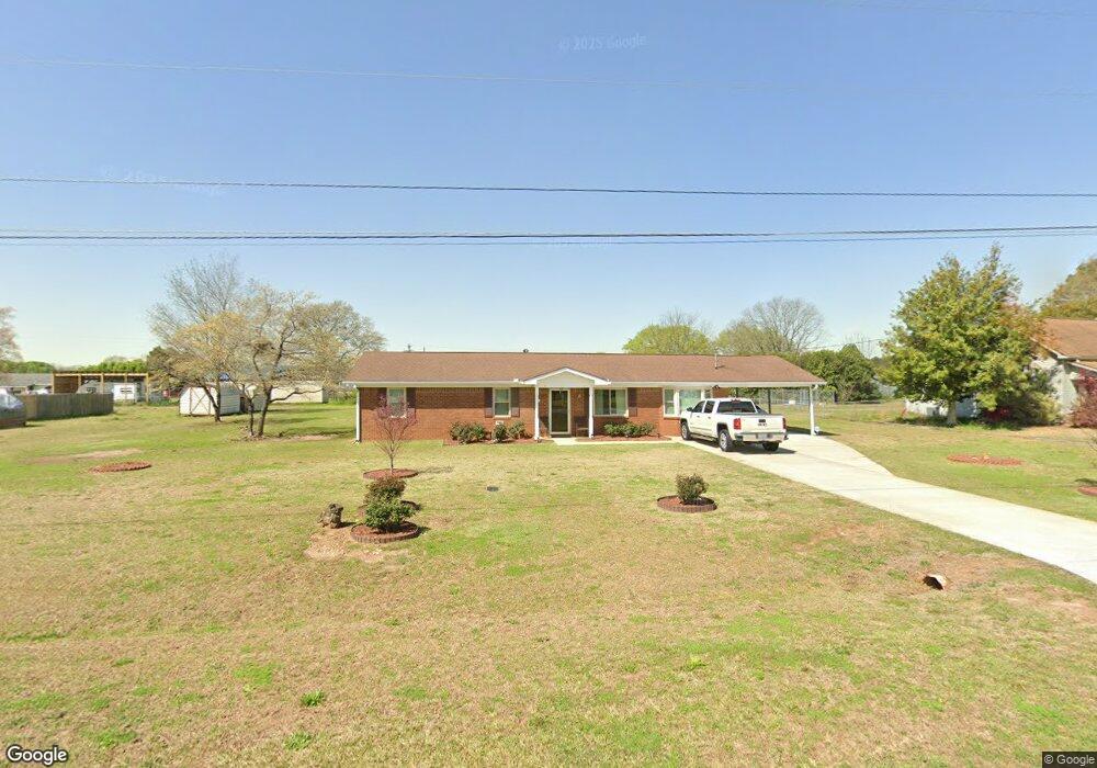
This home is located at 122 Chase Ct, Byron, GA 31008 and is currently estimated at $193,937, approximately $134 per square foot. 122 Chase Ct is a home located in Peach County with nearby schools including Kay Road Elementary School, Fort Valley Middle School, and Peach County High School.
Ownership History
Date
Name
Owned For
Owner Type
Purchase Details
Closed on
Nov 16, 2006
Sold by
Mixon Leona O
Bought by
Mccormick Verna
Current Estimated Value
Purchase Details
Closed on
Feb 20, 1998
Bought by
Mixon Leona O
Purchase Details
Closed on
Dec 28, 1989
Bought by
Mcatee Robert F and Mcatee Donna D
Purchase Details
Closed on
Sep 1, 1989
Bought by
Southeastern Properties Inc
Purchase Details
Closed on
Nov 30, 1988
Bought by
Snellgrove Debra Jean
Purchase Details
Closed on
Mar 25, 1987
Bought by
Snellgrove Milo
Purchase Details
Closed on
Mar 20, 1987
Bought by
Wright Stanley and Snellgrove Larry
Create a Home Valuation Report for This Property
The Home Valuation Report is an in-depth analysis detailing your home's value as well as a comparison with similar homes in the area
Home Values in the Area
Average Home Value in this Area
Purchase History
| Date | Buyer | Sale Price | Title Company |
|---|---|---|---|
| Mccormick Verna | $102,500 | -- | |
| Mixon Leona O | $65,000 | -- | |
| Mcatee Robert F | $47,500 | -- | |
| Southeastern Properties Inc | $6,500 | -- | |
| Snellgrove Debra Jean | -- | -- | |
| Snellgrove Milo | -- | -- | |
| Wright Stanley | -- | -- |
Source: Public Records
Tax History Compared to Growth
Tax History
| Year | Tax Paid | Tax Assessment Tax Assessment Total Assessment is a certain percentage of the fair market value that is determined by local assessors to be the total taxable value of land and additions on the property. | Land | Improvement |
|---|---|---|---|---|
| 2024 | $1,625 | $47,040 | $7,040 | $40,000 |
| 2023 | $1,601 | $46,080 | $7,040 | $39,040 |
| 2022 | $1,052 | $41,080 | $7,040 | $34,040 |
| 2021 | $1,045 | $35,480 | $7,040 | $28,440 |
| 2020 | $1,161 | $39,200 | $7,040 | $32,160 |
| 2019 | $1,138 | $38,280 | $7,040 | $31,240 |
| 2018 | $1,144 | $38,280 | $7,040 | $31,240 |
| 2017 | $1,150 | $38,280 | $7,040 | $31,240 |
| 2016 | $1,145 | $38,280 | $7,040 | $31,240 |
| 2015 | $1,147 | $38,280 | $7,040 | $31,240 |
| 2014 | $1,148 | $38,280 | $7,040 | $31,240 |
| 2013 | -- | $38,280 | $7,040 | $31,240 |
Source: Public Records
Map
Nearby Homes
- 167 Erin Ct
- 199 Red Tail Cir
- 127 Erin Ct
- 109 Red Tail Cir
- 107 Red Tail Cir
- 152 Hawks Ridge Trace
- 120 Hawks Place
- 0 Housers Mill Rd Unit 5515996
- 120 Hawks Ridge Trace
- 117 Hawks Ridge Trace
- 127 Hawks Ridge Trace
- 219 Rowland Cir
- 24C Sterling Dr
- 245 Sterling Dr
- 53.91 Acres Anna Marie Circle (Autumn Cove Subdivision)
- 800 John E Sullivan Rd